Belmont-Luthézieu
| Belmont-Luthézieu | |
|---|---|
 | |
 Belmont-Luthézieu | |
|
Location within Auvergne-Rhône-Alpes region  Belmont-Luthézieu | |
| Coordinates: 45°53′00″N 5°39′00″E / 45.8833°N 5.65°ECoordinates: 45°53′00″N 5°39′00″E / 45.8833°N 5.65°E | |
| Country | France |
| Region | Auvergne-Rhône-Alpes |
| Department | Ain |
| Arrondissement | Belley |
| Canton | Champagne-en-Valromey |
| Government | |
| • Mayor (2008–2014) | Jean-Baptiste Zambelli |
| Area1 | 19.77 km2 (7.63 sq mi) |
| Population (2008)2 | 489 |
| • Density | 25/km2 (64/sq mi) |
| Time zone | CET (UTC+1) |
| • Summer (DST) | CEST (UTC+2) |
| INSEE/Postal code | 01036 / 01260 |
| Elevation |
251–1,104 m (823–3,622 ft) (avg. 425 m or 1,394 ft) |
|
1 French Land Register data, which excludes lakes, ponds, glaciers > 1 km² (0.386 sq mi or 247 acres) and river estuaries. 2 Population without double counting: residents of multiple communes (e.g., students and military personnel) only counted once. | |
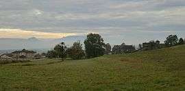
Belmont-Luthézieu is a commune in the Ain department in eastern France.
Geography
The commune is 18 km north of Belley. There are several waterfalls, gorges and caves in a forested environment.
Population
| Historical population | ||
|---|---|---|
| Year | Pop. | ±% |
| 1793 | 575 | — |
| 1800 | 460 | −20.0% |
| 1806 | 609 | +32.4% |
| 1821 | 565 | −7.2% |
| 1831 | 665 | +17.7% |
| 1836 | 682 | +2.6% |
| 1841 | 721 | +5.7% |
| 1846 | 756 | +4.9% |
| 1851 | 738 | −2.4% |
| 1856 | 739 | +0.1% |
| 1861 | 733 | −0.8% |
| 1866 | 735 | +0.3% |
| 1872 | 724 | −1.5% |
| 1876 | 642 | −11.3% |
| 1881 | 608 | −5.3% |
| 1886 | 626 | +3.0% |
| 1891 | 610 | −2.6% |
| 1896 | 628 | +3.0% |
| 1901 | 600 | −4.5% |
| 1906 | 551 | −8.2% |
| 1911 | 509 | −7.6% |
| 1921 | 418 | −17.9% |
| 1926 | 401 | −4.1% |
| 1931 | 380 | −5.2% |
| 1936 | 361 | −5.0% |
| 1946 | 342 | −5.3% |
| 1954 | 270 | −21.1% |
| 1962 | 275 | +1.9% |
| 1968 | 240 | −12.7% |
| 1975 | 300 | +25.0% |
| 1982 | 293 | −2.3% |
| 1990 | 308 | +5.1% |
| 1999 | 394 | +27.9% |
| 2008 | 489 | +24.1% |
History
The priory of Belmont was founded in 1110. It has been in the parish of Luthézieu since the 12th century.
Mayors
| Name | Elected | Left office |
|---|---|---|
| André Michaud | 1995 | 2001 |
| Jean-Baptiste Zambelli | 2001 | Re-elected in 2008. (Incumbent) |
See also
References
| Wikimedia Commons has media related to Belmont-Luthézieu. |
This article is issued from Wikipedia - version of the 2/12/2016. The text is available under the Creative Commons Attribution/Share Alike but additional terms may apply for the media files.