Villes
| Villa | |
|---|---|
 | |
 Villa | |
|
Location within Auvergne-Rhône-Alpes region  Villa | |
| Coordinates: 46°05′21″N 5°47′09″E / 46.0892°N 5.7858°ECoordinates: 46°05′21″N 5°47′09″E / 46.0892°N 5.7858°E | |
| Country | France |
| Region | Auvergne-Rhône-Alpes |
| Department | Ain |
| Arrondissement | Nantua |
| Canton | Bellegarde-sur-Valserine |
| Intercommunality | Bassin Bellegardien |
| Government | |
| • Mayor (2008–2014) | Marie-Hélène Bouvier |
| Area1 | 9.60 km2 (3.71 sq mi) |
| Population (2008)2 | 361 |
| • Density | 38/km2 (97/sq mi) |
| Time zone | CET (UTC+1) |
| • Summer (DST) | CEST (UTC+2) |
| INSEE/Postal code | 01448 / 01200 |
| Elevation | 445–1,322 m (1,460–4,337 ft) |
|
1 French Land Register data, which excludes lakes, ponds, glaciers > 1 km² (0.386 sq mi or 247 acres) and river estuaries. 2 Population without double counting: residents of multiple communes (e.g., students and military personnel) only counted once. | |
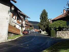
Villes is a commune in the Ain department in eastern France.
Population
| Historical population | ||
|---|---|---|
| Year | Pop. | ±% |
| 1793 | 310 | — |
| 1800 | 271 | −12.6% |
| 1806 | 406 | +49.8% |
| 1821 | 429 | +5.7% |
| 1831 | 417 | −2.8% |
| 1836 | 346 | −17.0% |
| 1841 | 432 | +24.9% |
| 1846 | 431 | −0.2% |
| 1851 | 395 | −8.4% |
| 1856 | 439 | +11.1% |
| 1861 | 369 | −15.9% |
| 1866 | 349 | −5.4% |
| 1872 | 325 | −6.9% |
| 1876 | 345 | +6.2% |
| 1881 | 328 | −4.9% |
| 1886 | 302 | −7.9% |
| 1891 | 275 | −8.9% |
| 1896 | 260 | −5.5% |
| 1901 | 257 | −1.2% |
| 1906 | 277 | +7.8% |
| 1911 | 240 | −13.4% |
| 1921 | 198 | −17.5% |
| 1926 | 179 | −9.6% |
| 1931 | 139 | −22.3% |
| 1936 | 134 | −3.6% |
| 1946 | 141 | +5.2% |
| 1954 | 114 | −19.1% |
| 1962 | 108 | −5.3% |
| 1968 | 146 | +35.2% |
| 1975 | 157 | +7.5% |
| 1982 | 184 | +17.2% |
| 1990 | 226 | +22.8% |
| 1999 | 268 | +18.6% |
| 2008 | 361 | +34.7% |
See also
References
| Wikimedia Commons has media related to Villes. |
This article is issued from Wikipedia - version of the 10/27/2016. The text is available under the Creative Commons Attribution/Share Alike but additional terms may apply for the media files.