Neuville-sur-Ain
| Neuville-sur-Ain | ||
|---|---|---|
|
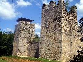
Thol chateau | ||
| ||
 Neuville-sur-Ain | ||
|
Location within Auvergne-Rhône-Alpes region  Neuville-sur-Ain | ||
| Coordinates: 46°05′00″N 5°22′00″E / 46.0833°N 5.3667°ECoordinates: 46°05′00″N 5°22′00″E / 46.0833°N 5.3667°E | ||
| Country | France | |
| Region | Auvergne-Rhône-Alpes | |
| Department | Ain | |
| Arrondissement | Bourg-en-Bresse | |
| Canton | Pont-d'Ain | |
| Government | ||
| • Mayor (2008–2014) | Thierry Dupuis | |
| Area1 | 19.79 km2 (7.64 sq mi) | |
| Population (2008)2 | 1,516 | |
| • Density | 77/km2 (200/sq mi) | |
| Time zone | CET (UTC+1) | |
| • Summer (DST) | CEST (UTC+2) | |
| INSEE/Postal code | 01273 / 01160 | |
| Elevation |
242–427 m (794–1,401 ft) (avg. 300 m or 980 ft) | |
|
1 French Land Register data, which excludes lakes, ponds, glaciers > 1 km² (0.386 sq mi or 247 acres) and river estuaries. 2 Population without double counting: residents of multiple communes (e.g., students and military personnel) only counted once. | ||
.svg.png)
Neuville-sur-Ain is a commune in the Ain department in eastern France.
Population
| Historical population | ||
|---|---|---|
| Year | Pop. | ±% |
| 1793 | 1,374 | — |
| 1800 | 1,199 | −12.7% |
| 1806 | 1,373 | +14.5% |
| 1821 | 1,269 | −7.6% |
| 1831 | 1,414 | +11.4% |
| 1836 | 1,445 | +2.2% |
| 1841 | 1,492 | +3.3% |
| 1846 | 1,515 | +1.5% |
| 1851 | 1,522 | +0.5% |
| 1856 | 1,444 | −5.1% |
| 1861 | 1,374 | −4.8% |
| 1866 | 1,446 | +5.2% |
| 1872 | 1,476 | +2.1% |
| 1876 | 1,503 | +1.8% |
| 1881 | 1,488 | −1.0% |
| 1886 | 1,439 | −3.3% |
| 1891 | 1,376 | −4.4% |
| 1896 | 1,363 | −0.9% |
| 1901 | 1,351 | −0.9% |
| 1906 | 1,293 | −4.3% |
| 1911 | 1,200 | −7.2% |
| 1921 | 986 | −17.8% |
| 1926 | 957 | −2.9% |
| 1931 | 964 | +0.7% |
| 1936 | 932 | −3.3% |
| 1946 | 1,012 | +8.6% |
| 1954 | 901 | −11.0% |
| 1962 | 1,469 | +63.0% |
| 1968 | 932 | −36.6% |
| 1975 | 979 | +5.0% |
| 1982 | 945 | −3.5% |
| 1990 | 1,151 | +21.8% |
| 1999 | 1,236 | +7.4% |
| 2008 | 1,516 | +22.7% |
See also
References
| Wikimedia Commons has media related to Neuville-sur-Ain. |
This article is issued from Wikipedia - version of the 10/27/2016. The text is available under the Creative Commons Attribution/Share Alike but additional terms may apply for the media files.