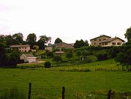
Ceignes
| Ceignes | |
|---|---|
 | |
 Ceignes | |
|
Location within Auvergne-Rhône-Alpes region  Ceignes | |
| Coordinates: 46°07′15″N 5°30′00″E / 46.1208°N 5.5°ECoordinates: 46°07′15″N 5°30′00″E / 46.1208°N 5.5°E | |
| Country | France |
| Region | Auvergne-Rhône-Alpes |
| Department | Ain |
| Arrondissement | Nantua |
| Canton | Izernore |
| Government | |
| • Mayor (2008–2014) | Alain Auboeuf |
| Area1 | 10.01 km2 (3.86 sq mi) |
| Population (2008)2 | 271 |
| • Density | 27/km2 (70/sq mi) |
| Time zone | CET (UTC+1) |
| • Summer (DST) | CEST (UTC+2) |
| INSEE/Postal code | 01067 / 01430 |
| Elevation |
580–862 m (1,903–2,828 ft) (avg. 630 m or 2,070 ft) |
|
1 French Land Register data, which excludes lakes, ponds, glaciers > 1 km² (0.386 sq mi or 247 acres) and river estuaries. 2 Population without double counting: residents of multiple communes (e.g., students and military personnel) only counted once. | |
Ceignes (French pronunciation: [sɛɲ]) is a commune in the Ain department in eastern France.
Population
| Historical population | ||
|---|---|---|
| Year | Pop. | ±% |
| 1793 | 352 | — |
| 1800 | 373 | +6.0% |
| 1806 | 442 | +18.5% |
| 1821 | 444 | +0.5% |
| 1831 | 402 | −9.5% |
| 1836 | 435 | +8.2% |
| 1841 | 436 | +0.2% |
| 1846 | 411 | −5.7% |
| 1851 | 417 | +1.5% |
| 1856 | 393 | −5.8% |
| 1861 | 355 | −9.7% |
| 1866 | 350 | −1.4% |
| 1872 | 308 | −12.0% |
| 1876 | 319 | +3.6% |
| 1881 | 287 | −10.0% |
| 1886 | 291 | +1.4% |
| 1891 | 267 | −8.2% |
| 1896 | 259 | −3.0% |
| 1901 | 239 | −7.7% |
| 1906 | 225 | −5.9% |
| 1911 | 185 | −17.8% |
| 1921 | 178 | −3.8% |
| 1926 | 150 | −15.7% |
| 1931 | 146 | −2.7% |
| 1936 | 135 | −7.5% |
| 1946 | 128 | −5.2% |
| 1954 | 134 | +4.7% |
| 1962 | 131 | −2.2% |
| 1968 | 124 | −5.3% |
| 1975 | 114 | −8.1% |
| 1982 | 136 | +19.3% |
| 1990 | 160 | +17.6% |
| 1999 | 230 | +43.8% |
| 2008 | 271 | +17.8% |
See also
References
| Wikimedia Commons has media related to Ceignes. |
This article is issued from Wikipedia - version of the 2/11/2016. The text is available under the Creative Commons Attribution/Share Alike but additional terms may apply for the media files.