Bellignat
| Bellignat | ||
|---|---|---|
|
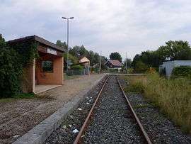
Train station | ||
| ||
 Bellignat | ||
|
Location within Auvergne-Rhône-Alpes region  Bellignat | ||
| Coordinates: 46°14′41″N 5°37′58″E / 46.2447°N 5.6328°ECoordinates: 46°14′41″N 5°37′58″E / 46.2447°N 5.6328°E | ||
| Country | France | |
| Region | Auvergne-Rhône-Alpes | |
| Department | Ain | |
| Arrondissement | Nantua | |
| Canton | Oyonnax-Sud | |
| Government | ||
| • Mayor (2008–2014) | Victor Jacquenod | |
| Area1 | 7.84 km2 (3.03 sq mi) | |
| Population (2008)2 | 3,464 | |
| • Density | 440/km2 (1,100/sq mi) | |
| Time zone | CET (UTC+1) | |
| • Summer (DST) | CEST (UTC+2) | |
| INSEE/Postal code | 01031 / 01810 | |
| Elevation |
516–913 m (1,693–2,995 ft) (avg. 521 m or 1,709 ft) | |
|
1 French Land Register data, which excludes lakes, ponds, glaciers > 1 km² (0.386 sq mi or 247 acres) and river estuaries. 2 Population without double counting: residents of multiple communes (e.g., students and military personnel) only counted once. | ||

Bellignat is a commune in the Ain department in eastern France.
Population
| Historical population | ||
|---|---|---|
| Year | Pop. | ±% |
| 1793 | 283 | — |
| 1800 | 346 | +22.3% |
| 1806 | 362 | +4.6% |
| 1821 | 364 | +0.6% |
| 1831 | 304 | −16.5% |
| 1836 | 352 | +15.8% |
| 1841 | 390 | +10.8% |
| 1846 | 367 | −5.9% |
| 1851 | 329 | −10.4% |
| 1856 | 318 | −3.3% |
| 1861 | 308 | −3.1% |
| 1866 | 333 | +8.1% |
| 1872 | 307 | −7.8% |
| 1876 | 328 | +6.8% |
| 1881 | 296 | −9.8% |
| 1886 | 287 | −3.0% |
| 1891 | 301 | +4.9% |
| 1896 | 321 | +6.6% |
| 1901 | 344 | +7.2% |
| 1906 | 515 | +49.7% |
| 1911 | 594 | +15.3% |
| 1921 | 646 | +8.8% |
| 1926 | 710 | +9.9% |
| 1931 | 641 | −9.7% |
| 1936 | 518 | −19.2% |
| 1946 | 533 | +2.9% |
| 1954 | 659 | +23.6% |
| 1962 | 850 | +29.0% |
| 1968 | 848 | −0.2% |
| 1975 | 1,096 | +29.2% |
| 1982 | 2,602 | +137.4% |
| 1990 | 3,233 | +24.3% |
| 1999 | 3,825 | +18.3% |
| 2008 | 3,464 | −9.4% |
See also
References
External links
| Wikimedia Commons has media related to Bellignat. |
This article is issued from Wikipedia - version of the 10/30/2016. The text is available under the Creative Commons Attribution/Share Alike but additional terms may apply for the media files.