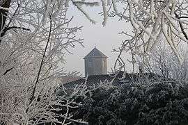
Bâgé-la-Ville
| Bâgé-la-Ville | ||
|---|---|---|
 | ||
| ||
 Bâgé-la-Ville | ||
|
Location within Auvergne-Rhône-Alpes region  Bâgé-la-Ville | ||
| Coordinates: 46°19′00″N 4°57′00″E / 46.3167°N 4.95°ECoordinates: 46°19′00″N 4°57′00″E / 46.3167°N 4.95°E | ||
| Country | France | |
| Region | Auvergne-Rhône-Alpes | |
| Department | Ain | |
| Arrondissement | Bourg-en-Bresse | |
| Canton | Bâgé-le-Châtel | |
| Government | ||
| • Mayor (2008–2014) | Dominique Repiquet | |
| Area1 | 39.68 km2 (15.32 sq mi) | |
| Population (2008)2 | 2,866 | |
| • Density | 72/km2 (190/sq mi) | |
| Time zone | CET (UTC+1) | |
| • Summer (DST) | CEST (UTC+2) | |
| INSEE/Postal code | 01025 / 01380 | |
| Elevation |
179–217 m (587–712 ft) (avg. 212 m or 696 ft) | |
|
1 French Land Register data, which excludes lakes, ponds, glaciers > 1 km² (0.386 sq mi or 247 acres) and river estuaries. 2 Population without double counting: residents of multiple communes (e.g., students and military personnel) only counted once. | ||
.svg.png)
Bâgé-la-Ville is a commune in the Ain department in eastern France.
Geography
Bâgé-la-Ville is in the heart of Bresse, between Bourg-en-Bresse and Mâcon.
It is the largest commune in the department in terms of area.
Population
| Historical population | ||
|---|---|---|
| Year | Pop. | ±% |
| 1793 | 1,809 | — |
| 1800 | 2,001 | +10.6% |
| 1806 | 1,960 | −2.0% |
| 1821 | 2,043 | +4.2% |
| 1831 | 2,017 | −1.3% |
| 1836 | 2,043 | +1.3% |
| 1841 | 2,072 | +1.4% |
| 1846 | 2,069 | −0.1% |
| 1851 | 2,103 | +1.6% |
| 1856 | 2,054 | −2.3% |
| 1861 | 2,095 | +2.0% |
| 1866 | 2,142 | +2.2% |
| 1872 | 1,987 | −7.2% |
| 1876 | 1,992 | +0.3% |
| 1881 | 1,918 | −3.7% |
| 1886 | 1,931 | +0.7% |
| 1891 | 1,885 | −2.4% |
| 1896 | 1,902 | +0.9% |
| 1901 | 1,863 | −2.1% |
| 1906 | 1,896 | +1.8% |
| 1911 | 1,865 | −1.6% |
| 1921 | 1,731 | −7.2% |
| 1926 | 1,708 | −1.3% |
| 1931 | 1,596 | −6.6% |
| 1936 | 1,586 | −0.6% |
| 1946 | 1,550 | −2.3% |
| 1954 | 1,469 | −5.2% |
| 1962 | 1,399 | −4.8% |
| 1968 | 1,383 | −1.1% |
| 1975 | 1,361 | −1.6% |
| 1982 | 1,596 | +17.3% |
| 1990 | 1,959 | +22.7% |
| 1999 | 2,314 | +18.1% |
| 2008 | 2,866 | +23.9% |
See also
Personalities
- Louis Duret, court physician
References
| Wikimedia Commons has media related to Bâgé-la-Ville. |
This article is issued from Wikipedia - version of the 10/27/2016. The text is available under the Creative Commons Attribution/Share Alike but additional terms may apply for the media files.