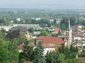
Villieu-Loyes-Mollon
| Villieu-Loyes-Mollon | |
|---|---|
 | |
 Villieu-Loyes-Mollon | |
|
Location within Auvergne-Rhône-Alpes region  Villieu-Loyes-Mollon | |
| Coordinates: 45°55′31″N 5°13′17″E / 45.925244°N 5.221424°ECoordinates: 45°55′31″N 5°13′17″E / 45.925244°N 5.221424°E | |
| Country | France |
| Region | Auvergne-Rhône-Alpes |
| Department | Ain |
| Arrondissement | Bourg-en-Bresse |
| Canton | Meximieux |
| Intercommunality | Plaine de l'Ain |
| Government | |
| • Mayor (2008–2014) | Eric Beaufort |
| Area1 | 15.91 km2 (6.14 sq mi) |
| Population (2008)2 | 2,937 |
| • Density | 180/km2 (480/sq mi) |
| Time zone | CET (UTC+1) |
| • Summer (DST) | CEST (UTC+2) |
| INSEE/Postal code | 01450 / 01800 |
| Elevation | 220–298 m (722–978 ft) |
|
1 French Land Register data, which excludes lakes, ponds, glaciers > 1 km² (0.386 sq mi or 247 acres) and river estuaries. 2 Population without double counting: residents of multiple communes (e.g., students and military personnel) only counted once. | |
Villieu-Loyes-Mollon is a commune in the Ain department in eastern France.
It lies between Meximieux and Pont-d'Ain.
Population
| Historical population | ||
|---|---|---|
| Year | Pop. | ±% |
| 1901 | 612 | — |
| 1906 | 553 | −9.6% |
| 1911 | 459 | −17.0% |
| 1921 | 479 | +4.4% |
| 1926 | 516 | +7.7% |
| 1931 | 545 | +5.6% |
| 1936 | 550 | +0.9% |
| 1946 | 537 | −2.4% |
| 1954 | 515 | −4.1% |
| 1962 | 601 | +16.7% |
| 1968 | 732 | +21.8% |
| 1975 | 1,512 | +106.6% |
| 1982 | 1,801 | +19.1% |
| 1990 | 2,182 | +21.2% |
| 1999 | 2,407 | +10.3% |
| 2008 | 2,937 | +22.0% |
Twin cities
See also
References
| Wikimedia Commons has media related to Villieu-Loyes-Mollon. |
This article is issued from Wikipedia - version of the 3/15/2016. The text is available under the Creative Commons Attribution/Share Alike but additional terms may apply for the media files.