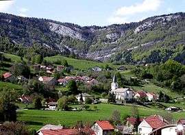
Champfromier
| Champfromier | |
|---|---|
 | |
 Champfromier | |
|
Location within Auvergne-Rhône-Alpes region  Champfromier | |
| Coordinates: 46°12′00″N 5°49′00″E / 46.2°N 5.8167°ECoordinates: 46°12′00″N 5°49′00″E / 46.2°N 5.8167°E | |
| Country | France |
| Region | Auvergne-Rhône-Alpes |
| Department | Ain |
| Arrondissement | Nantua |
| Canton | Bellegarde-sur-Valserine |
| Intercommunality | Bassin Bellegardien |
| Government | |
| • Mayor (2008–2014) | Michel de Souza |
| Area1 | 32.40 km2 (12.51 sq mi) |
| Population (2008)2 | 653 |
| • Density | 20/km2 (52/sq mi) |
| Time zone | CET (UTC+1) |
| • Summer (DST) | CEST (UTC+2) |
| INSEE/Postal code | 01081 / 01410 |
| Elevation |
480–1,540 m (1,570–5,050 ft) (avg. 646 m or 2,119 ft) |
|
1 French Land Register data, which excludes lakes, ponds, glaciers > 1 km² (0.386 sq mi or 247 acres) and river estuaries. 2 Population without double counting: residents of multiple communes (e.g., students and military personnel) only counted once. | |
Champfromier is a commune in the Ain department in eastern France.
Population
| Historical population | ||
|---|---|---|
| Year | Pop. | ±% |
| 1793 | 978 | — |
| 1800 | 1,249 | +27.7% |
| 1806 | 1,360 | +8.9% |
| 1821 | 1,357 | −0.2% |
| 1831 | 1,397 | +2.9% |
| 1836 | 1,247 | −10.7% |
| 1841 | 1,160 | −7.0% |
| 1846 | 1,215 | +4.7% |
| 1851 | 1,245 | +2.5% |
| 1856 | 1,094 | −12.1% |
| 1861 | 1,053 | −3.7% |
| 1866 | 1,042 | −1.0% |
| 1872 | 961 | −7.8% |
| 1876 | 966 | +0.5% |
| 1881 | 904 | −6.4% |
| 1886 | 951 | +5.2% |
| 1891 | 910 | −4.3% |
| 1896 | 861 | −5.4% |
| 1901 | 831 | −3.5% |
| 1906 | 839 | +1.0% |
| 1911 | 794 | −5.4% |
| 1921 | 724 | −8.8% |
| 1926 | 592 | −18.2% |
| 1931 | 570 | −3.7% |
| 1936 | 557 | −2.3% |
| 1946 | 456 | −18.1% |
| 1954 | 597 | +30.9% |
| 1962 | 517 | −13.4% |
| 1968 | 428 | −17.2% |
| 1975 | 326 | −23.8% |
| 1982 | 332 | +1.8% |
| 1990 | 440 | +32.5% |
| 1999 | 593 | +34.8% |
| 2008 | 653 | +10.1% |
See also
References
| Wikimedia Commons has media related to Champfromier. |
This article is issued from Wikipedia - version of the 10/27/2016. The text is available under the Creative Commons Attribution/Share Alike but additional terms may apply for the media files.