Crazy Peak
| Crazy Peak | |
|---|---|
 Crazy Peak at left background | |
| Highest point | |
| Elevation | 11,214 ft (3,418 m) [1] |
| Prominence | 5,719 ft (1,743 m) [1] |
| Listing | |
| Coordinates | 46°01′05″N 110°16′36″W / 46.01806°N 110.27667°WCoordinates: 46°01′05″N 110°16′36″W / 46.01806°N 110.27667°W [2] |
| Geography | |
 Crazy Peak Montana | |
| Location | Sweet Grass County, Montana, U.S. |
| Parent range | Crazy Mountains |
| Topo map | USGS Crazy Peak |
| Climbing | |
| Easiest route | Hike, scramble |
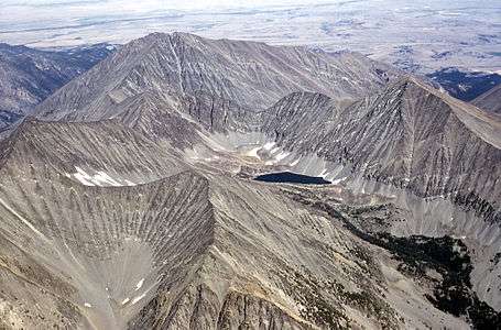
Crazy Peak is the highest peak in the Crazy Mountains, an isolated range of the Montana Rockies, in the United States.[3] Crazy Peak dominates the surroundings, rising over 7,000 feet (2,100 m) above the Yellowstone River Valley, and is the highest peak in Montana north of the Beartooth Mountains, which are 50 miles (80 km) to the south. Crazy Peak is also the most topographically prominent peak in Montana.[4] A small glacier exists on the northeast slope of the mountain. The mountain is located on private land within the Gallatin National Forest.
See also
References
- 1 2 "Crazy Peak, Montana". Peakbagger.com. Retrieved September 15, 2014.
- ↑ "Crazy Peak". Geographic Names Information System. United States Geological Survey. Retrieved September 15, 2014.
- ↑ Crazy Peak, MT (Map). TopoQwest (United States Geological Survey Maps). Retrieved September 15, 2014.
- ↑ "America's 57 - the Ultras". Peaklist. Retrieved September 15, 2014.
External links
This article is issued from Wikipedia - version of the 1/18/2016. The text is available under the Creative Commons Attribution/Share Alike but additional terms may apply for the media files.