Whitefish, Montana
| Whitefish, Montana | ||
|---|---|---|
| City | ||
|
Looking north from downtown Whitefish | ||
| ||
| Motto: "Montana's outdoor recreation playground"[1] | ||
 Location of Whitefish, Montana | ||
| Coordinates: 48°24′42″N 114°20′24″W / 48.41167°N 114.34000°WCoordinates: 48°24′42″N 114°20′24″W / 48.41167°N 114.34000°W | ||
| Country | United States | |
| State | Montana | |
| County | Flathead | |
| Area[2] | ||
| • Total | 11.80 sq mi (30.56 km2) | |
| • Land | 6.43 sq mi (16.65 km2) | |
| • Water | 5.37 sq mi (13.91 km2) | |
| Elevation | 3,028 ft (923 m) | |
| Population (2010)[3] | ||
| • Total | 6,357 | |
| • Estimate (2015)[4] | 7,073 | |
| • Density | 988.6/sq mi (381.7/km2) | |
| Time zone | Mountain (MST) (UTC-7) | |
| • Summer (DST) | MDT (UTC-6) | |
| ZIP code | 59937 | |
| Area code(s) | 406 | |
| FIPS code | 30-79825 | |
| GNIS feature ID | 0793219 | |
| Website | Official City site | |


Whitefish (Salish: epɫx̣ʷy̓u, "has whitefish"[5]) is a city in Flathead County, Montana, United States. The population was 6,357 at the 2010 census. It is home to a ski resort on Big Mountain called Whitefish Mountain Resort. Former Montana Governor Brian Schweitzer hails from Whitefish.[6]
History

The Great Northern Railway was built through what is now Whitefish in 1904, which sparked development of the town. Early residents of the town worked for the railroad and nearby logging industries.[7] By the late 1940s, with the successful construction of a ski resort on Big Mountain (a collaboration between outside developers and local businessmen) the tourism sector was becoming increasingly important. The community was named for its location near Whitefish Lake.[8]
In 2006, over 68,000 passengers embarked and disembarked through the historic Whitefish Depot, a stop on Amtrak's Empire Builder line,[9] with some percentage of those being headed to the ski resort on Big Mountain. Whitefish was also called Stumptown as the area was cleared for the train station.
Geography
Whitefish is located at 48°14′42″N 114°20′24″W / 48.24500°N 114.34000°W (48.411772, -114.339865),[10] at an altitude of 3,028 feet (923 m).[11] The town is located on the western side of the continental divide, near Glacier National Park.
According to the United States Census Bureau, the city has a total area of 11.80 square miles (30.56 km2), of which, 6.43 square miles (16.65 km2) is land and 5.37 square miles (13.91 km2) is water.[2]
Climate
This climatic region is typified by large seasonal temperature differences, with warm to hot (and often humid) summers and cold (sometimes severely cold) winters. According to the Köppen Climate Classification system, Whitefish has a humid continental climate, abbreviated "Dfb" on climate maps.[12]
Demographics
| Historical population | |||
|---|---|---|---|
| Census | Pop. | %± | |
| 1890 | 640 | — | |
| 1900 | 446 | −30.3% | |
| 1910 | 417 | −6.5% | |
| 1920 | 574 | 37.6% | |
| 1930 | 575 | 0.2% | |
| 1940 | 858 | 49.2% | |
| 1950 | 1,025 | 19.5% | |
| 1960 | 1,519 | 48.2% | |
| 1970 | 3,349 | 120.5% | |
| 1980 | 3,703 | 10.6% | |
| 1990 | 4,368 | 18.0% | |
| 2000 | 5,032 | 15.2% | |
| 2010 | 6,357 | 26.3% | |
| Est. 2015 | 7,073 | [13] | 11.3% |
| U.S. Decennial Census[14] 2015 Estimate[4] | |||

2000 census
As of the census[15] of 2000, there were 5,032 people, 2,229 households, and 1,203 families residing in the city. The population density was 1,138.5 people per square mile (439.6/km²). There were 2,652 housing units at an average density of 600.0 per square mile (231.7/km²). The racial makeup of the city was 95.97% White, 0.14% African American, 1.11% Native American, 0.58% Asian, 0.06% Pacific Islander, 0.72% from other races, and 1.43% from two or more races. Hispanic or Latino of any race were 1.93% of the population.
There were 2,229 households out of which 26.2% had children under the age of 18 living with them, 41.2% were married couples living together, 9.8% had a female householder with no husband present, and 46.0% were non-families. 34.4% of all households were made up of individuals and 10.9% had someone living alone who was 65 years of age or older. The average household size was 2.20 and the average family size was 2.86.
In the city the population was spread out with 21.6% under the age of 18, 8.6% from 18 to 24, 32.9% from 25 to 44, 22.5% from 45 to 64, and 14.4% who were 65 years of age or older. The median age was 37 years. For every 100 females there were 92.4 males. For every 100 females age 18 and over, there were 91.7 males.
The median income for a household in the city was $33,038, and the median income for a family was $41,009. Males had a median income of $36,298 versus $19,583 for females. The per capita income for the city was $24,098. About 13.8% of families and 18.2% of the population were below the poverty line, including 32.9% of those under age 18 and 12.7% of those age 65 or over.
2010 census
As of the census[3] of 2010, there were 6,357 people, 2,982 households, and 1,562 families residing in the city. The population density was 988.6 inhabitants per square mile (381.7/km2). There were 4,086 housing units at an average density of 635.5 per square mile (245.4/km2). The racial makeup of the city was 95.8% White, 0.5% African American, 0.8% Native American, 0.8% Asian, 0.1% Pacific Islander, 0.3% from other races, and 1.7% from two or more races. Hispanic or Latino of any race were 2.8% of the population.
There were 2,982 households of which 24.5% had children under the age of 18 living with them, 40.1% were married couples living together, 8.5% had a female householder with no husband present, 3.8% had a male householder with no wife present, and 47.6% were non-families. 36.7% of all households were made up of individuals and 11.4% had someone living alone who was 65 years of age or older. The average household size was 2.10 and the average family size was 2.77.
The median age in the city was 40.1 years. 19.6% of residents were under the age of 18; 7.1% were between the ages of 18 and 24; 30.2% were from 25 to 44; 28.9% were from 45 to 64; and 14.3% were 65 years of age or older. The gender makeup of the city was 50.3% male and 49.7% female.
Arts and culture
Annual cultural events
Huckleberry Days Arts Festival is an annual arts festival featuring 100 artists and food vendors. The event includes a huckleberry dessert bake-off contest.[16]
The Taste of Whitefish is an annual event that has been held for more than twenty-five years. The event features over twenty-five restaurants, caterers and beverage companies offering samples of their specialties.[17][18]
The World Indoor Golf Championship has been held in Whitefish for over sixteen years and is a 9-hole “miniature golf” tournament in downtown Whitefish.[19]
Museums and other points of interest
- Whitefish Mountain Resort
- Stumptown Museum
- Great Northern Brewing Company
- Alpine Theatre Project
- Whitefish Theatre Company
Education
Whitefish is served by the Whitefish School District. Schools in the district include Muldown Elementary School, Whitefish Middle School. Whitefish High School and Whitefish Independent High School.[20] Whitefish High School is home to numerous state championship teams; the most recent is the girls' cross country team. They have won four consecutive titles.
Media
Newspapers
- The Whitefish Pilot
- Whitefish Area News, from the Flathead Beacon
- Whitefish Free Press
AM radio
- KERR 750, Anderson Radio Broadcasting, Inc.
- KJJR 880, Bee Broadcasting, Inc.
- KOFI 1180, KOFI, Inc.
- KSAM 1240, Bee Broadcasting, Inc.
- KYWL 1340, Anderson Radio Broadcasting, Inc.
FM radio
- KUKL-FM 91.7, University of Montana-Missoula
- KQRK 92.3, Anderson Radio Broadcasting, Inc.
- KHNK 95.9, Bee Broadcasting, Inc.
- KALS 97.1, Kalispell Christian Radio Fellowship
- KBBZ 98.5, Bee Broadcasting, Inc.
- KKMT 99.7, Anderson Radio Broadcasting, Inc.
- KIBG 100.7, Anderson Radio Broadcasting, Inc.
- KXZI-LP 101.9, Scott Johnston
- KANB-LP 102.3, Flathead Adventist Radio
- KRVO 103.1, Bee Broadcasting, Inc.
- KZMN 103.9, KOFI, Inc.
- KWOL-FM 105.1, Bee Broadcasting, Inc.
- KDBR 106.3, Bee Broadcasting, Inc.
Internet radio
Television
- KCFW (NBC), Channel 9
- KAJJ-CD (CBS), Channel 39
- K26DD-D (TBN), Channel 26
- K29AA-D (PBS), Channel 29
- KEXI-LD (PBS), Channel 35
- KCFW-DT (NBC), Channel 38
- KTMF-LD (ABC), Channel 42
Transportation

U.S. Route 93 and MT 40 travel through Whitefish. Whitefish has an Amtrak station stop for their Empire Builder (Chicago-Portland & Seattle) train. Airplane travel is available at Glacier Park International Airport along U.S. Route 2.
Notable people
- Bob Brown, Montana Secretary of State
- Murray Craven, former NHL hockey player
- Dennis Cross (1924–1991), actor[21]
- David Graham, retired professional golfer
- Sierra Fellers, professional skateboarder, born in Whitefish[22]
- Steve Howe, former MLB pitcher
- Kyle Huff, perpetrator of the Capitol Hill Massacre
- Phil Jackson, former coach of the Los Angeles Lakers, former coach of the Chicago Bulls, and former player for the New York Knicks; has won most championships of any coach in the National Basketball Association.
- Dorothy M. Johnson, Western author
- Tim Kasher, indie rock musician/frontman for Cursive and The Good Life, during the recording of The Game of Monogamy in 2010
- Ross M. Lence, political scientist and author
- Frank B. Morrison, Jr., Montana Supreme Court justice
- John Morrison, Montana state auditor
- Terry Moulton, Wisconsin politician
- Brian Schweitzer, Governor of Montana[6]
- Constance Towers, singer and actress
- Maggie Voisin, freestyle skier
- Ryan Zinke, Montana State Senator 2009-2012, congressman for Montana's at-large congressional district 2014 election[23]
References
- ↑ "Official Website of Whitefish Montana". Official Website of Whitefish Montana. Retrieved October 27, 2012.
- 1 2 "US Gazetteer files 2010". United States Census Bureau. Retrieved 2012-12-18.
- 1 2 "American FactFinder". United States Census Bureau. Retrieved 2012-12-18.
- 1 2 "Population Estimates". United States Census Bureau. Retrieved July 14, 2015.
- ↑ Tachini, Pete; Louie Adams, Sophie Mays, Mary Lucy Parker, Johnny Arlee, Frances Vanderburg, Lucy Vanderburg, Diana Christopher-Cote (1998). nyoʻnuntn q̓éymin, Flathead Nation Salish dictionary. Pablo, Montana: Bilingual Education Department, Salish Kootenai College. p. 161.
- 1 2 "Congress.org". Governor Brian Schweitzer (D-MT). Retrieved October 27, 2012.
- ↑ "area history WHITEFISH Montana". Great NW Montana Promotions, LLC. Retrieved October 27, 2012.
- ↑ "Profile for Whitefish, Montana, MT". ePodunk. Retrieved October 27, 2012.
- ↑ "Amtrak Fact Sheet, Fiscal Year 2006, State of Montana" (PDF). Amtrak. Retrieved 2007-09-20.
- ↑ "US Gazetteer files: 2010, 2000, and 1990". United States Census Bureau. 2011-02-12. Retrieved 2011-04-23.
- ↑ U.S. Geological Survey Geographic Names Information System: Whitefish, Montana
- ↑ Climate Summary for Whitefish, Montana
- ↑ "Annual Estimates of the Resident Population for Incorporated Places: April 1, 2010 to July 1, 2015". Retrieved July 2, 2016.
- ↑ United States Census Bureau. "Census of Population and Housing". Retrieved July 14, 2016.
- ↑ "American FactFinder". United States Census Bureau. Retrieved 2008-01-31.
- ↑ "Whitefish Chamber of Commerce". Whitefish Chamber of Commerce. Retrieved October 27, 2012.
- ↑ "Taste of Whitefis". Whitefish Chamber of Commerce. Retrieved October 27, 2012.
- ↑ "Taste of Whitefish". All Trips. Retrieved October 27, 2012.
- ↑ "World Indoor Golf Championships". Whitefish Chamber of Commerce. Retrieved October 27, 2012.
- ↑ "Whitefish School District". Whitefish School District. Retrieved October 27, 2012.
- ↑ "Dennis Cross". IMDb. Retrieved October 27, 2012.
- ↑ "Sierra Fellers". ESPN Sports. Retrieved October 27, 2012.
- ↑ Ryan Zinke
External links
| Wikimedia Commons has media related to Whitefish, Montana. |
| Wikivoyage has a travel guide for Whitefish. |
- Official City website
- Whitefish Chamber of Commerce
- Official Whitefish Travel Planning and Visitor Information
- Whitefish, Montana at DMOZ
- City-Data.com
- ePodunk: Profile for Whitefish, Montana
- Whitefish School District
- Whitefish Free Press
Municipalities and communities of Flathead County, Montana, United States | ||
|---|---|---|
| Cities | 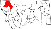 | |
| CDPs | ||
| Unincorporated communities | ||
| Indian reservation | ||
| Footnotes | ‡This populated place also has portions in an adjacent county or counties | |