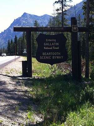
Gallatin National Forest
| Gallatin National Forest | |
|---|---|
|
IUCN category VI (protected area with sustainable use of natural resources) | |
 | |
 | |
| Location | Montana, USA |
| Nearest city | Bozeman, MT |
| Coordinates | 45°16′21″N 110°22′06″W / 45.27250°N 110.36833°WCoordinates: 45°16′21″N 110°22′06″W / 45.27250°N 110.36833°W |
| Area | 1,819,515 acres (7,363.32 km2)[1] |
| Established | February 10, 1899[2] |
| Governing body | U.S. Forest Service |
| Website | Custer-Gallatin National Forest |
Founded in 1899, Gallatin National Forest is located in south central Montana, United States. The forest comprises 1,819,515 acres (7,363.32 km2) and has portions of both the Absaroka-Beartooth and Lee Metcalf Wilderness areas within its boundaries. Gallatin National Forest borders Yellowstone National Park on the north and northwest and is part of the Greater Yellowstone Ecosystem, a region which encompasses almost 20,000,000 acres (81,000 km2). The forest is named after Albert Gallatin (1761–1849), U.S. Secretary of the Treasury and scholar of Native American languages and cultures.
In descending order of land area the forest is located in parts of Park, Gallatin, Sweet Grass, Madison, Carbon, and Meagher counties.
Administration
Since 2014, the Gallatin and Custer National Forests are managed together as the Custer-Gallatin National Forest with headquarters in Bozeman, Montana.[3] There are local ranger district offices located in West Yellowstone, Livingston and Gardiner in Montana for Gallatin, and Ashland and Red Lodge in Montana, and in Camp Crook in South Dakota for Custer.
Features
There are six separate mountain ranges within the forest including the Gallatin, Madison, Bridger, Crazy, Absaroka, and Beartooth Ranges. The Beartooth's are home to Granite Peak, which at 12,799 ft (3,901 m), is the highest point in Montana and also in the forest. Quake Lake on the Madison River is the site of the 1959 earthquake and landslide which formed the lake. A separate section of the forest north of Livingston, Montana is located in the Crazy Mountains which rise over 7,000 ft (2,100 m) above the great plains to the east. The forest includes two wilderness areas, the Absaroka-Beartooth (943,626 acres (3,818.72 km2)) and the Lee Metcalf (254,288 acres (1,029.07 km2)).
While the lower elevations are often covered in grasses and sagebrush, higher altitudes support Douglas fir, with several species of spruce, cottonwood and aspen being the dominant tree species. Of the 4,000 mi (6,400 km) of streams and rivers there are major tributaries of the Yellowstone River, which bisects the western and eastern sections of the forest running through Paradise Valley. The Gallatin and Madison Rivers, major tributaries of the Missouri River, also are found in the forest. The habitat supports over 300 wildlife species, including the grizzly bear, bald eagle, and peregrine falcon. Many western North American species are represented in this climax ecosystem including elk, mule deer, bison, moose, bighorn sheep, antelope, mountain lion, wolves and black bear. Various subspecies of trout are plentiful in the streams and they contribute to the forest being one of the preeminent fly fishing regions in the United States.
Over 2,290 mi (3,690 km) of hiking trails are located in the forest providing access into wilderness areas and interlinking with trails in Yellowstone National Park. There are almost 40 vehicle accessible campgrounds scattered throughout the forest, numerous picnic areas and even cabins that can be rented for a nominal fee through the forest's district offices. West Yellowstone, Montana provides access both into the forest and to Yellowstone National Park and is a popular snowmobile center during the winter. Nighttime temperatures can be below freezing any time of the year and mosquitos in the late spring and early summer also pose problems. Summertime high temperatures average in the 70's and the wintertime lows can drop below -40 degrees. Most of the precipitation falls in the form of snow with some places averaging over 33 ft (10 m) annually.
Access the forest off Interstate 90 south on U.S. Highway 89 from Livingston, Montana to Gardiner, Montana or south on U.S. 191 from Bozeman, Montana to West Yellowstone. The forest headquarters is located in Bozeman.
See also
References
- ↑ "Land Areas of the National Forest System" (PDF). U.S. Forest Service. January 2012. Retrieved June 25, 2012.
- ↑ "The National Forests of the United States" (PDF). U.S. Forest Service. Retrieved June 25, 2012.
- ↑ Laura Lundquist (November 14, 2014). "Custer and Gallatin forests finalize merger". Bozeman Daily Chronicle. Retrieved 6 June 2016.
External links
- Custer-Gallatin National Forest - official site
- Gallatin County Emergency Management
- Gallatin National Forest FAQ, Facts and Deep Cuts