Hamilton, Montana
| Hamilton, Montana | |
|---|---|
| City | |
|
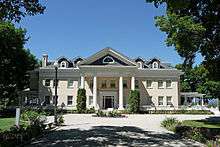
Downtown Hamilton | |
 Location of Hamilton, Montana | |
| Coordinates: 46°14′54″N 114°9′35″W / 46.24833°N 114.15972°WCoordinates: 46°14′54″N 114°9′35″W / 46.24833°N 114.15972°W | |
| Country | United States |
| State | Montana |
| County | Ravalli |
| Government | |
| • Mayor | Jerry E. Steele[1] |
| Area[2] | |
| • Total | 2.57 sq mi (6.66 km2) |
| • Land | 2.53 sq mi (6.55 km2) |
| • Water | 0.04 sq mi (0.10 km2) |
| Elevation | 3,570 ft (1,088 m) |
| Population (2010)[3] | |
| • Total | 4,348 |
| • Estimate (2015)[4] | 4,602 |
| • Density | 1,718.6/sq mi (663.6/km2) |
| Time zone | Mountain (MST) (UTC-7) |
| • Summer (DST) | MDT (UTC-6) |
| ZIP code | 59840 |
| Area code(s) | 406 |
| FIPS code | 30-33775 |
| GNIS feature ID | 0784496 |
| Website | www.cityofhamilton.net |

Hamilton (Salish: čɫc̓lc̓lé [5]) is a city in and the county seat of Ravalli County, Montana, United States.[6] The population was 4,348 at the 2010 census. Significant outlying population growth is shown in the area; the ZIP Code Tabulation Area for Hamilton's ZIP Code, 59840, had a population of 12,979 at the United States Census Bureau 2013 estimate.[7]
History
Hamilton was founded by copper king Marcus Daly in the late 19th century. It was named for J.W. Hamilton, who provided the right-of-way to the railroad.[8] Daly is said to have wanted to begin business in the then county seat of Grantsdale, but was denied the opportunity. He supposedly founded Hamilton out of his own pocket as a reaction to being rebuffed at Grantsdale.
The Ravalli County Museum, founded in 1955, is located in the former Ravalli County Courthouse and focuses on County history, natural history and art.
In the summer of 2000, Hamilton made international headlines when forest fires throughout the Bitterroot Valley filled the area with smoke and prompted the evacuation of many residents. President Clinton declared a state of emergency in the area and dispatched National Guardsmen to assist with fighting the fires.
Hamilton is, as of 2004, home to two microbiological research and production facilities: the government-run Rocky Mountain Laboratories, and a branch of the Corixa Corporation (bought in the late 1990s from Ribi ImmunoChem Research, Inc.). The Corixa Corporation was bought by GlaxoSmithKline in 2005. NIAID completed construction of a Biosafety Level 4 biohazard laboratory as part of the Rocky Mountain Laboratories (RML) facility in 2008. This facility has begun operations using highly-pathogenic organisms including the Lentivirus family of viruses.[9]
Geography and climate
Hamilton is located at 46°14′54″N 114°9′35″W / 46.24833°N 114.15972°W (46.248412, -114.159852).[10]
According to the United States Census Bureau, the city has a total area of 2.57 square miles (6.66 km2), of which, 2.53 square miles (6.55 km2) is land and 0.04 square miles (0.10 km2) is water.[2]
| Climate data for Hamilton, Montana (1981–2010) | |||||||||||||
|---|---|---|---|---|---|---|---|---|---|---|---|---|---|
| Month | Jan | Feb | Mar | Apr | May | Jun | Jul | Aug | Sep | Oct | Nov | Dec | Year |
| Average high °F (°C) | 36.7 (2.6) |
41.8 (5.4) |
51.4 (10.8) |
59.1 (15.1) |
67.6 (19.8) |
75.2 (24) |
85.1 (29.5) |
83.7 (28.7) |
72.8 (22.7) |
59.3 (15.2) |
44.2 (6.8) |
34.0 (1.1) |
59.2 (15.1) |
| Average low °F (°C) | 18.8 (−7.3) |
20.7 (−6.3) |
26.9 (−2.8) |
32.7 (0.4) |
39.5 (4.2) |
45.6 (7.6) |
50.2 (10.1) |
48.6 (9.2) |
40.8 (4.9) |
31.8 (−0.1) |
24.3 (−4.3) |
16.8 (−8.4) |
33.1 (0.6) |
| Average precipitation inches (mm) | 0.88 (22.4) |
0.86 (21.8) |
0.97 (24.6) |
0.99 (25.1) |
1.67 (42.4) |
1.61 (40.9) |
0.99 (25.1) |
1.06 (26.9) |
1.01 (25.7) |
0.76 (19.3) |
1.19 (30.2) |
1.17 (29.7) |
13.17 (334.5) |
| Average snowfall inches (cm) | 3.0 (7.6) |
3.2 (8.1) |
1.5 (3.8) |
0.3 (0.8) |
0.2 (0.5) |
0.0 (0) |
0.0 (0) |
0.0 (0) |
0.0 (0) |
0.1 (0.3) |
2.3 (5.8) |
3.5 (8.9) |
14.3 (36.3) |
| Source: NOAA[11] | |||||||||||||
Demographics
| Historical population | |||
|---|---|---|---|
| Census | Pop. | %± | |
| 1880 | 50 | — | |
| 1900 | 1,257 | — | |
| 1910 | 2,240 | 78.2% | |
| 1920 | 1,700 | −24.1% | |
| 1930 | 1,839 | 8.2% | |
| 1940 | 2,332 | 26.8% | |
| 1950 | 2,678 | 14.8% | |
| 1960 | 2,475 | −7.6% | |
| 1970 | 2,499 | 1.0% | |
| 1980 | 2,661 | 6.5% | |
| 1990 | 2,737 | 2.9% | |
| 2000 | 3,705 | 35.4% | |
| 2010 | 4,348 | 17.4% | |
| Est. 2015 | 4,602 | [12] | 5.8% |
| U.S. Decennial Census[13] 2015 Estimate[4] | |||
2010 census
As of the census[3] of 2010, there were 4,348 people, 2,175 households, and 1,006 families residing in the city. The population density was 1,718.6 inhabitants per square mile (663.6/km2). There were 2,456 housing units at an average density of 970.8 per square mile (374.8/km2). The racial makeup of the city was 95.0% White, 0.3% African American, 0.6% Native American, 1.4% Asian, 0.2% from other races, and 2.5% from two or more races. Hispanic or Latino of any race were 3.1% of the population.
There were 2,175 households of which 23.6% had children under the age of 18 living with them, 30.6% were married couples living together, 11.7% had a female householder with no husband present, 3.9% had a male householder with no wife present, and 53.7% were non-families. 47.0% of all households were made up of individuals and 22.8% had someone living alone who was 65 years of age or older. The average household size was 1.92 and the average family size was 2.72.
The median age in the city was 43 years. 20.1% of residents were under the age of 18; 7.4% were between the ages of 18 and 24; 24.4% were from 25 to 44; 23.4% were from 45 to 64; and 24.7% were 65 years of age or older. The gender makeup of the city was 46.6% male and 53.4% female.
2000 census
As of the census[14] of 2000, there were 3,705 people, 1,772 households, and 855 families residing in the city. The population density was 1,603.6 people per square mile (619.3/km²). There were 1,915 housing units at an average density of 828.8 per square mile (320.1/km²). The racial makeup of the city was 96.22% White, 0.11% African American, 0.89% Native American, 0.78% Asian, 0.22% from other races, and 1.78% from two or more races. Hispanic or Latino of any race were 1.65% of the population.
There were 1,772 households out of which 22.3% had children under the age of 18 living with them, 36.3% were married couples living together, 9.5% had a female householder with no husband present, and 51.7% were non-families. 47.6% of all households were made up of individuals and 24.9% had someone living alone who was 65 years of age or older. The average household size was 1.95 and the average family size was 2.81.
In the city the population was spread out with 20.2% under the age of 18, 6.8% from 18 to 24, 24.0% from 25 to 44, 20.6% from 45 to 64, and 28.3% who were 65 years of age or older. The median age was 44 years. For every 100 females there were 82.2 males. For every 100 females age 18 and over, there were 74.9 males.
The median income for a household in the city was $22,013, and the median income for a family was $30,665. Males had a median income of $25,795 versus $22,138 for females. The per capita income for the city was $14,689. About 14.3% of families and 17.8% of the population were below the poverty line, including 28.4% of those under age 18 and 15.3% of those age 65 or over.
Education
- Hamilton High School
- The Bitterroot College Program of the University of Montana is located in Hamilton.[15] In May 2012, it was renamed Bitterroot College University of Montana.[16][17]
City Council
Hamilton has three Wards with two representatives from each Ward.
Ward 1
- Kristi Bielski
- Joe Petrusatitis
Ward 2
- Travis Martinez
- Rod Pogachar
Ward 3
- Ken Bell
- Jenny West[18]
Notable people
- Willy Burgdorfer, scientist who discovered the cause of Lyme disease
- Herald Rea Cox, bacteriologist
- Marcus Daly, one of the "Copper Kings" of Butte, Montana, owned the Bitterroot Stock Farm near Hamilton
- Henry L. Myers, United States Senator from Montana
- Jerry J. O'Connell, United States Representative from Montana, editor and publisher of local newspaper
- Val Skinner, golfer, winner of six LPGA Tour events
- Michael D. Stevens, Formerly Master Chief Petty Officer of the Navy
References
- ↑ "HAMILTON, MONTANA". City of Hamilton. City of Hamilton. Retrieved 9 August 2015.
- 1 2 "US Gazetteer files 2010". United States Census Bureau. Retrieved 2012-12-18.
- 1 2 "American FactFinder". United States Census Bureau. Retrieved 2012-12-18.
- 1 2 "Population Estimates". United States Census Bureau. Retrieved July 16, 2016.
- ↑ Tachini, Pete; Louie Adams, Sophie Mays, Mary Lucy Parker, Johnny Arlee, Frances Vanderburg, Lucy Vanderburg, Diana Christopher-Cote (1998). nyoʻnuntn q̓éymin, Flathead Nation Salish dictionary. Pablo, Montana: Bilingual Education Department, Salish Kootenai College. p. 64.
- ↑ "Find a County". National Association of Counties. Retrieved 2011-06-07.
- ↑ http://www.city-data.com/zips/59840.html
- ↑ "Profile for Hamilton, Montana". ePodunk. Retrieved 2010-05-28.
- ↑ "Rocky Mountain Laboratories, NIAID, NIH". NIH. Retrieved 2012-09-24.
- ↑ "US Gazetteer files: 2010, 2000, and 1990". United States Census Bureau. 2011-02-12. Retrieved 2011-04-23.
- ↑ "NOWData - NOAA Online Weather Data". National Oceanic and Atmospheric Administration. Retrieved May 5, 2013.
- ↑ "Annual Estimates of the Resident Population for Incorporated Places: April 1, 2010 to July 1, 2015". Retrieved July 2, 2016.
- ↑ "Census of Population and Housing". Census.gov. Retrieved June 4, 2015.
- ↑ "American FactFinder". United States Census Bureau. Retrieved 2008-01-31.
- ↑ Bitterroot College Program
- ↑ Montana University System’s Board of Regents Approve Re-branding of Montana’s Two-Year Colleges and Programs of Higher Education, As Part of the Montana University System’s College!NOW Initiative, Helena, Montana: Montana University System Office of the Commissioner of Higher Education, May 25, 2012
- ↑ Montana Renames Technical Colleges, Inside Higher Ed, July 13, 2012
- ↑ "City of Hamilton - City Council". City of Hamilton. City of Hamilton. Retrieved 8 August 2015.
External links
- Explore the Bitterroot
- Ravalli Republic newspaper
- Hamilton, Montana community website
- Thebitterrootvalley.com A connection to other towns in the Bitterroot Valley
Municipalities and communities of Ravalli County, Montana, United States | ||
|---|---|---|
| City | 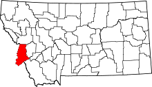 | |
| Towns | ||
| CDPs | ||
| Other communities | ||