Yellowstone County, Montana
| Yellowstone County, Montana | ||
|---|---|---|
| ||
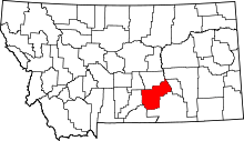 Location in the U.S. state of Montana | ||
 Montana's location in the U.S. | ||
| Founded | February 26, 1883 | |
| Named for | Yellowstone River | |
| Seat | Billings | |
| Largest city | Billings | |
| Area | ||
| • Total | 2,649 sq mi (6,861 km2) | |
| • Land | 2,633 sq mi (6,819 km2) | |
| • Water | 16 sq mi (41 km2), 0.6% | |
| Population (est.) | ||
| • (2015) | 157,048 | |
| Congressional district | At-large | |
| Time zone | Mountain: UTC-7/-6 | |
| Website |
www | |

Yellowstone County is the most populous county in the U.S. state of Montana. As of the 2010 census, the population was 147,972, and a 2014 estimate put the population at 155,634.[1] Its county seat is Billings.[2] Yellowstone County is named for the Yellowstone River which roughly bisects the county from southwest to northeast.[3] The river in turn was named after the yellow Sandstone cliffs in what is now Yellowstone County.[4]
Yellowstone County is included in the Billings, MT Metropolitan Statistical Area.
Geography
According to the U.S. Census Bureau, the county has a total area of 2,649 square miles (6,860 km2), of which 2,633 square miles (6,820 km2) is land and 16 square miles (41 km2) (0.6%) is water.[5]
Major highways
Adjacent counties
- Musselshell County - north
- Rosebud County - northeast
- Treasure County - east
- Big Horn County - southeast
- Carbon County - southwest
- Stillwater County - west
- Golden Valley County - northwest
National protected areas
Demographics
| Historical population | |||
|---|---|---|---|
| Census | Pop. | %± | |
| 1890 | 2,065 | — | |
| 1900 | 6,212 | 200.8% | |
| 1910 | 22,944 | 269.3% | |
| 1920 | 29,600 | 29.0% | |
| 1930 | 30,785 | 4.0% | |
| 1940 | 41,182 | 33.8% | |
| 1950 | 55,875 | 35.7% | |
| 1960 | 79,016 | 41.4% | |
| 1970 | 87,367 | 10.6% | |
| 1980 | 108,035 | 23.7% | |
| 1990 | 113,419 | 5.0% | |
| 2000 | 129,352 | 14.0% | |
| 2010 | 147,972 | 14.4% | |
| Est. 2015 | 157,048 | [6] | 6.1% |
| U.S. Decennial Census[7] 1790-1960[8] 1900-1990[9] 1990-2000[10] 2010-2015[11] | |||
2000 census
As of the census of 2000, there were 129,352 people, 52,084 households, and 34,219 families residing in the county. The population density was 49 people per square mile (19/km²). There were 54,563 housing units at an average density of 21 per square mile (8/km²). The racial makeup of the county was 92.78% White, 0.45% Black or African American, 3.05% Native American, 0.54% Asian, 0.04% Pacific Islander, 1.26% from other races, and 1.87% from two or more races. 3.70% of the population were Hispanic or Latino of any race. 31.1% were of German, 10.4% Norwegian, 9.7% Irish, 9.3% English and 5.4% American ancestry.
There were 52,084 households out of which 31.60% had children under the age of 18 living with them, 51.80% were married couples living together, 10.10% had a female householder with no husband present, and 34.30% were non-families. 27.90% of all households were made up of individuals and 10.10% had someone living alone who was 65 years of age or older. The average household size was 2.43 and the average family size was 2.98.
In the county the population was spread out with 25.50% under the age of 18, 9.30% from 18 to 24, 28.70% from 25 to 44, 23.20% from 45 to 64, and 13.30% who were 65 years of age or older. The median age was 37 years. For every 100 females there were 95.20 males. For every 100 females age 18 and over, there were 91.60 males.
The median income for a household in the county was $36,727, and the median income for a family was $45,277. Males had a median income of $33,475 versus $21,566 for females. The per capita income for the county was $19,303. About 8.50% of families and 11.10% of the population were below the poverty line, including 14.50% of those under age 18 and 7.40% of those age 65 or over.
2010 census
As of the 2010 United States Census, there were 147,972 people, 60,672 households, and 38,367 families residing in the county.[12] The population density was 56.2 inhabitants per square mile (21.7/km2). There were 63,943 housing units at an average density of 24.3 per square mile (9.4/km2).[13] The racial makeup of the county was 90.7% white, 4.0% American Indian, 0.6% black or African American, 0.6% Asian, 0.1% Pacific islander, 1.2% from other races, and 2.8% from two or more races. Those of Hispanic or Latino origin made up 4.7% of the population.[12] In terms of ancestry, 32.4% were German, 14.0% were Irish, 11.3% were English, 10.0% were American, and 9.9% were Norwegian.[14]
| Year | Republican | Democratic |
|---|---|---|
| 2012 | 58.9% 40,500 | 38.4% 26,403 |
| 2008 | 51.6% 36,483 | 45.3% 32,038 |
| 2004 | 61.7% 40,903 | 36.4% 24,120 |
| 2000 | 59.0% 33,922 | 35.4% 20,370 |
| 1996 | 47.2% 26,367 | 41.1% 22,992 |
| 1992 | 40.4% 22,822 | 35.7% 20,163 |
| 1988 | 55.4% 28,069 | 43.4% 21,987 |
| 1984 | 63.0% 34,124 | 35.9% 19,437 |
| 1980 | 56.6% 27,332 | 31.6% 15,272 |
| 1976 | 57.1% 25,201 | 41.5% 18,329 |
| 1972 | 62.6% 25,205 | 33.8% 13,602 |
| 1968 | 58.8% 19,898 | 34.5% 11,682 |
| 1964 | 46.8% 15,571 | 52.5% 17,446 |
| 1960 | 60.8% 19,467 | 38.6% 12,356 |
Of the 60,672 households, 30.5% had children under the age of 18 living with them, 48.0% were married couples living together, 10.5% had a female householder with no husband present, 36.8% were non-families, and 29.7% of all households were made up of individuals. The average household size was 2.38 and the average family size was 2.94. The median age was 38.3 years.[12]
The median income for a household in the county was $48,641 and the median income for a family was $62,380. Males had a median income of $42,899 versus $30,403 for females. The per capita income for the county was $26,152. About 7.9% of families and 11.2% of the population were below the poverty line, including 15.6% of those under age 18 and 7.7% of those age 65 or over.[15]
Communities
Cities
Town
Census-designated places
Unincorporated communities
Ghost towns
See also
- List of cemeteries in Yellowstone County, Montana
- List of lakes in Yellowstone County, Montana
- List of mountains in Yellowstone County, Montana
- National Register of Historic Places listings in Yellowstone County, Montana
References
- ↑ http://factfinder.census.gov/faces/tableservices/jsf/pages/productview.xhtml?src=bkmk
- ↑ "Find a County". National Association of Counties. Retrieved 2011-06-07.
- ↑ "Montana Digital Atlas - Montana Natural Resources Information System". Montana State Library, State of Montana. Retrieved 2007-09-27.
- ↑ History of Yellowstone as a Place Name
- ↑ "2010 Census Gazetteer Files". United States Census Bureau. August 22, 2012. Retrieved November 30, 2014.
- ↑ "County Totals Dataset: Population, Population Change and Estimated Components of Population Change: April 1, 2010 to July 1, 2015". Retrieved July 2, 2016.
- ↑ "U.S. Decennial Census". United States Census Bureau. Retrieved November 30, 2014.
- ↑ "Historical Census Browser". University of Virginia Library. Retrieved November 30, 2014.
- ↑ "Population of Counties by Decennial Census: 1900 to 1990". United States Census Bureau. Retrieved November 30, 2014.
- ↑ "Census 2000 PHC-T-4. Ranking Tables for Counties: 1990 and 2000" (PDF). United States Census Bureau. Retrieved November 30, 2014.
- ↑ "Yellowstone County QuickFacts". United States Census Bureau. Retrieved March 29, 2014.
- 1 2 3 "DP-1 Profile of General Population and Housing Characteristics: 2010 Demographic Profile Data". United States Census Bureau. Retrieved 2016-01-10.
- ↑ "Population, Housing Units, Area, and Density: 2010 - County". United States Census Bureau. Retrieved 2016-01-10.
- ↑ "DP02 SELECTED SOCIAL CHARACTERISTICS IN THE UNITED STATES – 2006-2010 American Community Survey 5-Year Estimates". United States Census Bureau. Retrieved 2016-01-10.
- ↑ "DP03 SELECTED ECONOMIC CHARACTERISTICS – 2006-2010 American Community Survey 5-Year Estimates". United States Census Bureau. Retrieved 2016-01-10.
External links
 |
Golden Valley County | Musselshell County | Rosebud County | |
| Stillwater County | |
Treasure County | ||
| ||||
| | ||||
| Carbon County | Big Horn County | Big Horn County |
Municipalities and communities of Yellowstone County, Montana, United States | ||
|---|---|---|
| Cities | | |
| Town | ||
| CDPs | ||
| Other unincorporated communities | ||
| Indian reservation | ||
| Ghost town | ||
| Footnotes | ‡This populated place also has portions in an adjacent county or counties | |
Coordinates: 45°56′N 108°16′W / 45.94°N 108.27°W