Mount Stuart
| Mount Stuart | |
|---|---|
 Mount Stuart from the south. | |
| Highest point | |
| Elevation | 9,415 ft (2,870 m) NGVD 29[1] |
| Prominence | 5,354 ft (1,632 m) [1] |
| Listing |
|
| Coordinates | 47°28′30″N 120°54′11″W / 47.4751179°N 120.9031444°WCoordinates: 47°28′30″N 120°54′11″W / 47.4751179°N 120.9031444°W [2] |
| Geography | |
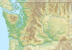 Mount Stuart Location in Washington | |
| Location | Chelan County, Washington U.S. |
| Parent range | Stuart Range, Cascade Range |
| Topo map | USGS Mount Stuart |
| Geology | |
| Age of rock | Late Cretaceous |
| Mountain type | Granite |
| Climbing | |
| First ascent | 1873 by A. McPherson and party |
| Easiest route | Major scramble |
Mount Stuart is a mountain in the Cascade Range, in the U.S. state of Washington. It is the second highest non-volcanic peak in the state, after Bonanza Peak and tenth-highest overall.[3] Mount Stuart is the highest peak in the Stuart Range, and it is located in the central part of the Washington Cascades, south of Stevens Pass and east of Snoqualmie Pass in the Alpine Lakes Wilderness.
Mount Stuart was given its name by George B. McClellan on August 26, 1853, in honor of his oldest and best friend, "the late Capt. Jas. Stuart of the Rifles—a gallant soldier & accomplished gentleman."[4]
Mount Stuart is more notable for its local relief than for its absolute elevation. For example, the south face rises 5,000 feet (1,500 m) in just 2 horizontal miles (3.2 km). The northeast and northwest sides of the mountain exhibit similar steep relief.[5] Due to its location away from higher peaks, Mount Stuart has a topographic prominence of 5,354 feet (1,632 m), making it the sixth most prominent in the state.[6] The rock of Mount Stuart is rugged due to the extensive jointing of the granite.[7] The north slopes of the mountain shelter three glaciers, including Stuart, Ice Cliff and Sherpa Glaciers from west to east.
It is not known for sure who made the first ascent of Mount Stuart. According to Fred Beckey: "Claude Rusk... was told by Frank Bryant of Yakima about finding a stick at the summit bearing the name `Angus McPherson—1873.' A. H. Sylvester, who climbed to the summit in 1897 and 1899 for triangulation, believed the first ascent was made by Frank Tweedy and Richard Goode during the Northern Pacific land survey."[7] Tweedy (after whom Tweedy's pussypaws is named) climbed Mount Stuart on August 5, 1883, and two days later again with Goode (after whom Goode Mountain is named). They did not report finding evidence of an earlier ascent.[8] Since the easiest route is not too technical, an earlier Native American ascent is also a possibility.
The standard route is the Cascadian Couloir up the southeast flank of the mountain, which ascends to a false summit just southeast of the main summit, and finishes along a short ridge. The route involves scrambling, and often, steep snow. Far more technical climbs are available on the complex north face and other aspects of the mountain.[7]
See also
References
- 1 2 "Mount Stuart, Washington". Peakbagger.com.
- ↑ "Mount Stuart". NGS data sheet. U.S. National Geodetic Survey.
- ↑ Howbert, Jeff. "Washington 100 Highest Peaks". The Northwest Peakbaggers Asylum.
- ↑ Beckey, Fred (2003). Range of Glaciers: The Exploration and Survey of the Northern Cascade Range. Oregon Historical Society Press. pp. 80, 83. ISBN 0-87595-243-7.
- ↑ Mount Stuart quadrangle, Washington (Map). 1:24000. 7.5 Minute Topographic. USGS.
- ↑ Howbert, Jeff. "All Washington Peaks with 2000 Feet of Prominence". The Northwest Peakbaggers Asylum.
- 1 2 3 Beckey, Fred W. (1987). Cascade Alpine Guide, Vol. 1, Columbia River to Stevens Pass (2nd ed.). Mountaineers Books. p. 300.
- ↑ John Roper, Washington's highest mountains first ascent chronology, 2004
External links
- "Mount Stuart". Geographic Names Information System. United States Geological Survey.
- "Mount Stuart". SummitPost.org.