Mount Peale
| Mount Peale | |
|---|---|
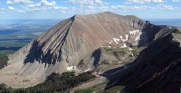 The north face of Mount Peale, as seen from the summit of Mount Mellenthin | |
| Highest point | |
| Elevation | 12,726 ft (3,879 m) NAVD 88[1] |
| Prominence | 6,161 ft (1,878 m) [2] |
| Listing |
|
| Coordinates | 38°26′18″N 109°13′45″W / 38.4384643°N 109.229186525°WCoordinates: 38°26′18″N 109°13′45″W / 38.4384643°N 109.229186525°W [1] |
| Geography | |
 Mount Peale Location in Utah | |
| Location | San Juan County, Utah, U.S. |
| Parent range | La Sal Mountains |
| Topo map | USGS Mount Peale (UT) |
| Climbing | |
| Easiest route | La Sal Pass Route: 2.5 mile hike/scramble |
Mount Peale is the highest point in the La Sal Mountains of San Juan County, in the southeastern part of Utah, United States. It is also the highest point in Utah outside the Uinta Mountains.[4][5] It is located about 20 mi (32 km) southeast of Moab. The summit is the highest point in the Manti-La Sal National Forest and the Mount Peale Research Natural Area. Mount Peale was named for Albert Peale, a mineralogist on the Hayden Survey of 1875.[5]
The La Sal Mountains sit on the arid Colorado Plateau, near such famous desert landmarks as Canyonlands National Park and Arches National Park. However, due to their height, the La Sals are heavily forested and usually snow-capped until early summer (there is one snowfield on the north side that usually lasts year round).[6] Mount Peale can be seen on a clear day from the Wasatch Plateau of central Utah, near Orangeville, over 115 miles (190 km) away.
Mount Peale can be accessed from various directions, but is most commonly climbed from the area of La Sal Pass, 10,125 ft (3,086 m), about 3 mi (5 km) to the southwest of the peak. La Sal Pass is accessed from the southeast via a graded gravel road. From the pass the summit is obtained by a short but steep off-trail hike of about 2.5 mi (4.0 km) with about 2,600 ft (800 m) of elevation gain. The route often involves some travel on snow, even in summer.[5][6]
See also
References
- 1 2 "Mount Peale". NGS data sheet. U.S. National Geodetic Survey. Retrieved 2016-04-18.
- ↑ "Mount Peale, Utah". Peakbagger.com. Retrieved 2012-05-05.
- ↑ "Utah County High Points". Peakbagger.com. Retrieved 2016-04-21.
- ↑ "Utah 12,000-foot Peaks". Peakbagger.com. Retrieved 2012-05-05.
- 1 2 3 "Mount Peale". SummitPost.org. Retrieved 2012-05-05.
- 1 2 Michael R. Kelsey, Guide to the World's Mountains (third edition), Kelsey Publishing, 1996, ISBN 0-944510-02-7, pp. 682–683.
External links
![]() Media related to Mount Peale at Wikimedia Commons
Media related to Mount Peale at Wikimedia Commons