Dillon, Montana
| Dillon, Montana | |
|---|---|
| City | |
|
Business District of Dillon | |
 Location of Dillon, Montana | |
| Coordinates: 45°12′57″N 112°38′3″W / 45.21583°N 112.63417°WCoordinates: 45°12′57″N 112°38′3″W / 45.21583°N 112.63417°W | |
| Country | United States |
| State | Montana |
| County | Beaverhead |
| Area[1] | |
| • Total | 1.76 sq mi (4.56 km2) |
| • Land | 1.76 sq mi (4.56 km2) |
| • Water | 0 sq mi (0 km2) |
| Elevation | 5,240 ft (1,560 m) |
| Population (2010)[2] | |
| • Total | 4,134 |
| • Estimate (2015)[3] | 4,210 |
| • Density | 2,348.9/sq mi (906.9/km2) |
| Time zone | Mountain (MST) (UTC-7) |
| • Summer (DST) | MDT (UTC-6) |
| ZIP code | 59725 |
| Area code(s) | 406 |
| FIPS code | 30-20800 |
| GNIS feature ID | 0770653 |
| Website | www.dillonmt.org |

Dillon is a city in and the county seat of Beaverhead County, Montana, United States.[4] The population was 4,134 at the 2010 census. The town was named for Union Pacific Railroad President Sidney Dillon.[5]

History
- Dillon was founded in the Beaverhead Valley as a railroad town in 1880 by Union Pacific Railroad President Sydney Dillon.
- The location of Dillon was selected by the railroad because of its close location to gold mines in the area.[6]
- Gold was first discovered in the Dillon area at Grasshopper Creek in 1862.
- The last real gold rush in the Dillon area happened in the Argenta area in 1920 and lasted for 30 years.
- The first ore that was discovered in the Dillon areas was silver. Gold was found soon after and this discovery caused people to come to the area in droves.[7]
- Dillon served as a central location for transporting goods to boom towns such as Bannack, Argenta, Glen, and Virginia City.
- In 1881 Dillon became part of a contentious battle with Bannack to become the county seat of Beaverhead County.
- The first brick building was built in the frontier town of Dillon in 1882.
- In 1884, Dillon became an incorporated town and began building sidewalks and permanent dwellings for the residents.
- While many of the gold mining towns around Dillon died, Dillon was able to stay a thriving town due to the railroad and talc mining in the area.[6]
- The cattle industry was established in 1865 in what would become the city of Dillon.
- With a large sheep-ranching community in the Dillon area, Dillon was once the largest exporter of sheep wool in Montana.
- The Montana Normal College was established as a teaching college in 1892, and is still functioning as a college renowned for its Education program.[8]
- A circus elephant named Old Pitt was struck by lightning in 1943 and is buried at the fairgrounds.
Geography

Dillon is located at 45°12′57″N 112°38′3″W / 45.21583°N 112.63417°W (45.215735, -112.634055),[10] at an elevation of 5102 feet (1555 m).[11] It lies approximately 40 miles (64 km) east of the Continental Divide.
According to the United States Census Bureau, the city has a total area of 1.76 square miles (4.56 km2), all of it land.[1]
Dillon is home to the Beaverhead River, a "blue ribbon" fly fishing river.
Demographics
| Historical population | |||
|---|---|---|---|
| Census | Pop. | %± | |
| 1890 | 1,012 | — | |
| 1900 | 1,530 | 51.2% | |
| 1910 | 1,835 | 19.9% | |
| 1920 | 2,701 | 47.2% | |
| 1930 | 2,422 | −10.3% | |
| 1940 | 3,014 | 24.4% | |
| 1950 | 3,268 | 8.4% | |
| 1960 | 3,690 | 12.9% | |
| 1970 | 4,548 | 23.3% | |
| 1980 | 3,976 | −12.6% | |
| 1990 | 3,991 | 0.4% | |
| 2000 | 3,752 | −6.0% | |
| 2010 | 4,134 | 10.2% | |
| Est. 2015 | 4,210 | [12] | 1.8% |
| U.S. Decennial Census[13] 2015 Estimate[3] | |||
In April 2010, Dillon was listed as one of "America's Prettiest Towns" according to Forbes magazine.
2010 census
As of the census[2] of 2010, there were 4,134 people, 1,774 households, and 897 families residing in the city. The population density was 2,348.9 inhabitants per square mile (906.9/km2). There were 1,930 housing units at an average density of 1,096.6 per square mile (423.4/km2). The racial makeup of the city was 94.7% White, 0.3% African American, 1.4% Native American, 0.5% Asian, 0.6% Pacific Islander, 0.6% from other races, and 1.9% from two or more races. Hispanic or Latino of any race were 3.5% of the population.
There were 1,774 households of which 23.0% had children under the age of 18 living with them, 38.2% were married couples living together, 9.1% had a female householder with no husband present, 3.3% had a male householder with no wife present, and 49.4% were non-families. 40.1% of all households were made up of individuals and 15.9% had someone living alone who was 65 years of age or older. The average household size was 2.08 and the average family size was 2.82.
The median age in the city was 33.9 years. 20% of residents were under the age of 18; 19.4% were between the ages of 18 and 24; 20.3% were from 25 to 44; 23.7% were from 45 to 64; and 16.7% were 65 years of age or older. The gender makeup of the city was 49.4% male and 50.6% female.
2000 census
As of the census[14] of 2000, there were 3,752 people, 1,669 households, and 934 families residing in the city. The population density was 2,300.7 people per square mile (888.7/km²). There were 1,831 housing units at an average density of 1,122.7 per square mile (433.7/km²). The racial makeup of the city was 96.43% White, 0.35% African American, 1.31% Native American, 0.13% Asian, 0.61% from other races, and 1.17% from two or more races. Hispanic or Latino of any race were 1.95% of the population.
There were 1,669 households out of which 27.6% had children under the age of 18 living with them, 44.3% were married couples living together, 8.3% had a female householder with no husband present, and 44.0% were non-families. 36.2% of all households were made up of individuals and 14.9% had someone living alone who was 65 years of age or older. The average household size was 2.19 and the average family size was 2.88.
In the city the population was spread out with 22.7% under the age of 18, 11.1% from 18 to 24, 25.5% from 25 to 44, 22.4% from 45 to 64, and 18.3% who were 65 years of age or older. The median age was 39 years. For every 100 females there were 97.5 males. For every 100 females age 18 and over, there were 94.6 males.
The median income for a household in the city was $26,389, and the median income for a family was $39,643. Males had a median income of $25,625 versus $18,906 for females. The per capita income for the city was $16,432. About 13.8% of families and 18.2% of the population were below the poverty line, including 15.9% of those under age 18 and 15.9% of those age 65 or over.
Media
Radio
KDBM AM 1490 and KBEV-FM 98.3, owned by the Dead-Air Broadcasting Company. KDWG FM 90.9 is operated by the University of Montana Western. K219DN is a local translator for KUFM (FM), University of Montana Public Radio.
Television
Television stations come from Butte and Denver
- KXLF (Channel 4) CBS affiliate
- KDVR (Channel 5) Fox Affiliate
- KTVM (Channel 6) NBC affiliate
- KUSM (Channel 9) PBS affiliate
KDVR (Channel 5) Fox Affiliate
Newspaper
Dillon has two primary newspapers.
- Dillonite: Includes sections such as new job listings in and around the area, any and all things "for sale", ISO, recent activity, and upcoming events.
- Dillon Tribune: Shows sports, obituaries, community, classified, weather and calendar.
Education
Dillon is part of School District 10 under Superintendent Glen A. Johnson.
Schools in this district include: Parkview Elementary School (mascot-panther), under Principal Greg Fitzgerald, and the Dillon Middle School (mascot-cougar) is under Principal Randy Shipman.[15]
Dillon is home to Beaverhead County High School, a Class "A" High School under Principal Gary Haverfield. The High School mascot is the Beaver.[16]
The city is also home to the University of Montana Western, formerly Western Montana College, under provost and vice chancellor Deborah Hedeen and Chancellor Beth Weatherby. The college mascot is the Bulldog.[17]
Economy
Several of Dillon's largest employers include Barretts Minerals Inc., Barrett Hospital and HealthCare, and Beaverhead County. Great Harvest Bread Company has its franchising headquarters in Dillon. Patagonia has an outlet in Dillon.
Dillon has 31 restaurants[18] which include local businesses such as Papa T's Family Dining, Sparky's Garage, Stageline Pizza, the Lion's Den, 4 B's Restaurant, Sweetwater Coffee, and La Fiesta Mexicana. The Beaverhead Brewing Company is also located in Dillon.[19] Fast food chains with locations in Dillon include Dairy Queen, McDonalds, Subway, Pita Pit, Taco John's, and Pizza Hut.
Chain stores in Dillon are Safeway, Van's IGA, Ace Hardware, and Murdoch's Ranch & Home Supply. The Beaverhead County Museum[20] is located in Dillon. Public facilities in Dillon include the Dillon Public Library, Post Office, and Barrett's Park. The YMCA has a location within the city limits.[21]
Common recreational activities which draw tourism to Dillon consists of fishing on the Beaverhead River, Snowmobiling, Hiking, shopping at the Patagonia outlet, 4-Wheeling, or skiing at Maverick Mountain Ski Area. Notably, Dillon is also home to the annual "Montana's Biggest Weekend" event, also known as the Jaycee Labor Day Rodeo, Concert, & Parade.[22]
Climate
Dillon experiences a semi-arid climate (Köppen BSk) with cold, dry winters and hot, wetter summers.
| Climate data for Dillon, Montana | |||||||||||||
|---|---|---|---|---|---|---|---|---|---|---|---|---|---|
| Month | Jan | Feb | Mar | Apr | May | Jun | Jul | Aug | Sep | Oct | Nov | Dec | Year |
| Record high °F (°C) | 60 (16) |
65 (18) |
74 (23) |
84 (29) |
91 (33) |
94 (34) |
102 (39) |
100 (38) |
94 (34) |
86 (30) |
79 (26) |
65 (18) |
102 (39) |
| Average high °F (°C) | 34.4 (1.3) |
40.4 (4.7) |
48.1 (8.9) |
57.3 (14.1) |
66.3 (19.1) |
75.2 (24) |
83.5 (28.6) |
82.3 (27.9) |
72.2 (22.3) |
60.2 (15.7) |
42.9 (6.1) |
34.2 (1.2) |
58.08 (14.49) |
| Daily mean °F (°C) | 24.0 (−4.4) |
28.7 (−1.8) |
35.6 (2) |
43.3 (6.3) |
51.6 (10.9) |
59.3 (15.2) |
65.5 (18.6) |
64.2 (17.9) |
55.5 (13.1) |
45.7 (7.6) |
32.1 (0.1) |
24.1 (−4.4) |
44.13 (6.76) |
| Average low °F (°C) | 13.5 (−10.3) |
16.9 (−8.4) |
23.0 (−5) |
29.2 (−1.6) |
36.8 (2.7) |
43.4 (6.3) |
47.4 (8.6) |
46.0 (7.8) |
38.8 (3.8) |
31.2 (−0.4) |
21.2 (−6) |
14.0 (−10) |
30.12 (−1.04) |
| Record low °F (°C) | −36 (−38) |
−40 (−40) |
−26 (−32) |
−3 (−19) |
15 (−9) |
23 (−5) |
30 (−1) |
25 (−4) |
9 (−13) |
−13 (−25) |
−31 (−35) |
−37 (−38) |
−40 (−40) |
| Average precipitation inches (mm) | 0.37 (9.4) |
0.25 (6.4) |
0.66 (16.8) |
1.22 (31) |
2.25 (57.2) |
1.87 (47.5) |
1.19 (30.2) |
1.18 (30) |
1.07 (27.2) |
0.85 (21.6) |
0.39 (9.9) |
0.35 (8.9) |
11.65 (296.1) |
| Average precipitation days (≥ 0.01 inch) | 3.7 | 3.0 | 5.1 | 6.5 | 11.4 | 9.1 | 6.9 | 7.0 | 5.4 | 4.8 | 4.4 | 3.4 | 70.7 |
| Source #1: NOAA (normals, 1971–2000) [23] | |||||||||||||
| Source #2: The Weather Channel (Records) [24] | |||||||||||||
Notable people
- Ed Barker - NFL wide receiver
- Lloyd Meeds - Politician, lobbyist, and navy officer.
- Edwin L. Norris - former Governor of Montana[25]
- Jacob Thorkelson, United States Representative from Montana[26]
- Benjamin F. White, last Governor of Montana Territory
References
- 1 2 "US Gazetteer files 2010". United States Census Bureau. Retrieved 2012-12-18.
- 1 2 "American FactFinder". United States Census Bureau. Retrieved 2012-12-18.
- 1 2 "Population Estimates". United States Census Bureau. Retrieved July 16, 2016.
- ↑ "Find a County". National Association of Counties. Retrieved 2011-06-07.
- ↑ Gannett, Henry (1905). The Origin of Certain Place Names in the United States. Govt. Print. Off. p. 106.
- 1 2 "Dillon History". Beaverhead County Museum. Beaverhead County Museum. Retrieved 2 February 2015.
- ↑ "Archives". Mining History Association. Retrieved 2 February 2015.
- ↑ "Dillon (Southwest Montana)". TravelMT. TravelMT. Retrieved 2 February 2015.
- ↑ http://www.roadsideamerica.com/story/4495
- ↑ "US Gazetteer files: 2010, 2000, and 1990". United States Census Bureau. 2011-02-12. Retrieved 2011-04-23.
- ↑ U.S. Geological Survey Geographic Names Information System: Dillon, Montana
- ↑ "Annual Estimates of the Resident Population for Incorporated Places: April 1, 2010 to July 1, 2015". Retrieved July 2, 2016.
- ↑ "Census of Population and Housing". Census.gov. Retrieved June 4, 2015.
- ↑ "American FactFinder". United States Census Bureau. Retrieved 2008-01-31.
- ↑ "Dillon Middle School". Dillon Middle School. Retrieved 3 February 2015.
- ↑ "Beaverhead County High School". Beaverhead County High School. Schoolwires.Com. Retrieved 3 February 2015.
- ↑ "UMW Homepage". University of Montana Western. Retrieved 3 February 2015.
- ↑ "Best Restaurantsin Dillon, MT". TripAdvisor. Retrieved 4 February 2015.
- ↑ "Beaverhead Brewing Company Homepage". Beaverhead Brewing Company. Retrieved 4 February 2015.
- ↑ "Beaverhead County Museum". Beaverhead County Museum. Retrieved 4 February 2015.
- ↑ "SouthWestern Montana Family YMCA". SouthWestern Montana Family YMCA. Retrieved 4 February 2015.
- ↑ "Montana's Biggest Weekend". VisitMT.Com. Retrieved 4 February 2015.
- ↑ "Climatography of the United States NO.81" (PDF). National Oceanic and Atmospheric Administration. Retrieved January 15, 2011.
- ↑ "Monthly Averages for Dillon, MT". The Weather Channel. Retrieved January 15, 2011.
- ↑ "Edwin L. Norris". National Governors Association. Retrieved 14 October 2012.
- ↑ "THORKELSON, Jacob, (1876 - 1945)". Biographical Directory of the United States Congress. Retrieved October 14, 2012.
External links
Municipalities and communities of Beaverhead County, Montana, United States | ||
|---|---|---|
| City | 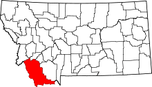 | |
| Town | ||
| CDP | ||
| Ghost towns | ||
| Unincorporated communities | ||