List of Ultras of the United States
The following sortable table comprises the 128 ultra-prominent summits of the United States of America. Each of these peaks has at least 1500 meters (4921 feet) of topographic prominence.[1]
The summit of a mountain or hill may be measured in three principal ways:
- The topographic elevation of a summit measures the height of the summit above a geodetic sea level.[2][3]
- The topographic prominence of a summit is a measure of how high the summit rises above its surroundings.[4][3]
- The topographic isolation (or radius of dominance) of a summit measures how far the summit lies from its nearest point of equal elevation.[5]
Denali is one of only three summits on Earth with more than 6000 meters (19,685 feet) of topographic prominence. Three summits of the United States exceed 4000 meters (13,123 feet), six exceed 3500 meters (11,483 feet), ten exceed 3000 meters (9843 feet), 19 exceed 2500 meters (8202 feet), 45 exceed 2000 meters (6562 feet), the following 128 ultra-prominent summits exceed 1500 meters (4921 feet), and 264 major summits exceed 1000 meters (3281 feet) of topographic prominence.
Ultra-prominent summits
Of these 128 ultra-prominent summits of the United States, 65 are located in Alaska, nine in California, eight in Nevada, eight in Utah, seven in Washington, six in Hawaiʻi, five in Arizona, four in Oregon, four in Montana, three in Colorado, three in Wyoming, three in Idaho, and one each in New Hampshire, North Carolina, and New Mexico. Four of these peaks lie on the international Alaska-Yukon border and two lie on the international Alaska-British Columbia border.
Gallery
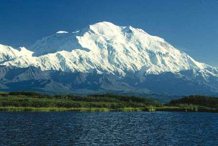
- 1. Denali in Alaska is the highest summit of the United States and all of North America.
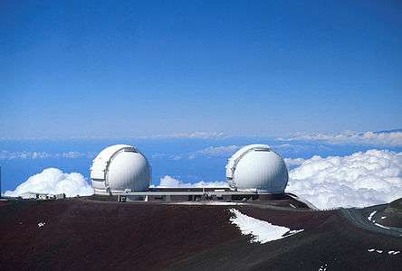 2. Mauna Kea on the Island of Hawaiʻi is the tallest mountain on Earth as measured from base to summit.
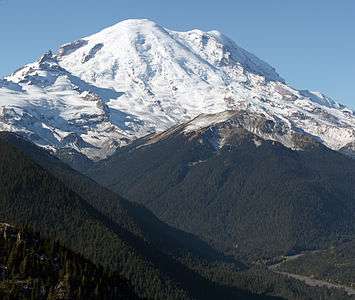 3. Mount Rainier is the highest summit of Washington and the Cascade Range.
 4. Mount Fairweather lies on the Alaska-British Columbia international border.
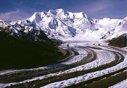 5. Mount Blackburn in Alaska is the highest summit of the Wrangell Mountains.
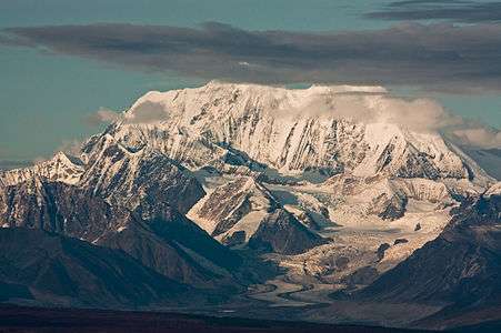 6. Mount Hayes is the highest summit of the eastern Alaska Range.
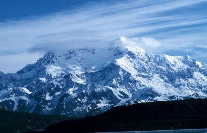 7. Mount Saint Elias is the second highest summit of both Canada and the United States.
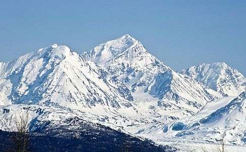 8. Mount Marcus Baker is the highest summit of the Chugach Mountains of Alaska.
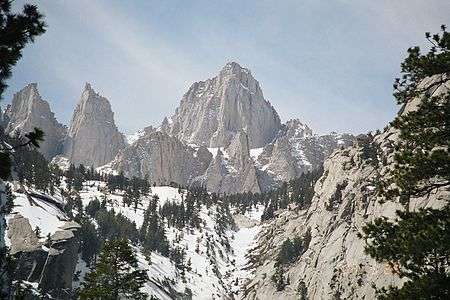 9. Mount Whitney highest summit of the Sierra Nevada and California.
 10. Haleakalā is the highest summit of the Island of Maui.
 11. Mount Shasta in California is the highest summit of the southern Cascade Range.
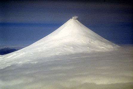
 13. Redoubt Volcano is the highest summit of the Aleutian Range.
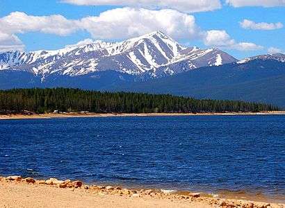 14. Mount Elbert is the highest summit of Colorado and the Rocky Mountains.
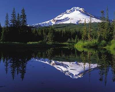 28. Mount Hood is the highest summit of Oregon.
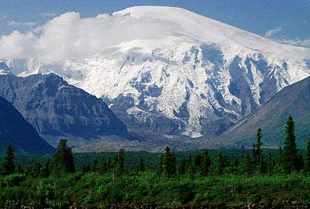 29. Mount Sanford in Alaska is the third highest volcano in the United States.
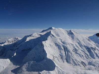 35. Mount Foraker is the second highest major summit of the Alaska Range.
 38. Mauna Loa on the Island of Hawaiʻi is the most voluminous mountain on Earth.
 40. Gannett Peak is the highest summit of the Wind River Range and Wyoming.
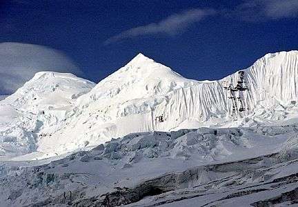 43. Mount Bona in Alaska is the highest volcano in the United States.
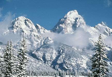 46. Grand Teton in Wyoming is the highest summit of the Teton Range.
 49. Kings Peak is the highest summit of the Uinta Range and Utah.
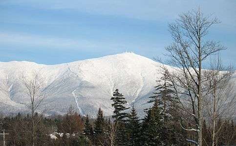 59. Mount Washington is the highest summit of the White Mountains and New Hampshire.
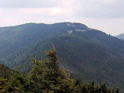 62. Mount Mitchell is the highest summit of North Carolina and the Appalachian Mountains.
 64. Humphreys Peak is the highest summit of the San Francisco Peaks and Arizona.
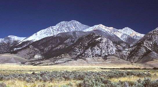 65. Borah Peak is the highest summit of the Lost River Range and Idaho.
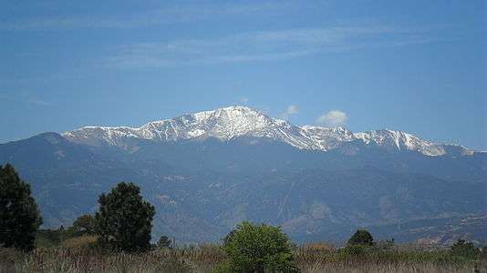 89. Pikes Peak in Colorado was the inspiration for America the Beautiful.
See also
- List of mountain peaks of North America
- List of mountain peaks of Greenland
- List of mountain peaks of Canada
- List of mountain peaks of the Rocky Mountains
- List of mountain peaks of the United States
- List of the highest major summits of the United States
- List of the most prominent summits of the United States
- List of the ultra-prominent summits of the United States
- List of the most isolated major summits of the United States
- List of mountain peaks of Alaska
- List of mountain peaks of California
- List of mountain peaks of Colorado
- List of mountain peaks of Hawaiʻi
- List of mountain peaks of México
- List of mountain peaks of Central America
- List of mountain peaks of the Caribbean
- United States of America
- Geography of the United States
- Geology of the United States
- Category:Mountains of the United States
- Physical geography
References
- ↑ This article defines a significant summit as a summit with at least 100 meters (328.1 feet) of topographic prominence, and a major summit as a summit with at least 500 meters (1640 feet) of topographic prominence. An ultra-prominent summit is a summit with at least 1500 meters (4921 feet) of topographic prominence.
- ↑ All elevations in the 48 states of the contiguous United States include an elevation adjustment from the National Geodetic Vertical Datum of 1929 (NGVD 29) to the North American Vertical Datum of 1988 (NAVD 88). For further information, please see this United States National Geodetic Survey note.
- 1 2 If the elevation or prominence of a summit is calculated as a range of values, the arithmetic mean is shown.
- ↑ The topographic prominence of a summit is the topographic elevation difference between the summit and its highest or key col to a higher summit. The summit may be near its key col or quite far away. The key col for Denali in Alaska is the Isthmus of Rivas in Nicaragua, 7642 kilometers (4749 miles) away.
- ↑ The topographic isolation of a summit is the great-circle distance to its nearest point of equal elevation.
- ↑ The summit of Denali is the highest point of the Alaska Range, the State of Alaska, the United States of America, and greater North America. Denali is the third most topographically prominent and third most topographically isolated summit on Earth after Mount Everest and Aconcagua.
- ↑ "Denali". Peakbagger.com. Retrieved 4 May 2016.
- ↑ "Denali". Bivouac.com. Retrieved 4 May 2016.
- ↑ The summit of Mauna Kea is the highest point of the Island of Hawaiʻi, the U.S. State of Hawaiʻi, and all islands of the Pacific Ocean.
- ↑ Mauna Kea is the tallest mountain on Earth as measured from base to summit. The shield volcano sits on the ocean floor at a depth of 5998 meters (19,678 feet) for a total height of 10,205.3 meters (33,482 feet).
- ↑ "SUMMIT". Datasheet for NGS Station TU2314. United States National Geodetic Survey. Retrieved 4 May 2016.
- ↑ "Mauna Kea". Peakbagger.com. Retrieved 4 May 2016.
- ↑ "Mauna Kea". Bivouac.com. Retrieved 4 May 2016.
- ↑ The summit of Mount Rainier is the highest point of the Cascade Range and the U.S. State of Washington. Mount Rainier is the most prominent summit in the contiguous United States and the fourth most prominent in North America.
- ↑ The elevation of Mount Rainier includes an adjustment of +1.914 m (+6.28 ft) from NGVD 29 to NAVD 88.
- ↑ "Mount Rainier". Peakbagger.com. Retrieved 4 May 2016.
- ↑ "Mount Rainier". Bivouac.com. Retrieved 4 May 2016.
- ↑ Mount Fairweather lies on the international border between Alaska and British Columbia. The peak is the highest point of the Canadian Province of British Columbia and the southernmost and easternmost summit of its elevation in both Canada and the United States.
- ↑ "Mount Fairweather". Peakbagger.com. Retrieved 4 May 2016.
- ↑ "Mount Fairweather". Bivouac.com. Retrieved 4 May 2016.
- ↑ The summit of Mount Blackburn is the highest point of the Wrangell Mountains.
- ↑ "MT BLACKBURN". Datasheet for NGS Station UV4136. United States National Geodetic Survey. Retrieved 4 May 2016.
- ↑ "Mount Blackburn". Peakbagger.com. Retrieved 4 May 2016.
- ↑ "Mount Blackburn". Bivouac.com. Retrieved 4 May 2016.
- ↑ The summit of Mount Hayes is the highest point of the Hayes Range.
- ↑ Mount Hayes is the northernmost 4000-meter (13,123-foot) summit of Alaska, the United States, and greater North America.
- ↑ "Mount Hayes". Peakbagger.com. Retrieved 4 May 2016.
- ↑ "Mount Hayes". Bivouac.com. Retrieved 4 May 2016.
- ↑ Mount Saint Elias is the second highest major summit of both Canada and the United States.
- ↑ "Mount Saint Elias". Peakbagger.com. Retrieved 4 May 2016.
- ↑ "Mount Saint Elias". Bivouac.com. Retrieved 4 May 2016.
- ↑ The summit of Mount Marcus Baker is the highest point of the Chugach Mountains.
- ↑ "Mount Marcus Baker". Peakbagger.com. Retrieved 4 May 2016.
- ↑ "Mount Marcus Baker". Bivouac.com. Retrieved 4 May 2016.
- ↑ The summit of Mount Whitney is the highest point of the Sierra Nevada, the State of California, and the contiguous United States.
- ↑ Mount Whitney is the southernmost and easternmost summit of its elevation in United States.
- ↑ "WHITNEY". Datasheet for NGS Station GT1811. United States National Geodetic Survey. Retrieved 4 May 2016.
- ↑ "Mount Whitney". Peakbagger.com. Retrieved 4 May 2016.
- ↑ "Mount Whitney". Bivouac.com. Retrieved 4 May 2016.
- ↑ The summit of Haleakalā is the highest point of the Island of Maui and the westernmost 3000 meter (9842.5-foot) summit of the United States.
- ↑ "Haleakalā". Peakbagger.com. Retrieved 4 May 2016.
- ↑ "Haleakalā". Bivouac.com. Retrieved 4 May 2016.
- ↑ The summit of Mount Shasta is the highest point of the southern Cascade Range.
- ↑ "MT SHASTA". Datasheet for NGS Station MX1016. United States National Geodetic Survey. Retrieved 4 May 2016.
- ↑ "Mount Shasta". Peakbagger.com. Retrieved 4 May 2016.
- ↑ "Mount Shasta". Bivouac.com. Retrieved 4 May 2016.
- ↑ The summit of Shishaldin Volcano is the highest point of Unimak Island and the Aleutian Islands.
- ↑ Shishaldin Volcano is the westernmost summit of its elevation in Alaska, the United States, and greater North America.
- ↑ "Shishaldin Volcano". Peakbagger.com. Retrieved 4 May 2016.
- ↑ "Shishaldin Volcano". Bivouac.com. Retrieved 4 May 2016.
- ↑ The summit of Redoubt Volcano is the highest point of the Chigmit Mountains.
- ↑ Redoubt Volcano is the westernmost summit of its elevation in Alaska and greater North America.
- ↑ "Redoubt Volcano". Peakbagger.com. Retrieved 4 May 2016.
- ↑ "Redoubt Volcano". Bivouac.com. Retrieved 4 May 2016.
- ↑ The summit of Mount Elbert is the highest point of the U.S. State of Colorado, the Rocky Mountains of North America, and the entire Mississippi River drainage basin.
- ↑ "MOUNT ELBERT". Datasheet for NGS Station KL0637. United States National Geodetic Survey. Retrieved 4 May 2016.
- ↑ "Mount Elbert". Peakbagger.com. Retrieved 4 May 2016.
- ↑ "Mount Elbert". Bivouac.com. Retrieved 4 May 2016.
- ↑ The summit of Mount Baker is the highest point of the northern Cascade Range.
- ↑ The elevation of Mount Baker includes an adjustment of +1.430 m (+4.69 ft) from NGVD 29 to NAVD 88.
- ↑ "Mount Baker". Peakbagger.com. Retrieved 4 May 2016.
- ↑ "Mount Baker". Bivouac.com. Retrieved 4 May 2016.
- ↑ The summit of Mount Torbert is the highest point of the Tordrillo Mountains.
- ↑ Mount Torbert is the westernmost summit of its elevation in Alaska and greater North America.
- ↑ "Mount Torbert". Peakbagger.com. Retrieved 4 May 2016.
- ↑ "Mount Torbert". Bivouac.com. Retrieved 4 May 2016.
- ↑ The summit of San Jacinto Peak is the highest point of the San Jacinto Mountains.
- ↑ "SAN JACINTO". Datasheet for NGS Station DX5119. United States National Geodetic Survey. Retrieved 4 May 2016.
- ↑ "San Jacinto Peak". Peakbagger.com. Retrieved 4 May 2016.
- ↑ "San Jacinto Peak". Bivouac.com. Retrieved 4 May 2016.
- ↑ The summit of San Gorgonio Mountain is the highest point of the San Bernardino Mountains.
- ↑ The elevation of San Gorgonio Mountain includes an adjustment of +1.303 m (+4.27 ft) from NGVD 29 to NAVD 88.
- ↑ "San Gorgonio Mountain". Peakbagger.com. Retrieved 4 May 2016.
- ↑ "San Gorgonio Mountain". Bivouac.com. Retrieved 4 May 2016.
- ↑ The summit of Charleston Peak is the highest point of the Spring Mountains.
- ↑ "CHARLESTON". Datasheet for NGS Station GR1965. United States National Geodetic Survey. Retrieved 4 May 2016.
- ↑ "Charleston Peak". Peakbagger.com. Retrieved 4 May 2016.
- ↑ "Charleston Peak". Bivouac.com. Retrieved 4 May 2016.
- ↑ The summit of Mount Pavlof is the highest point of the Alaska Peninsula.
- ↑ "Mount Pavlof". Peakbagger.com. Retrieved 4 May 2016.
- ↑ "Mount Pavlof". Bivouac.com. Retrieved 4 May 2016.
- ↑ The summit of Mount Veniaminof is the highest point of the Alaska Pennisula.
- ↑ "Mount Veniaminof". Peakbagger.com. Retrieved 4 May 2016.
- ↑ "Mount Veniaminof". Bivouac.com. Retrieved 4 May 2016.
- ↑ "MOUNT ADAMS". Datasheet for NGS Station SB1004. United States National Geodetic Survey. Retrieved 4 May 2016.
- ↑ "Mount Adams". Peakbagger.com. Retrieved 4 May 2016.
- ↑ "Mount Adams". Bivouac.com. Retrieved 4 May 2016.
- ↑ "Mount Hubbard". Peakbagger.com. Retrieved 4 May 2016.
- ↑ "Mount Hubbard". Bivouac.com. Retrieved 4 May 2016.
- ↑ The summit of Mount Isto is the highest point of the Brooks Range.
- ↑ Mount Isto is the northernmost ultra-prominent summit of Alaska and the United States.
- ↑ "Mount Isto". Peakbagger.com. Retrieved 4 May 2016.
- ↑ "Mount Isto". Bivouac.com. Retrieved 4 May 2016.
- ↑ Iliamna Volcano is the westernmost 3000-meter (9843-foot) summit of Alaska and greater North America.
- ↑ "Iliamna Volcano". Peakbagger.com. Retrieved 4 May 2016.
- ↑ "Iliamna Volcano". Bivouac.com. Retrieved 4 May 2016.
- ↑ The summit of Mount Olympus is the highest point of the Olympic Mountains.
- ↑ "MT OLYMPUS". Datasheet for NGS Station SY1857. United States National Geodetic Survey. Retrieved 4 May 2016.
- ↑ "Mount Olympus". Peakbagger.com. Retrieved 4 May 2016.
- ↑ "Mount Olympus". Bivouac.com. Retrieved 4 May 2016.
- ↑ "Mount Cook". Peakbagger.com. Retrieved 4 May 2016.
- ↑ "Mount Cook". Bivouac.com. Retrieved 4 May 2016.
- ↑ The summit of Mount Hood is the highest point of the Oregon Cascades and the U.S. State of Oregon.
- ↑ "MOUNT HOOD HIGHEST POINT". Datasheet for NGS Station RC2244. United States National Geodetic Survey. Retrieved 4 May 2016.
- ↑ "Mount Hood". Peakbagger.com. Retrieved 4 May 2016.
- ↑ "Mount Hood". Bivouac.com. Retrieved 4 May 2016.
- ↑ "Mount Sanford". Peakbagger.com. Retrieved 4 May 2016.
- ↑ "Mount Sanford". Bivouac.com. Retrieved 4 May 2016.
- ↑ "Mount Tom White". Peakbagger.com. Retrieved 4 May 2016.
- ↑ "Mount Tom White". Bivouac.com. Retrieved 4 May 2016.
- ↑ The summit of Wheeler Peak is the highest point of the Snake Range.
- ↑ "WHEELER PEAK". Datasheet for NGS Station JP0339. United States National Geodetic Survey. Retrieved 4 May 2016.
- ↑ "Wheeler Peak". Peakbagger.com. Retrieved 4 May 2016.
- ↑ "Wheeler Peak". Bivouac.com. Retrieved 4 May 2016.
- ↑ "GLACIER PEAK". Datasheet for NGS Station TQ0506. United States National Geodetic Survey. Retrieved 4 May 2016.
- ↑ The elevation of Glacier Peak includes an adjustment of +1.492 m (+4.90 ft) from NGVD 29 to NAVD 88.
- ↑ "Glacier Peak". Peakbagger.com. Retrieved 4 May 2016.
- ↑ "Glacier Peak". Bivouac.com. Retrieved 4 May 2016.
- ↑ The summit of Mount Kimball is the highest point of the Delta Range.
- ↑ "Mount Kimball". Peakbagger.com. Retrieved 4 May 2016.
- ↑ "Mount Kimball". Bivouac.com. Retrieved 4 May 2016.
- ↑ "Mount Griggs". Peakbagger.com. Retrieved 4 May 2016.
- ↑ "Mount Griggs". Bivouac.com. Retrieved 4 May 2016.
- ↑ Mount Foraker is the westernmost 5000-meter (16,404-foot) summit of Alaska, the United States, and greater North America.
- ↑ "Mount Foraker". Peakbagger.com. Retrieved 4 May 2016.
- ↑ "Mount Foraker". Bivouac.com. Retrieved 4 May 2016.
- ↑ The summit of White Mountain Peak is the highest point of the White Mountains.
- ↑ "WHITE MOUNTAIN PEAK". Datasheet for NGS Station HR2559. United States National Geodetic Survey. Retrieved 4 May 2016.
- ↑ "White Mountain Peak". Peakbagger.com. Retrieved 4 May 2016.
- ↑ "White Mountain Peak". Bivouac.com. Retrieved 4 May 2016.
- ↑ "Mount Crillon". Peakbagger.com. Retrieved 4 May 2016.
- ↑ "Mount Crillon". Bivouac.com. Retrieved 4 May 2016.
- ↑ Mauna Loa is the southernmost and westernmost 4000-meter (13,123-foot) summit of Hawaiʻi and the United States.
- ↑ The shield volcano Mauna Loa is the most voluminous mountain on Earth with an estimated volume of 74,000 km³ (17,800 cubic miles), or enough material to fill the Grand Canyon more than 18 times.
- ↑ "Mauna Loa". Peakbagger.com. Retrieved 4 May 2016.
- ↑ "Mauna Loa". Bivouac.com. Retrieved 4 May 2016.
- ↑ The summit of Cloud Peak is the highest point of the Bighorn Mountains.
- ↑ Cloud Peak is the northernmost 4000-meter (13,123-foot) summit of the Rocky Mountains.
- ↑ "CLOUD PEAK". Datasheet for NGS Station PW0524. United States National Geodetic Survey. Retrieved 4 May 2016.
- ↑ "Cloud Peak". Peakbagger.com. Retrieved 4 May 2016.
- ↑ "Cloud Peak". Bivouac.com. Retrieved 4 May 2016.
- ↑ The summit of Gannett Peak is the highest point of the Wind River Range, the U.S. State of Wyoming, and the central Rocky Mountains.
- ↑ Gannett Peak is the northernmost and westernmost summit of its elevation in the Rocky Mountains.
- ↑ "GANNETT PEAK CAIRN". Datasheet for NGS Station OW0356. United States National Geodetic Survey. Retrieved 4 May 2016.
- ↑ "Gannett Peak". Peakbagger.com. Retrieved 4 May 2016.
- ↑ "Gannett Peak". Bivouac.com. Retrieved 4 May 2016.
- ↑ The summit of Mount Vsevidof is the highest point of Umnak Island and the Fox Islands.
- ↑ Mount Vsevidof is the westernmost 2000-meter (6562-foot) summit of Alaska, the United States, and greater North America.
- ↑ "Mount Vsevidof". Peakbagger.com. Retrieved 4 May 2016.
- ↑ "Mount Vsevidof". Bivouac.com. Retrieved 4 May 2016.
- ↑ The summit of Mount Hesperus is the highest point of the western Alaska Range.
- ↑ Mount Hesperus is the westernmost summit of its elevation in Alaska and greater North America.
- ↑ "Mount Hesperus". Peakbagger.com. Retrieved 4 May 2016.
- ↑ "Mount Hesperus". Bivouac.com. Retrieved 4 May 2016.
- ↑ The summit of Mount Bona is the highest point of the northwest Saint Elias Mountains.
- ↑ "Mount Bona". Peakbagger.com. Retrieved 4 May 2016.
- ↑ "Mount Bona". Bivouac.com. Retrieved 4 May 2016.
- ↑ "Mount Drum". Peakbagger.com. Retrieved 4 May 2016.
- ↑ "Mount Drum". Bivouac.com. Retrieved 4 May 2016.
- ↑ "Mount Chiginagak". Peakbagger.com. Retrieved 4 May 2016.
- ↑ "Mount Chiginagak". Bivouac.com. Retrieved 4 May 2016.
- ↑ The summit of Grand Teton is the highest point of the Teton Range.
- ↑ Grand Teton is the northernmost and westernmost 4000-meter (13,123-foot) summit of the Rocky Mountains.
- ↑ "GRAND TETON". Datasheet for NGS Station OX0838. United States National Geodetic Survey. Retrieved 4 May 2016.
- ↑ "Grand Teton". Peakbagger.com. Retrieved 4 May 2016.
- ↑ "Grand Teton". Bivouac.com. Retrieved 4 May 2016.
- ↑ The summit of Sacajawea Peak is the highest point of the Wallowa Mountains and the Columbia Plateau.
- ↑ The elevation of Sacajawea Peak includes an adjustment of +1.560 m (+5.12 ft) from NGVD 29 to NAVD 88.
- ↑ "Sacajawea Peak". Peakbagger.com. Retrieved 4 May 2016.
- ↑ "Sacajawea Peak". Bivouac.com. Retrieved 4 May 2016.
- ↑ The summit of Mount Neacola is the highest point of the Neacola Mountains.
- ↑ "Mount Neacola". Peakbagger.com. Retrieved 4 May 2016.
- ↑ "Mount Neacola". Bivouac.com. Retrieved 4 May 2016.
- ↑ The summit of Kings Peak is the highest point of the Uinta Mountains, the U.S. State of Utah, and the western Rocky Mountains.
- ↑ The elevation of Kings Peak includes an adjustment of +1.807 m (+5.93 ft) from NGVD 29 to NAVD 88.
- ↑ "Kings Peak". Peakbagger.com. Retrieved 4 May 2016.
- ↑ "Kings Peak". Bivouac.com. Retrieved 4 May 2016.
- ↑ The summit of Mount Graham is the highest point of the Pinaleño Mountains.
- ↑ "GRAHAM". Datasheet for NGS Station CY1235. United States National Geodetic Survey. Retrieved 4 May 2016.
- ↑ "Mount Graham". Peakbagger.com. Retrieved 4 May 2016.
- ↑ "Mount Graham". Bivouac.com. Retrieved 4 May 2016.
- ↑ "Mount Douglas". Peakbagger.com. Retrieved 4 May 2016.
- ↑ "Mount Douglas". Bivouac.com. Retrieved 4 May 2016.
- ↑ The summit of Mount San Antonio is the highest point of the San Gabriel Mountains.
- ↑ The elevation of Mount San Antonio includes an adjustment of +1.214 m (+3.98 ft) from NGVD 29 to NAVD 88.
- ↑ "Mount San Antonio". Peakbagger.com. Retrieved 4 May 2016.
- ↑ "Mount San Antonio". Bivouac.com. Retrieved 4 May 2016.
- ↑ "Kichatna Spire". Peakbagger.com. Retrieved 4 May 2016.
- ↑ "Kichatna Spire". Bivouac.com. Retrieved 4 May 2016.
- ↑ "De Long Peak". Peakbagger.com. Retrieved 4 May 2016.
- ↑ The summit of Telescope Peak is the highest point of the Panamint Range.
- ↑ "TELESCOPE". Datasheet for NGS Station GS0799. United States National Geodetic Survey. Retrieved 4 May 2016.
- ↑ "Telescope Peak". Peakbagger.com. Retrieved 4 May 2016.
- ↑ "Telescope Peak". Bivouac.com. Retrieved 4 May 2016.
- ↑ The summit of Mount Peale is the highest point of the La Sal Mountains and the Colorado Plateau.
- ↑ "MOUNT PEALE". Datasheet for NGS Station JM0496. United States National Geodetic Survey. Retrieved 4 May 2016.
- ↑ "Mount Peale". Peakbagger.com. Retrieved 4 May 2016.
- ↑ "Mount Peale". Bivouac.com. Retrieved 4 May 2016.
- ↑ "POGROMNI VOLCANO". Datasheet for NGS Station UV9965. United States National Geodetic Survey. Retrieved 4 May 2016.
- ↑ "Pogromni Volcano". Peakbagger.com. Retrieved 4 May 2016.
- ↑ "Pogromni Volcano". Bivouac.com. Retrieved 4 May 2016.
- ↑ "Dewey Peak". Peakbagger.com. Retrieved 4 May 2016.
- ↑ "Dewey Peak". Bivouac.com. Retrieved 4 May 2016.
- ↑ The summit of Mount Washington is the highest point of the White Mountains, the State of New Hampshire, and the northeastern United States.
- ↑ Mount Washington is the easternmost ultra-prominent summit of the United States.
- ↑ "MT WASH". Datasheet for NGS Station PF0951. United States National Geodetic Survey. Retrieved 4 May 2016.
- ↑ The elevation of Mount Washington includes an adjustment of +0.020 m (+0.07 ft) from NGVD 29 to NAVD 88.
- ↑ "Mount Washington". Peakbagger.com. Retrieved 4 May 2016.
- ↑ "Mount Washington". Bivouac.com. Retrieved 4 May 2016.
- ↑ The summit of Mount Igikpak is the highest point of the Schwatka Mountains.
- ↑ "Mount Igikpak". Peakbagger.com. Retrieved 4 May 2016.
- ↑ "Mount Igikpak". Bivouac.com. Retrieved 4 May 2016.
- ↑ "Snow Tower". Peakbagger.com. Retrieved 4 May 2016.
- ↑ "Snow Tower". Bivouac.com. Retrieved 4 May 2016.
- ↑ The summit of Mount Mitchell is the highest point of the Appalachian Mountains, the State of North Carolina, and the eastern United States.
- ↑ Mount Mitchell is the easternmost 2000-meter (6562-foot) summit of the United States.
- ↑ The elevation of Mount Mitchell includes an adjustment of +0.025 m (+0.08 ft) from NGVD 29 to NAVD 88.
- ↑ "Mount Mitchell". Peakbagger.com. Retrieved 4 May 2016.
- ↑ "Mount Mitchell". Bivouac.com. Retrieved 4 May 2016.
- ↑ The summit of Truuli Peak is the highest point of the Kenai Mountains.
- ↑ "Truuli Peak". Peakbagger.com. Retrieved 4 May 2016.
- ↑ "Truuli Peak". Bivouac.com. Retrieved 4 May 2016.
- ↑ The summit of Humphreys Peak is the highest point of the San Francisco Peaks and the U.S. State of Arizona.
- ↑ The elevation of Humphreys Peak includes an adjustment of +1.345 m (+4.41 ft) from NGVD 29 to NAVD 88.
- ↑ "Humphreys Peak". Peakbagger.com. Retrieved 4 May 2016.
- ↑ "Humphreys Peak". Bivouac.com. Retrieved 4 May 2016.
- ↑ The summit of Borah Peak is the highest point of the Lost River Range and the U.S. State of Idaho.
- ↑ "BEAUTY RESET". Datasheet for NGS Station PZ0770. United States National Geodetic Survey. Retrieved 4 May 2016.
- ↑ "Borah Peak". Peakbagger.com. Retrieved 4 May 2016.
- ↑ "Borah Peak". Bivouac.com. Retrieved 4 May 2016.
- ↑ "Mount Natazhat". Peakbagger.com. Retrieved 4 May 2016.
- ↑ "Mount Natazhat". Bivouac.com. Retrieved 4 May 2016.
- ↑ "HANAGITA PEAK". Datasheet for NGS Station UV3837. United States National Geodetic Survey. Retrieved 4 May 2016.
- ↑ "Hanagita Peak". Peakbagger.com. Retrieved 4 May 2016.
- ↑ "Hanagita Peak". Bivouac.com. Retrieved 4 May 2016.
- ↑ The summit of Tanaga Volcano is the highest point of Tanaga Island and the Andreanof Islands.
- ↑ Tanaga Volcano is the westernmost summit of its elevation in Alaska, the United States, and greater North America.
- ↑ "Tanaga Volcano". Peakbagger.com. Retrieved 4 May 2016.
- ↑ "Tanaga Volcano". Bivouac.com. Retrieved 4 May 2016.
- ↑ The summit of Makushin Volcano is the highest point of Unalaska Island.
- ↑ "Makushin Volcano". Peakbagger.com. Retrieved 4 May 2016.
- ↑ "Makushin Volcano". Bivouac.com. Retrieved 4 May 2016.
- ↑ The summit of Sovereign Mountain is the highest point of the Talkeetna Mountains.
- ↑ "Sovereign Mountain". Peakbagger.com. Retrieved 4 May 2016.
- ↑ "Sovereign Mountain". Bivouac.com. Retrieved 4 May 2016.
- ↑ The summit of Mount Jefferson is the highest point of the Toquima Range.
- ↑ The elevation of Mount Jefferson includes an adjustment of +1.666 m (+5.47 ft) from NGVD 29 to NAVD 88.
- ↑ "Mount Jefferson". Peakbagger.com. Retrieved 4 May 2016.
- ↑ "Mount Jefferson". Bivouac.com. Retrieved 4 May 2016.
- ↑ The summit of Mount Ellen is the highest point of the Henry Mountains.
- ↑ The elevation of Mount Ellen includes an adjustment of +1.486 m (+4.88 ft) from NGVD 29 to NAVD 88.
- ↑ "Mount Ellen". Peakbagger.com. Retrieved 4 May 2016.
- ↑ "Mount Ellen". Bivouac.com. Retrieved 4 May 2016.
- ↑ "Isanotski Peaks". Peakbagger.com. Retrieved 4 May 2016.
- ↑ "Isanotski Peaks". Bivouac.com. Retrieved 4 May 2016.
- ↑ The summit of Deseret Peak is the highest point of the Stansbury Mountains.
- ↑ "Deseret Peak". Peakbagger.com. Retrieved 4 May 2016.
- ↑ "Deseret Peak". Bivouac.com. Retrieved 4 May 2016.
- ↑ "MOUNT JEFFERSON". Datasheet for NGS Station QD1739. United States National Geodetic Survey. Retrieved 4 May 2016.
- ↑ The elevation of Mount Jefferson includes an adjustment of +1.388 m (+4.55 ft) from NGVD 29 to NAVD 88.
- ↑ "Mount Jefferson". Peakbagger.com. Retrieved 4 May 2016.
- ↑ "Mount Jefferson". Bivouac.com. Retrieved 4 May 2016.
- ↑ "Isthmus Peak". Peakbagger.com. Retrieved 4 May 2016.
- ↑ "Isthmus Peak". Bivouac.com. Retrieved 4 May 2016.
- ↑ "Frosty Peak". Peakbagger.com. Retrieved 4 May 2016.
- ↑ "Frosty Peak". Bivouac.com. Retrieved 4 May 2016.
- ↑ The summit of Pilot Peak is the highest point of the Pilot Range.
- ↑ "PILOT PEAK". Datasheet for NGS Station MT0738. United States National Geodetic Survey. Retrieved 4 May 2016.
- ↑ "Pilot Peak". Peakbagger.com. Retrieved 4 May 2016.
- ↑ "Pilot Peak". Bivouac.com. Retrieved 4 May 2016.
- ↑ The summit of Crazy Peak is the highest point of the Crazy Mountains.
- ↑ The elevation of Crazy Peak includes an adjustment of +1.421 m (+4.66 ft) from NGVD 29 to NAVD 88.
- ↑ "Crazy Peak". Peakbagger.com. Retrieved 4 May 2016.
- ↑ "Crazy Peak". Bivouac.com. Retrieved 4 May 2016.
- ↑ The summit of Great Sitkin Volcano is the highest point of Great Sitkin Island.
- ↑ "Great Sitkin Volcano". Peakbagger.com. Retrieved 4 May 2016.
- ↑ "Great Sitkin Volcano". Bivouac.com. Retrieved 4 May 2016.
- ↑ "Puʻu Kukui". Peakbagger.com. Retrieved 4 May 2016.
- ↑ "Puʻu Kukui". Bivouac.com. Retrieved 4 May 2016.
- ↑ The summit of Mount Cleveland is the highest point of Chuginadak Island.
- ↑ "MOUNT CLEVELAND". Datasheet for NGS Station UV9122. United States National Geodetic Survey. Retrieved 4 May 2016.
- ↑ "Mount Cleveland". Peakbagger.com. Retrieved 4 May 2016.
- ↑ "Mount Cleveland". Bivouac.com. Retrieved 4 May 2016.
- ↑ The summit of McDonald Peak is the highest point of the Mission Range.
- ↑ The elevation of McDonald Peak includes an adjustment of +1.318 m (+4.32 ft) from NGVD 29 to NAVD 88.
- ↑ "McDonald Peak". Peakbagger.com. Retrieved 4 May 2016.
- ↑ "McDonald Peak". Bivouac.com. Retrieved 4 May 2016.
- ↑ "Mount Wrangell". Peakbagger.com. Retrieved 4 May 2016.
- ↑ "Mount Wrangell". Bivouac.com. Retrieved 4 May 2016.
- ↑ "SOUTH SISTER". Datasheet for NGS Station QD1872. United States National Geodetic Survey. Retrieved 4 May 2016.
- ↑ "South Sister". Peakbagger.com. Retrieved 4 May 2016.
- ↑ "South Sister". Bivouac.com. Retrieved 4 May 2016.
- ↑ The summit of Devils Paw is the highest point of the Juneau Icefield.
- ↑ "Devils Paw". Peakbagger.com. Retrieved 4 May 2016.
- ↑ "Devils Paw". Bivouac.com. Retrieved 4 May 2016.
- ↑ "Mount Seattle". Peakbagger.com. Retrieved 4 May 2016.
- ↑ "Mount Seattle". Bivouac.com. Retrieved 4 May 2016.
- ↑ The summit of Sierra Blanca Peak is the highest point of the Sacramento Mountains.
- ↑ "SIERRA BLANCA". Datasheet for NGS Station DR1010. United States National Geodetic Survey. Retrieved 4 May 2016.
- ↑ "Sierra Blanca Peak". Peakbagger.com. Retrieved 4 May 2016.
- ↑ "Sierra Blanca Peak". Bivouac.com. Retrieved 4 May 2016.
- ↑ Pikes Peak is the easternmost 14,000-foot (4267-meter) summit and ultra-prominent summit of the Rocky Mountains. Pikes Peak was the inspiration for the lyrics of America the Beautiful.
- ↑ "PIKES PEAK". Datasheet for NGS Station JK1242. United States National Geodetic Survey. Retrieved 4 May 2016.
- ↑ "Pikes Peak". Peakbagger.com. Retrieved 4 May 2016.
- ↑ "Pikes Peak". Bivouac.com. Retrieved 4 May 2016.
- ↑ Mount Russell is the westernmost summit of its elevation in Alaska and greater North America.
- ↑ "Mount Russell". Peakbagger.com. Retrieved 4 May 2016.
- ↑ "Mount Russell". Bivouac.com. Retrieved 4 May 2016.
- ↑ The summit of Mount Nebo is the highest point of the Wasatch Range.
- ↑ The elevation of Mount Nebo includes an adjustment of +1.395 m (+4.58 ft) from NGVD 29 to NAVD 88.
- ↑ "Mount Nebo". Peakbagger.com. Retrieved 4 May 2016.
- ↑ "Mount Nebo". Bivouac.com. Retrieved 4 May 2016.
- ↑ The summit of Snowshoe Peak is the highest point of the Cabinet Mountains.
- ↑ The elevation of Snowshoe Peak includes an adjustment of +1.367 m (+4.48 ft) from NGVD 29 to NAVD 88.
- ↑ "Snowshoe Peak". Peakbagger.com. Retrieved 4 May 2016.
- ↑ "Snowshoe Peak". Bivouac.com. Retrieved 4 May 2016.
- ↑ The summit of North Schell Peak is the highest point of the Schell Creek Range.
- ↑ "NORTH SHELL". Datasheet for NGS Station KP0332. United States National Geodetic Survey. Retrieved 4 May 2016.
- ↑ "North Schell Peak". Peakbagger.com. Retrieved 4 May 2016.
- ↑ "North Schell Peak". Bivouac.com. Retrieved 4 May 2016.
- ↑ The summit of Hayford Peak is the highest point of the Sheep Range.
- ↑ "HAYFORD". Datasheet for NGS Station GR1917. United States National Geodetic Survey. Retrieved 4 May 2016.
- ↑ "Hayford Peak". Peakbagger.com. Retrieved 4 May 2016.
- ↑ "Hayford Peak". Bivouac.com. Retrieved 4 May 2016.
- ↑ "Mount Foresta". Peakbagger.com. Retrieved 4 May 2016.
- ↑ "Mount Foresta". Bivouac.com. Retrieved 4 May 2016.
- ↑ The summit of Star Peak is the highest point of the Humboldt Range.
- ↑ "STAR PEAK RESET". Datasheet for NGS Station LS0554. United States National Geodetic Survey. Retrieved 4 May 2016.
- ↑ "Star Peak". Peakbagger.com. Retrieved 4 May 2016.
- ↑ "Star Peak". Bivouac.com. Retrieved 4 May 2016.
- ↑ The summit of Veniaminof Peak is the highest point of Baranof Island.
- ↑ "Veniaminof Peak". Peakbagger.com. Retrieved 4 May 2016.
- ↑ "Veniaminof Peak". Bivouac.com. Retrieved 4 May 2016.
- ↑ The summit of Diamond Peak is the highest point of the Lemhi Range.
- ↑ "DIAMOND RESET". Datasheet for NGS Station PZ0750. United States National Geodetic Survey. Retrieved 4 May 2016.
- ↑ "Diamond Peak". Peakbagger.com. Retrieved 4 May 2016.
- ↑ "Diamond Peak". Bivouac.com. Retrieved 4 May 2016.
- ↑ The summit of Flat Top Mountain is the highest point of the Oquirrh Mountains.
- ↑ The elevation of Flat Top Mountain includes an adjustment of +1.329 m (+4.36 ft) from NGVD 29 to NAVD 88.
- ↑ "Flat Top Mountain". Peakbagger.com. Retrieved 4 May 2016.
- ↑ "Flat Top Mountain". Bivouac.com. Retrieved 4 May 2016.
- ↑ The summit of Bearhole Peak is the highest point of the Granite Range.
- ↑ "Bearhole Peak". Peakbagger.com. Retrieved 4 May 2016.
- ↑ "Bearhole Peak". Bivouac.com. Retrieved 4 May 2016.
- ↑ The summit of Mount Steller is the highest point of Waxell Ridge.
- ↑ "Mount Steller". Peakbagger.com. Retrieved 4 May 2016.
- ↑ "Mount Steller". Bivouac.com. Retrieved 4 May 2016.
- ↑ The summit of Mount Stuart is the highest point of the Wenatchee Mountains.
- ↑ "MOUNT STUART". Datasheet for NGS Station SX1189. United States National Geodetic Survey. Retrieved 4 May 2016.
- ↑ The elevation of Mount Stuart includes an adjustment of +1.388 m (+4.55 ft) from NGVD 29 to NAVD 88.
- ↑ "Mount Stuart". Peakbagger.com. Retrieved 4 May 2016.
- ↑ "Mount Stuart". Bivouac.com. Retrieved 4 May 2016.
- ↑ The summit of Blanca Peak is the highest point of the Sangre de Cristo Mountains and the entire Rio Grande drainage basin.
- ↑ Blanca Peak is the southernmost ultra-prominent summit of the Rocky Mountains.
- ↑ The elevation of Blanca Peak includes an adjustment of +1.755 m (+5.76 ft) from NGVD 29 to NAVD 88.
- ↑ "Blanca Peak". Peakbagger.com. Retrieved 4 May 2016.
- ↑ "Blanca Peak". Bivouac.com. Retrieved 4 May 2016.
- ↑ The summit of Mount Miller is the highest point of Barkley Ridge.
- ↑ "Mount Miller". Peakbagger.com. Retrieved 4 May 2016.
- ↑ "Mount Miller". Bivouac.com. Retrieved 4 May 2016.
- ↑ The summit of Carlisle Volcano is the highest point of Carlisle Island.
- ↑ "CARLISLE PEAK". Datasheet for NGS Station TT5510. United States National Geodetic Survey. Retrieved 4 May 2016.
- ↑ "Carlisle Volcano". Peakbagger.com. Retrieved 4 May 2016.
- ↑ "Carlisle Volcano". Bivouac.com. Retrieved 4 May 2016.
- ↑ The summit of Mount Timpanogos is the highest point of the central Wasatch Range.
- ↑ "TIMPANOGOS". Datasheet for NGS Station LO0769. United States National Geodetic Survey. Retrieved 4 May 2016.
- ↑ "Mount Timpanogos". Peakbagger.com. Retrieved 4 May 2016.
- ↑ "Mount Timpanogos". Bivouac.com. Retrieved 4 May 2016.
- ↑ The summit of Bashful Peak is the highest point of the western Chugach Mountains.
- ↑ "Bashful Peak". Peakbagger.com. Retrieved 4 May 2016.
- ↑ "Bashful Peak". Bivouac.com. Retrieved 4 May 2016.
- ↑ The summit of Ibapah Peak is the highest point of the Deep Creek Range.
- ↑ The elevation of Ibapah Peak includes an adjustment of +1.517 m (+4.98 ft) from NGVD 29 to NAVD 88.
- ↑ "Ibapah Peak". Peakbagger.com. Retrieved 4 May 2016.
- ↑ "Ibapah Peak". Bivouac.com. Retrieved 4 May 2016.
- ↑ The summit of Mount Cleveland is the highest point of the Lewis Range.
- ↑ "CLEVELAND". Datasheet for NGS Station TM1009. United States National Geodetic Survey. Retrieved 4 May 2016.
- ↑ "Mount Cleveland". Peakbagger.com. Retrieved 4 May 2016.
- ↑ "Mount Cleveland". Bivouac.com. Retrieved 4 May 2016.
- ↑ The summit of Kawaikini is the highest point of the Island of Kauaʻi.
- ↑ "Kawaikini". Peakbagger.com. Retrieved 4 May 2016.
- ↑ "Kawaikini". Bivouac.com. Retrieved 4 May 2016.
- ↑ The summit of She Devil is the highest point of the Seven Devils Mountains.
- ↑ The elevation of She Devil includes an adjustment of +1.365 m (+4.48 ft) from NGVD 29 to NAVD 88.
- ↑ "She Devil". Peakbagger.com. Retrieved 4 May 2016.
- ↑ "She Devil". Bivouac.com. Retrieved 4 May 2016.
- ↑ "Tetlin Peak". Peakbagger.com. Retrieved 4 May 2016.
- ↑ "Tetlin Peak". Bivouac.com. Retrieved 4 May 2016.
- ↑ The summit of Arc Dome is the highest point of the Toiyabe Range.
- ↑ The elevation of Arc Dome includes an adjustment of +1.665 m (+5.46 ft) from NGVD 29 to NAVD 88.
- ↑ "Arc Dome". Peakbagger.com. Retrieved 4 May 2016.
- ↑ "Arc Dome". Bivouac.com. Retrieved 4 May 2016.
- ↑ "LASSEN". Datasheet for NGS Station LT0688. United States National Geodetic Survey. Retrieved 4 May 2016.
- ↑ "Lassen Peak". Peakbagger.com. Retrieved 4 May 2016.
- ↑ "Lassen Peak". Bivouac.com. Retrieved 4 May 2016.
- ↑ Mount Deborah is the northernmost summit of its elevation in Alaska, the United States, and greater North America.
- ↑ "Mount Deborah". Peakbagger.com. Retrieved 4 May 2016.
- ↑ "Mount Deborah". Bivouac.com. Retrieved 4 May 2016.
- ↑ "Necons Peak". Peakbagger.com. Retrieved 4 May 2016.
- ↑ "Necons Peak". Bivouac.com. Retrieved 4 May 2016.
- ↑ The elevation of Abercrombie Mountain includes an adjustment of +1.345 m (+4.41 ft) from NGVD 29 to NAVD 88.
- ↑ "Abercrombie Mountain". Peakbagger.com. Retrieved 4 May 2016.
- ↑ "Abercrombie Mountain". Bivouac.com. Retrieved 4 May 2016.
- ↑ The summit of Mount Lemmon is the highest point of the Santa Catalina Mountains.
- ↑ The elevation of Mount Lemmon includes an adjustment of +1.004 m (+3.29 ft) from NGVD 29 to NAVD 88.
- ↑ "Mount Lemmon". Peakbagger.com. Retrieved 4 May 2016.
- ↑ "Mount Lemmon". Bivouac.com. Retrieved 4 May 2016.
- ↑ The summit of Gareloi Volcano is the highest point of Gareloi Island.
- ↑ Gareloi Volcano is the westernmost ultra-prominent summit of Alaska, the United States, and greater North America.
- ↑ "GARELOI VOLCANO". Datasheet for NGS Station TT5136. United States National Geodetic Survey. Retrieved 4 May 2016.
- ↑ "Gareloi Volcano". Peakbagger.com. Retrieved 4 May 2016.
- ↑ "Gareloi Volcano". Bivouac.com. Retrieved 4 May 2016.
- ↑ The summit of Chiricahua Peak is the highest point of the Chiricahua Mountains.
- ↑ The elevation of Chiricahua Peak includes an adjustment of +1.173 m (+3.85 ft) from NGVD 29 to NAVD 88.
- ↑ "Chiricahua Peak". Peakbagger.com. Retrieved 4 May 2016.
- ↑ "Chiricahua Peak". Bivouac.com. Retrieved 4 May 2016.
- ↑ "Stony Peak". Peakbagger.com. Retrieved 4 May 2016.
- ↑ "Stony Peak". Bivouac.com. Retrieved 4 May 2016.
- ↑ The summit of Mount Eddy is the highest point of the Klamath Mountains.
- ↑ "EDDY". Datasheet for NGS Station MX1043. United States National Geodetic Survey. Retrieved 4 May 2016.
- ↑ "Mount Eddy". Peakbagger.com. Retrieved 4 May 2016.
- ↑ "Mount Eddy". Bivouac.com. Retrieved 4 May 2016.
- ↑ "Mount Augusta". Peakbagger.com. Retrieved 4 May 2016.
- ↑ "Mount Augusta". Bivouac.com. Retrieved 4 May 2016.
- ↑ "Copper Peak". Peakbagger.com. Retrieved 4 May 2016.
- ↑ "Copper Peak". Bivouac.com. Retrieved 4 May 2016.
- ↑ "Mount Bear". Peakbagger.com. Retrieved 4 May 2016.
- ↑ "Mount Bear". Bivouac.com. Retrieved 4 May 2016.
- ↑ The summit of Korovin Volcano is the highest point of Atka Island.
- ↑ "Korovin Volcano". Peakbagger.com. Retrieved 4 May 2016.
- ↑ "Korovin Volcano". Bivouac.com. Retrieved 4 May 2016.
- ↑ The summit of Miller Peak is the highest point of the Huachuca Mountains.
- ↑ The elevation of Miller Peak includes an adjustment of +1.067 m (+3.50 ft) from NGVD 29 to NAVD 88.
- ↑ "Miller Peak". Peakbagger.com. Retrieved 4 May 2016.
- ↑ "Miller Peak". Bivouac.com. Retrieved 4 May 2016.
- ↑ The summit of Kamakou is the highest point of the Island of Molokaʻi.
- ↑ "Kamakou". Peakbagger.com. Retrieved 4 May 2016.
- ↑ "Kamakou". Bivouac.com. Retrieved 4 May 2016.
External links
- United States Geological Survey (USGS)
- United States National Geodetic Survey (NGS)
- Bivouac.com
- Peakbagger.com
- Peaklist.org
- Peakware.com
- Summitpost.org
Coordinates: 63°04′08″N 151°00′23″W / 63.0690°N 151.0063°W