Beaverhead County, Montana
| Beaverhead County, Montana | |
|---|---|
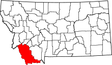 Location in the U.S. state of Montana | |
 Montana's location in the U.S. | |
| Founded | 1865 |
| Seat | Dillon |
| Largest city | Dillon |
| Area | |
| • Total | 5,572 sq mi (14,431 km2) |
| • Land | 5,542 sq mi (14,354 km2) |
| • Water | 30 sq mi (78 km2), 0.5% |
| Population (est.) | |
| • (2015) | 9,300 |
| • Density | 1.7/sq mi (1/km²) |
| Congressional district | At-large |
| Time zone | Mountain: UTC-7/-6 |
| Website |
www |
Beaverhead County is the largest county by area in the U.S. state of Montana. As of the 2010 census, the population was 9,246.[1] Its county seat is Dillon.[2] The county was founded in 1865.[3]
Much of the perimeter of the county is the Continental Divide, including all of its border with the state of Idaho. The divide heads east into Montana at the county border with Ravalli County, between Lost Trail Pass and Chief Joseph Pass.
History
The county name is derived from a rock formation, which the Shoshone described as being shaped like a beaver's head.[4]
The original county seat was the gold-mining town of Bannack. In 1881 it was moved to Dillon.
Geography
According to the U.S. Census Bureau, the county has a total area of 5,572 square miles (14,430 km2), of which 5,542 square miles (14,350 km2) is land and 30 square miles (78 km2) (0.3%) is water.[5] It is the largest county in Montana by area.
The Big Hole River runs through the county.
Adjacent counties
- Ravalli County, Montana - northwest
- Deer Lodge County, Montana - north
- Silver Bow County, Montana - north
- Madison County, Montana - east
- Fremont County, Idaho - southeast
- Clark County, Idaho - south
- Lemhi County, Idaho - west
Major highways
National protected areas
- Beaverhead National Forest (part)
- Big Hole National Battlefield
- Nez Perce National Historical Park (part)
- Red Rock Lakes National Wildlife Refuge
Demographics
| Historical population | |||
|---|---|---|---|
| Census | Pop. | %± | |
| 1870 | 722 | — | |
| 1880 | 2,712 | 275.6% | |
| 1890 | 4,655 | 71.6% | |
| 1900 | 5,615 | 20.6% | |
| 1910 | 6,446 | 14.8% | |
| 1920 | 7,369 | 14.3% | |
| 1930 | 6,654 | −9.7% | |
| 1940 | 6,943 | 4.3% | |
| 1950 | 6,671 | −3.9% | |
| 1960 | 7,194 | 7.8% | |
| 1970 | 8,187 | 13.8% | |
| 1980 | 8,186 | 0.0% | |
| 1990 | 8,424 | 2.9% | |
| 2000 | 9,202 | 9.2% | |
| 2010 | 9,246 | 0.5% | |
| Est. 2015 | 9,300 | [6] | 0.6% |
| U.S. Decennial Census[7] 1790-1960[8] 1900-1990[9] 1990-2000[10] 2010-2015[1] | |||
2000 census
As of the census[11] of 2000, there were 9,202 people, 3,684 households, and 2,354 families residing in the county. The population density was 2 people per square mile (1/km²). There were 4,571 housing units at an average density of 1 per square mile (0/km²). The racial makeup of the county was 95.86% White, 0.18% Black or African American, 1.46% Native American, 0.18% Asian, 0.04% Pacific Islander, 1.09% from other races, and 1.18% from two or more races. 2.67% of the population were Hispanic or Latino of any race. 16.7% were of German, 14.9% English, 10.7% Irish, 9.0% American and 7.2% Norwegian ancestry.
There were 3,684 households out of which 30.10% had children under the age of 18 living with them, 54.80% were married couples living together, 6.20% had a female householder with no husband present, and 36.10% were non-families. 29.70% of all households were made up of individuals and 11.00% had someone living alone who was 65 years of age or older. The average household size was 2.36 and the average family size was 2.95.
In the county the population was spread out with 24.60% under the age of 18, 11.90% from 18 to 24, 25.10% from 25 to 44, 24.90% from 45 to 64, and 13.60% who were 65 years of age or older. The median age was 38 years. For every 100 females there were 105.00 males. For every 100 females age 18 and over, there were 102.50 males.
The median income for a household in the county was $28,962, and the median income for a family was $38,971. Males had a median income of $26,162 versus $18,115 for females. The per capita income for the county was $15,621. About 12.80% of families and 17.10% of the population were below the poverty line, including 20.30% of those under age 18 and 12.20% of those age 65 or over.
2010 census
As of the 2010 United States Census, there were 9,246 people, 4,014 households, and 2,383 families residing in the county.[12] The population density was 1.7 inhabitants per square mile (0.66/km2). There were 5,273 housing units at an average density of 1.0 per square mile (0.39/km2).[13] The racial makeup of the county was 94.8% white, 1.4% American Indian, 0.4% Pacific islander, 0.4% Asian, 0.2% black or African American, 1.2% from other races, and 1.6% from two or more races. Those of Hispanic or Latino origin made up 3.7% of the population.[12] In terms of ancestry, 26.5% were German, 23.9% were English, 15.4% were Irish, 7.9% were Norwegian, 6.5% were Scottish, and 3.4% were American.[14]
Of the 4,014 households, 23.8% had children under the age of 18 living with them, 49.9% were married couples living together, 6.4% had a female householder with no husband present, 40.6% were non-families, and 33.0% of all households were made up of individuals. The average household size was 2.19 and the average family size was 2.79. The median age was 42.0 years.[12]
The median income for a household in the county was $38,264 and the median income for a family was $53,036. Males had a median income of $35,568 versus $27,314 for females. The per capita income for the county was $21,110. About 10.8% of families and 15.0% of the population were below the poverty line, including 14.4% of those under age 18 and 6.0% of those age 65 or over.[15]
Economy
Beaverhead County is one of the largest cattle and hay producing areas of Montana. Barrett's Minerals, one of the world's largest talc mines, calls Beaverhead County home.[16] In 2009, Barrett Hospital and Healthcare was the largest private employer in the county.
Education
The University of Montana Western is located in Dillon
Communities
City
- Dillon (county seat)
Town
Census-designated place
Unincorporated communities
Notable residents
- Joseph Poindexter, later Territorial Governor of Hawaii, served as County Attorney here.
Thomas Savage - novelist (1915-2003) spent his childhood and teen years on his family's ranch in Beaverhead County. His experiences there informed his best known novels, The Power of the Dog and The Sheep Queen.
See also
- List of cemeteries in Beaverhead County, Montana
- List of lakes in Beaverhead County, Montana
- List of mountains in Beaverhead County, Montana
- National Register of Historic Places listings in Beaverhead County, Montana
References
- 1 2 "State & County QuickFacts". United States Census Bureau. Retrieved September 14, 2013.
- ↑ "Find a County". National Association of Counties. Archived from the original on 2012-07-12. Retrieved 2011-06-07.
- ↑ "Montana Place Names Companion". Montana Place Names From Alzada to Zortman. Montana Historical Society Research Center. Retrieved December 1, 2014.
- ↑ Merrill, Andrea; Judy Jacobson (1997). Montana almanac. Helena, Montana: Falcon Publishing. p. 6. ISBN 1-56044-493-2.
- ↑ "2010 Census Gazetteer Files". United States Census Bureau. August 22, 2012. Retrieved November 27, 2014.
- ↑ "Annual Estimates of the Resident Population for Incorporated Places: April 1, 2010 to July 1, 2015". Retrieved May 18, 2016.
- ↑ "U.S. Decennial Census". United States Census Bureau. Archived from the original on May 11, 2015. Retrieved November 27, 2014.
- ↑ "Historical Census Browser". University of Virginia Library. Retrieved November 27, 2014.
- ↑ "Population of Counties by Decennial Census: 1900 to 1990". United States Census Bureau. Retrieved November 27, 2014.
- ↑ "Census 2000 PHC-T-4. Ranking Tables for Counties: 1990 and 2000" (PDF). United States Census Bureau. Retrieved November 27, 2014.
- ↑ "American FactFinder". United States Census Bureau. Archived from the original on 2013-09-11. Retrieved 2008-01-31.
- 1 2 3 "DP-1 Profile of General Population and Housing Characteristics: 2010 Demographic Profile Data". United States Census Bureau. Retrieved 2016-01-09.
- ↑ "Population, Housing Units, Area, and Density: 2010 - County". United States Census Bureau. Retrieved 2016-01-09.
- ↑ "DP02 SELECTED SOCIAL CHARACTERISTICS IN THE UNITED STATES – 2006-2010 American Community Survey 5-Year Estimates". United States Census Bureau. Retrieved 2016-01-09.
- ↑ "DP03 SELECTED ECONOMIC CHARACTERISTICS – 2006-2010 American Community Survey 5-Year Estimates". United States Census Bureau. Retrieved 2016-01-09.
- ↑ State of Montana. "Beaverhead County" (PDF). Archived from the original (PDF) on 6 September 2011. Retrieved 31 May 2011.
External links
 |
Ravalli County | Deer Lodge County and Silver Bow County | | |
| Lemhi County, Idaho | |
Madison County | ||
| ||||
| | ||||
| Clark County, Idaho | Fremont County, Idaho |
Municipalities and communities of Beaverhead County, Montana, United States | ||
|---|---|---|
| City | | |
| Town | ||
| CDP | ||
| Ghost towns | ||
| Unincorporated communities | ||
Coordinates: 45°07′N 112°54′W / 45.12°N 112.90°W