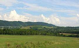
Saint-Paul-lès-Monestier
| Saint-Paul-lès-Monestier | |
|---|---|
 | |
 Saint-Paul-lès-Monestier | |
|
Location within Auvergne-Rhône-Alpes region  Saint-Paul-lès-Monestier | |
| Coordinates: 44°55′49″N 5°37′42″E / 44.9303°N 5.6283°ECoordinates: 44°55′49″N 5°37′42″E / 44.9303°N 5.6283°E | |
| Country | France |
| Region | Auvergne-Rhône-Alpes |
| Department | Isère |
| Arrondissement | Grenoble |
| Canton | Monestier-de-Clermont |
| Intercommunality | Monestier de Clermont |
| Government | |
| • Mayor (2014–2020) | André Droze |
| Area1 | 14 km2 (5 sq mi) |
| Population (2011)2 | 248 |
| • Density | 18/km2 (46/sq mi) |
| Time zone | CET (UTC+1) |
| • Summer (DST) | CEST (UTC+2) |
| INSEE/Postal code | 38438 / 38650 |
| Elevation |
515–1,800 m (1,690–5,906 ft) (avg. 816 m or 2,677 ft) |
|
1 French Land Register data, which excludes lakes, ponds, glaciers > 1 km² (0.386 sq mi or 247 acres) and river estuaries. 2 Population without double counting: residents of multiple communes (e.g., students and military personnel) only counted once. | |
Saint-Paul-lès-Monestier is a commune in the Isère department in southeastern France.
Population
| Historical population | ||
|---|---|---|
| Year | Pop. | ±% |
| 1793 | 316 | — |
| 1806 | 316 | +0.0% |
| 1821 | 293 | −7.3% |
| 1831 | 330 | +12.6% |
| 1841 | 363 | +10.0% |
| 1851 | 365 | +0.6% |
| 1861 | 321 | −12.1% |
| 1872 | 294 | −8.4% |
| 1881 | 261 | −11.2% |
| 1891 | 223 | −14.6% |
| 1901 | 210 | −5.8% |
| 1911 | 199 | −5.2% |
| 1921 | 165 | −17.1% |
| 1931 | 181 | +9.7% |
| 1946 | 132 | −27.1% |
| 1954 | 138 | +4.5% |
| 1962 | 142 | +2.9% |
| 1968 | 131 | −7.7% |
| 1975 | 132 | +0.8% |
| 1982 | 160 | +21.2% |
| 1990 | 190 | +18.8% |
| 1999 | 220 | +15.8% |
| 2006 | 283 | +28.6% |
| 2011 | 248 | −12.4% |
See also
References
| Wikimedia Commons has media related to Saint-Paul-lès-Monestier. |
This article is issued from Wikipedia - version of the 2/18/2016. The text is available under the Creative Commons Attribution/Share Alike but additional terms may apply for the media files.