Satolas-et-Bonce
| Satolas-et-Bonce | ||
|---|---|---|
|
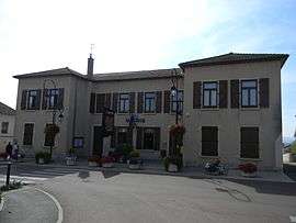
Town hall | ||
| ||
 Satolas-et-Bonce | ||
|
Location within Auvergne-Rhône-Alpes region  Satolas-et-Bonce | ||
| Coordinates: 45°41′39″N 5°07′52″E / 45.6942°N 5.1311°ECoordinates: 45°41′39″N 5°07′52″E / 45.6942°N 5.1311°E | ||
| Country | France | |
| Region | Auvergne-Rhône-Alpes | |
| Department | Isère | |
| Arrondissement | La Tour-du-Pin | |
| Canton | Verpillière | |
| Intercommunality | Porte de l'Isère | |
| Government | ||
| • Mayor (2014–2020) | Damien Michallet | |
| Area1 | 16.8 km2 (6.5 sq mi) | |
| Population (2011)2 | 2,137 | |
| • Density | 130/km2 (330/sq mi) | |
| Time zone | CET (UTC+1) | |
| • Summer (DST) | CEST (UTC+2) | |
| INSEE/Postal code | 38475 / 38290 | |
| Elevation |
200–285 m (656–935 ft) (avg. 253 m or 830 ft) | |
|
1 French Land Register data, which excludes lakes, ponds, glaciers > 1 km² (0.386 sq mi or 247 acres) and river estuaries. 2 Population without double counting: residents of multiple communes (e.g., students and military personnel) only counted once. | ||

Satolas-et-Bonce is a commune in the Isère department in southeastern France.
Geography
The Bourbre forms most of the commune's eastern border.
Population
| Historical population | ||
|---|---|---|
| Year | Pop. | ±% |
| 1800 | 932 | — |
| 1806 | 907 | −2.7% |
| 1821 | 1,082 | +19.3% |
| 1831 | 1,254 | +15.9% |
| 1841 | 1,273 | +1.5% |
| 1851 | 1,416 | +11.2% |
| 1861 | 1,309 | −7.6% |
| 1872 | 1,191 | −9.0% |
| 1881 | 1,188 | −0.3% |
| 1891 | 1,087 | −8.5% |
| 1901 | 971 | −10.7% |
| 1911 | 865 | −10.9% |
| 1921 | 822 | −5.0% |
| 1931 | 745 | −9.4% |
| 1946 | 605 | −18.8% |
| 1954 | 627 | +3.6% |
| 1962 | 677 | +8.0% |
| 1968 | 718 | +6.1% |
| 1975 | 760 | +5.8% |
| 1982 | 880 | +15.8% |
| 1990 | 1,365 | +55.1% |
| 1999 | 1,651 | +21.0% |
| 2006 | 1,941 | +17.6% |
| 2011 | 2,137 | +10.1% |
See also
References
| Wikimedia Commons has media related to Satolas-et-Bonce. |
This article is issued from Wikipedia - version of the 2/11/2016. The text is available under the Creative Commons Attribution/Share Alike but additional terms may apply for the media files.