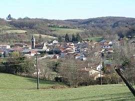
Cour-et-Buis
| Cour-et-Buis | |
|---|---|
 | |
 Cour-et-Buis | |
|
Location within Auvergne-Rhône-Alpes region  Cour-et-Buis | |
| Coordinates: 45°26′28″N 5°00′21″E / 45.4411°N 5.0058°ECoordinates: 45°26′28″N 5°00′21″E / 45.4411°N 5.0058°E | |
| Country | France |
| Region | Auvergne-Rhône-Alpes |
| Department | Isère |
| Arrondissement | Vienne |
| Canton | Beaurepaire |
| Intercommunality | Territoire de Beaurepaire |
| Government | |
| • Mayor (2014–2020) | Jacques Garnier |
| Area1 | 13.73 km2 (5.30 sq mi) |
| Population (2011)2 | 868 |
| • Density | 63/km2 (160/sq mi) |
| Time zone | CET (UTC+1) |
| • Summer (DST) | CEST (UTC+2) |
| INSEE/Postal code | 38134 / 38122 |
| Elevation |
328–462 m (1,076–1,516 ft) (avg. 343 m or 1,125 ft) |
|
1 French Land Register data, which excludes lakes, ponds, glaciers > 1 km² (0.386 sq mi or 247 acres) and river estuaries. 2 Population without double counting: residents of multiple communes (e.g., students and military personnel) only counted once. | |
Cour-et-Buis is a commune in the Isère department in southeastern France.
Population
| Historical population | ||
|---|---|---|
| Year | Pop. | ±% |
| 1793 | 515 | — |
| 1806 | 752 | +46.0% |
| 1821 | 429 | −43.0% |
| 1831 | 492 | +14.7% |
| 1841 | 654 | +32.9% |
| 1851 | 648 | −0.9% |
| 1861 | 588 | −9.3% |
| 1872 | 587 | −0.2% |
| 1881 | 596 | +1.5% |
| 1891 | 585 | −1.8% |
| 1901 | 544 | −7.0% |
| 1911 | 542 | −0.4% |
| 1921 | 493 | −9.0% |
| 1931 | 451 | −8.5% |
| 1946 | 474 | +5.1% |
| 1854 | 440 | −7.2% |
| 1962 | 407 | −7.5% |
| 1968 | 408 | +0.2% |
| 1975 | 424 | +3.9% |
| 1982 | 497 | +17.2% |
| 1990 | 571 | +14.9% |
| 1999 | 726 | +27.1% |
| 2008 | 851 | +17.2% |
| 2011 | 868 | +2.0% |
See also
References
| Wikimedia Commons has media related to Cour-et-Buis. |
This article is issued from Wikipedia - version of the 10/28/2016. The text is available under the Creative Commons Attribution/Share Alike but additional terms may apply for the media files.