Villard-Bonnot
| Villard-Bonnot | ||
|---|---|---|
|
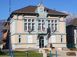
Town hall | ||
| ||
 Villard-Bonnot | ||
|
Location within Auvergne-Rhône-Alpes region  Villard-Bonnot | ||
| Coordinates: 45°14′20″N 5°53′21″E / 45.2389°N 5.8892°ECoordinates: 45°14′20″N 5°53′21″E / 45.2389°N 5.8892°E | ||
| Country | France | |
| Region | Auvergne-Rhône-Alpes | |
| Department | Isère | |
| Arrondissement | Grenoble | |
| Canton | Domène | |
| Intercommunality | Moyen Grésivaudan | |
| Government | ||
| • Mayor (2014–2020) | Daniel Chavand | |
| Area1 | 5.84 km2 (2.25 sq mi) | |
| Population (2012)2 | 7,325 | |
| • Density | 1,300/km2 (3,200/sq mi) | |
| Time zone | CET (UTC+1) | |
| • Summer (DST) | CEST (UTC+2) | |
| INSEE/Postal code | 38547 / 38190 | |
| Elevation |
218–448 m (715–1,470 ft) (avg. 235 m or 771 ft) | |
|
1 French Land Register data, which excludes lakes, ponds, glaciers > 1 km² (0.386 sq mi or 247 acres) and river estuaries. 2 Population without double counting: residents of multiple communes (e.g., students and military personnel) only counted once. | ||

Villard-Bonnot is a commune in the Isère department in southeastern France.
Population
| Historical population | ||
|---|---|---|
| Year | Pop. | ±% |
| 1793 | 698 | — |
| 1806 | 878 | +25.8% |
| 1821 | 842 | −4.1% |
| 1831 | 1,013 | +20.3% |
| 1841 | 1,019 | +0.6% |
| 1851 | 1,045 | +2.6% |
| 1861 | 1,073 | +2.7% |
| 1872 | 1,022 | −4.8% |
| 1881 | 1,333 | +30.4% |
| 1891 | 1,940 | +45.5% |
| 1901 | 2,316 | +19.4% |
| 1911 | 3,199 | +38.1% |
| 1921 | 5,045 | +57.7% |
| 1931 | 5,654 | +12.1% |
| 1946 | 4,820 | −14.8% |
| 1954 | 5,810 | +20.5% |
| 1962 | 6,499 | +11.9% |
| 1968 | 6,375 | −1.9% |
| 1975 | 6,031 | −5.4% |
| 1982 | 6,039 | +0.1% |
| 1990 | 6,382 | +5.7% |
| 1999 | 6,904 | +8.2% |
| 2006 | 7,265 | +5.2% |
| 2012 | 7,325 | +0.8% |
See also
References
| Wikimedia Commons has media related to Villard-Bonnot. |
This article is issued from Wikipedia - version of the 2/12/2016. The text is available under the Creative Commons Attribution/Share Alike but additional terms may apply for the media files.