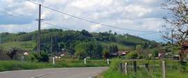
Bressieux
| Bressieux | |
|---|---|
 | |
 Bressieux | |
|
Location within Auvergne-Rhône-Alpes region  Bressieux | |
| Coordinates: 45°19′24″N 5°16′39″E / 45.3233°N 5.2775°ECoordinates: 45°19′24″N 5°16′39″E / 45.3233°N 5.2775°E | |
| Country | France |
| Region | Auvergne-Rhône-Alpes |
| Department | Isère |
| Arrondissement | Grenoble |
| Canton | Saint-Étienne-de-Saint-Geoirs |
| Intercommunality | Bièvre Toutes Aures |
| Government | |
| • Mayor (2008–2014) | Gérald Morel |
| Area1 | 0.8 km2 (0.3 sq mi) |
| Population (2009)2 | 88 |
| • Density | 110/km2 (280/sq mi) |
| Time zone | CET (UTC+1) |
| • Summer (DST) | CEST (UTC+2) |
| INSEE/Postal code | 38056 / 38870 |
| Elevation |
395–525 m (1,296–1,722 ft) (avg. 520 m or 1,710 ft) |
|
1 French Land Register data, which excludes lakes, ponds, glaciers > 1 km² (0.386 sq mi or 247 acres) and river estuaries. 2 Population without double counting: residents of multiple communes (e.g., students and military personnel) only counted once. | |
Bressieux is a commune in the Isère department in southeastern France.
Population
| Historical population | ||
|---|---|---|
| Year | Pop. | ±% |
| 1800 | 208 | — |
| 1821 | 245 | +17.8% |
| 1831 | 265 | +8.2% |
| 1841 | 183 | −30.9% |
| 1851 | 133 | −27.3% |
| 1861 | 94 | −29.3% |
| 1872 | 126 | +34.0% |
| 1881 | 102 | −19.0% |
| 1891 | 99 | −2.9% |
| 1901 | 94 | −5.1% |
| 1911 | 83 | −11.7% |
| 1921 | 65 | −21.7% |
| 1931 | 53 | −18.5% |
| 1946 | 33 | −37.7% |
| 1954 | 51 | +54.5% |
| 1962 | 69 | +35.3% |
| 1968 | 70 | +1.4% |
| 1975 | 76 | +8.6% |
| 1982 | 109 | +43.4% |
| 1990 | 96 | −11.9% |
| 1999 | 89 | −7.3% |
| 2009 | 88 | −1.1% |
See also
References
| Wikimedia Commons has media related to Bressieux. |
This article is issued from Wikipedia - version of the 10/28/2016. The text is available under the Creative Commons Attribution/Share Alike but additional terms may apply for the media files.