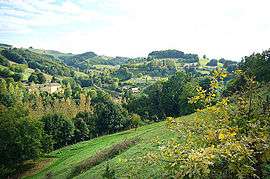
Saint-Michel-de-Saint-Geoirs
| Saint-Michel-de-Saint-Geoirs | |
|---|---|
 | |
 Saint-Michel-de-Saint-Geoirs | |
|
Location within Auvergne-Rhône-Alpes region  Saint-Michel-de-Saint-Geoirs | |
| Coordinates: 45°18′22″N 5°21′23″E / 45.3061°N 5.3564°ECoordinates: 45°18′22″N 5°21′23″E / 45.3061°N 5.3564°E | |
| Country | France |
| Region | Auvergne-Rhône-Alpes |
| Department | Isère |
| Arrondissement | Grenoble |
| Canton | Saint-Étienne-de-Saint-Geoirs |
| Intercommunality | Bièvre Toutes Aures |
| Government | |
| • Mayor (2014–2020) | Joël Mabily |
| Area1 | 7.14 km2 (2.76 sq mi) |
| Population (2011)2 | 298 |
| • Density | 42/km2 (110/sq mi) |
| Time zone | CET (UTC+1) |
| • Summer (DST) | CEST (UTC+2) |
| INSEE/Postal code | 38427 / 38590 |
| Elevation |
459–728 m (1,506–2,388 ft) (avg. 560 m or 1,840 ft) |
|
1 French Land Register data, which excludes lakes, ponds, glaciers > 1 km² (0.386 sq mi or 247 acres) and river estuaries. 2 Population without double counting: residents of multiple communes (e.g., students and military personnel) only counted once. | |
Saint-Michel-de-Saint-Geoirs is a commune in the Isère department in southeastern France.
https://www.st-michel-de-st-geoirs.fr
Population
| Historical population | ||
|---|---|---|
| Year | Pop. | ±% |
| 1793 | 306 | — |
| 1806 | 420 | +37.3% |
| 1821 | 443 | +5.5% |
| 1831 | 451 | +1.8% |
| 1841 | 508 | +12.6% |
| 1851 | 505 | −0.6% |
| 1861 | 488 | −3.4% |
| 1872 | 483 | −1.0% |
| 1881 | 507 | +5.0% |
| 1891 | 464 | −8.5% |
| 1901 | 442 | −4.7% |
| 1911 | 406 | −8.1% |
| 1921 | 340 | −16.3% |
| 1931 | 309 | −9.1% |
| 1946 | 310 | +0.3% |
| 1954 | 310 | +0.0% |
| 1962 | 237 | −23.5% |
| 1968 | 224 | −5.5% |
| 1975 | 203 | −9.4% |
| 1982 | 237 | +16.7% |
| 1990 | 222 | −6.3% |
| 1999 | 247 | +11.3% |
| 2006 | 322 | +30.4% |
| 2011 | 298 | −7.5% |
See also
References
| Wikimedia Commons has media related to Saint-Michel-de-Saint-Geoirs. |
This article is issued from Wikipedia - version of the 11/12/2016. The text is available under the Creative Commons Attribution/Share Alike but additional terms may apply for the media files.