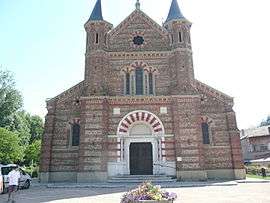
Roybon
| Roybon | ||
|---|---|---|
 | ||
| ||
 Roybon | ||
|
Location within Auvergne-Rhône-Alpes region  Roybon | ||
| Coordinates: 45°15′34″N 5°14′42″E / 45.2594°N 5.245°ECoordinates: 45°15′34″N 5°14′42″E / 45.2594°N 5.245°E | ||
| Country | France | |
| Region | Auvergne-Rhône-Alpes | |
| Department | Isère | |
| Arrondissement | Grenoble | |
| Canton | Roybon | |
| Intercommunality | Pays de Chambaran | |
| Government | ||
| • Mayor (2014–2020) | Serge Perraud | |
| Area1 | 67.31 km2 (25.99 sq mi) | |
| Population (2011)2 | 1,296 | |
| • Density | 19/km2 (50/sq mi) | |
| Time zone | CET (UTC+1) | |
| • Summer (DST) | CEST (UTC+2) | |
| INSEE/Postal code | 38347 / 38940 | |
| Elevation |
436–729 m (1,430–2,392 ft) (avg. 500 m or 1,600 ft) | |
|
1 French Land Register data, which excludes lakes, ponds, glaciers > 1 km² (0.386 sq mi or 247 acres) and river estuaries. 2 Population without double counting: residents of multiple communes (e.g., students and military personnel) only counted once. | ||

Roybon (French pronunciation: [ʁwa.bɔ̃]) is a commune in the Isère department in southeastern France.
Geography
The Galaure has its source in the commune.
Population
| Historical population | ||
|---|---|---|
| Year | Pop. | ±% |
| 1793 | 2,327 | — |
| 1806 | 2,573 | +10.6% |
| 1821 | 2,653 | +3.1% |
| 1831 | 2602 1841 | — |
| 2688 | 1,851 | — |
| 2294 | 1,861 | +0.5% |
| 2128 | 1,872 | +0.6% |
| 2048 | 1,881 | +0.5% |
| 1941 | 1,891 | +0.5% |
| 1876 | 1,901 | +0.5% |
| 1800 | 1,911 | +0.5% |
| 1565 | 1,921 | +0.5% |
| 1527 | 1,931 | +0.5% |
| 1408 | 1,946 | +0.8% |
| 1331 | 1,954 | +0.4% |
| 1331 | 1,962 | +0.4% |
| 1305 | 1,968 | +0.3% |
| 1487 | 1,975 | +0.4% |
| 1274 | 1,982 | +0.4% |
| 1220 | 1,990 | +0.4% |
| 1269 | 1,999 | +0.5% |
| 1231 | 2,006 | +0.4% |
| 1283 | 2,011 | +0.2% |
| 1296 | — | |
See also
References
| Wikimedia Commons has media related to Roybon. |
This article is issued from Wikipedia - version of the 10/28/2016. The text is available under the Creative Commons Attribution/Share Alike but additional terms may apply for the media files.