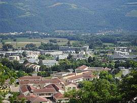
Montbonnot-Saint-Martin
| Montbonnot-Saint-Martin | ||
|---|---|---|
 | ||
| ||
 Montbonnot-Saint-Martin | ||
|
Location within Auvergne-Rhône-Alpes region  Montbonnot-Saint-Martin | ||
| Coordinates: 45°13′40″N 5°48′12″E / 45.2278°N 5.8033°ECoordinates: 45°13′40″N 5°48′12″E / 45.2278°N 5.8033°E | ||
| Country | France | |
| Region | Auvergne-Rhône-Alpes | |
| Department | Isère | |
| Arrondissement | Grenoble | |
| Canton | Saint-Ismier | |
| Government | ||
| • Mayor (2014–2020) | Pierre Beguery | |
| Area1 | 6.38 km2 (2.46 sq mi) | |
| Population (2011)2 | 4,681 | |
| • Density | 730/km2 (1,900/sq mi) | |
| Time zone | CET (UTC+1) | |
| • Summer (DST) | CEST (UTC+2) | |
| INSEE/Postal code | 38249 / 38330 | |
| Elevation |
215–356 m (705–1,168 ft) (avg. 300 m or 980 ft) | |
|
1 French Land Register data, which excludes lakes, ponds, glaciers > 1 km² (0.386 sq mi or 247 acres) and river estuaries. 2 Population without double counting: residents of multiple communes (e.g., students and military personnel) only counted once. | ||

Montbonnot-Saint-Martin is a commune in the Isère department in southeastern France and a suburb of Grenoble.
Population
| Historical population | ||
|---|---|---|
| Year | Pop. | ±% |
| 1793 | 212 | — |
| 1806 | 282 | +33.0% |
| 1821 | 297 | +5.3% |
| 1831 | 360 | +21.2% |
| 1841 | 325 | −9.7% |
| 1851 | 714 | +119.7% |
| 1861 | 695 | −2.7% |
| 1872 | 703 | +1.2% |
| 1881 | 670 | −4.7% |
| 1891 | 608 | −9.3% |
| 1901 | 580 | −4.6% |
| 1911 | 555 | −4.3% |
| 1921 | 493 | −11.2% |
| 1931 | 557 | +13.0% |
| 1946 | 600 | +7.7% |
| 1954 | 735 | +22.5% |
| 1962 | 782 | +6.4% |
| 1968 | 1,016 | +29.9% |
| 1975 | 1,735 | +70.8% |
| 1982 | 1,859 | +7.1% |
| 1990 | 2,808 | +51.0% |
| 1999 | 3,827 | +36.3% |
| 2006 | 4,487 | +17.2% |
| 2011 | 4,681 | +4.3% |
Economy
Inovallée is a science park located at Montbonnot-Saint-Martin.
See also
References
| Wikimedia Commons has media related to Montbonnot-Saint-Martin. |
This article is issued from Wikipedia - version of the 10/28/2016. The text is available under the Creative Commons Attribution/Share Alike but additional terms may apply for the media files.