Morestel
For the wine grape, see Morestel (grape).
| Morestel | ||
|---|---|---|
 | ||
| ||
 Morestel | ||
|
Location within Auvergne-Rhône-Alpes region  Morestel | ||
| Coordinates: 45°40′43″N 5°28′15″E / 45.6786°N 5.4708°ECoordinates: 45°40′43″N 5°28′15″E / 45.6786°N 5.4708°E | ||
| Country | France | |
| Region | Auvergne-Rhône-Alpes | |
| Department | Isère | |
| Arrondissement | La Tour-du-Pin | |
| Canton | Morestel | |
| Intercommunality | Pays des Couleurs | |
| Government | ||
| • Mayor (2014–2020) | Christian Rival | |
| Area1 | 8.03 km2 (3.10 sq mi) | |
| Population (2011)2 | 4,256 | |
| • Density | 530/km2 (1,400/sq mi) | |
| Time zone | CET (UTC+1) | |
| • Summer (DST) | CEST (UTC+2) | |
| INSEE/Postal code | 38261 / 38510 | |
| Elevation | 205–319 m (673–1,047 ft) | |
|
1 French Land Register data, which excludes lakes, ponds, glaciers > 1 km² (0.386 sq mi or 247 acres) and river estuaries. 2 Population without double counting: residents of multiple communes (e.g., students and military personnel) only counted once. | ||

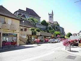
Morestel is a commune in the Isère department in south-eastern France.
Geography
Morestel is situated on the old National Highway 75, now RD 1075, between Bourg-en-Bresse and Grenoble.
Population
| Historical population | ||
|---|---|---|
| Year | Pop. | ±% |
| 1793 | 875 | — |
| 1806 | 936 | +7.0% |
| 1821 | 1,080 | +15.4% |
| 1831 | 1,326 | +22.8% |
| 1841 | 1,390 | +4.8% |
| 1851 | 1,437 | +3.4% |
| 1861 | 1,358 | −5.5% |
| 1872 | 1,296 | −4.6% |
| 1881 | 1,234 | −4.8% |
| 1891 | 1,446 | +17.2% |
| 1901 | 1,331 | −8.0% |
| 1911 | 1,405 | +5.6% |
| 1921 | 1,323 | −5.8% |
| 1931 | 1,270 | −4.0% |
| 1946 | 1,285 | +1.2% |
| 1954 | 1,286 | +0.1% |
| 1962 | 1,455 | +13.1% |
| 1968 | 1,782 | +22.5% |
| 1975 | 2,308 | +29.5% |
| 1982 | 2,738 | +18.6% |
| 1990 | 2,972 | +8.5% |
| 1999 | 3,034 | +2.1% |
| 2006 | 3,841 | +26.6% |
| 2011 | 4,256 | +10.8% |
See also
References
External links
| Wikimedia Commons has media related to Morestel. |
This article is issued from Wikipedia - version of the 10/8/2016. The text is available under the Creative Commons Attribution/Share Alike but additional terms may apply for the media files.