Vourey
| Vourey | ||
|---|---|---|
 | ||
| ||
 Vourey | ||
|
Location within Auvergne-Rhône-Alpes region  Vourey | ||
| Coordinates: 45°19′18″N 5°31′14″E / 45.3217°N 5.5206°ECoordinates: 45°19′18″N 5°31′14″E / 45.3217°N 5.5206°E | ||
| Country | France | |
| Region | Auvergne-Rhône-Alpes | |
| Department | Isère | |
| Arrondissement | Grenoble | |
| Canton | Rives | |
| Intercommunality | Pays Voironnais | |
| Government | ||
| • Mayor (2014–2020) | Fabienne Blachot-Minassian | |
| Area1 | 6.88 km2 (2.66 sq mi) | |
| Population (2012)2 | 1,609 | |
| • Density | 230/km2 (610/sq mi) | |
| Time zone | CET (UTC+1) | |
| • Summer (DST) | CEST (UTC+2) | |
| INSEE/Postal code | 38566 / 38210 | |
| Elevation |
181–402 m (594–1,319 ft) (avg. 192 m or 630 ft) | |
|
1 French Land Register data, which excludes lakes, ponds, glaciers > 1 km² (0.386 sq mi or 247 acres) and river estuaries. 2 Population without double counting: residents of multiple communes (e.g., students and military personnel) only counted once. | ||

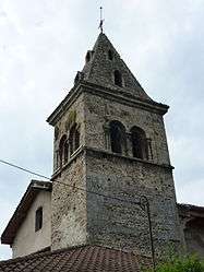
Vourey is a commune in the Isère department in southeastern France.
Population
| Historical population | ||
|---|---|---|
| Year | Pop. | ±% |
| 1793 | 1,048 | — |
| 1806 | 1,032 | −1.5% |
| 1821 | 1,176 | +14.0% |
| 1831 | 1,179 | +0.3% |
| 1841 | 1,189 | +0.8% |
| 1851 | 1,168 | −1.8% |
| 1861 | 1,055 | −9.7% |
| 1872 | 851 | −19.3% |
| 1881 | 860 | +1.1% |
| 1891 | 806 | −6.3% |
| 1901 | 787 | −2.4% |
| 1911 | 746 | −5.2% |
| 1921 | 674 | −9.7% |
| 1931 | 737 | +9.3% |
| 1946 | 665 | −9.8% |
| 1954 | 714 | +7.4% |
| 1962 | 677 | −5.2% |
| 1968 | 672 | −0.7% |
| 1975 | 761 | +13.2% |
| 1982 | 1,033 | +35.7% |
| 1990 | 1,236 | +19.7% |
| 1999 | 1,548 | +25.2% |
| 2006 | 1,640 | +5.9% |
| 2012 | 1,609 | −1.9% |
See also
References
| Wikimedia Commons has media related to Vourey. |
This article is issued from Wikipedia - version of the 10/28/2016. The text is available under the Creative Commons Attribution/Share Alike but additional terms may apply for the media files.