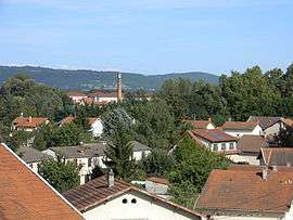
Pont-de-Chéruy
| Pont-de-Chéruy | ||
|---|---|---|
 | ||
| ||
 Pont-de-Chéruy | ||
|
Location within Auvergne-Rhône-Alpes region  Pont-de-Chéruy | ||
| Coordinates: 45°45′05″N 5°10′25″E / 45.7514°N 5.1736°ECoordinates: 45°45′05″N 5°10′25″E / 45.7514°N 5.1736°E | ||
| Country | France | |
| Region | Auvergne-Rhône-Alpes | |
| Department | Isère | |
| Arrondissement | Vienne | |
| Canton | Pont-de-Chéruy | |
| Intercommunality | Porte Dauphinoise de Lyon Satolas | |
| Government | ||
| • Mayor (2014–2020) | Alain Tuduri | |
| Area1 | 2.51 km2 (0.97 sq mi) | |
| Population (2011)2 | 5,104 | |
| • Density | 2,000/km2 (5,300/sq mi) | |
| Time zone | CET (UTC+1) | |
| • Summer (DST) | CEST (UTC+2) | |
| INSEE/Postal code | 38316 / 38230 | |
| Elevation | 196–236 m (643–774 ft) | |
|
1 French Land Register data, which excludes lakes, ponds, glaciers > 1 km² (0.386 sq mi or 247 acres) and river estuaries. 2 Population without double counting: residents of multiple communes (e.g., students and military personnel) only counted once. | ||

Pont-de-Chéruy is a commune in the Isère department in southeastern France.
Geography
The Bourbre flows north through the middle of the commune and crosses the town.
Population
| Historical population | ||
|---|---|---|
| Year | Pop. | ±% |
| 1872 | 846 | — |
| 1881 | 941 | +11.2% |
| 1891 | 1,186 | +26.0% |
| 1901 | 1,600 | +34.9% |
| 1911 | 1,951 | +21.9% |
| 1921 | 2,035 | +4.3% |
| 1931 | 2,231 | +9.6% |
| 1946 | 2,119 | −5.0% |
| 1954 | 2,224 | +5.0% |
| 1962 | 2,997 | +34.8% |
| 1968 | 3,561 | +18.8% |
| 1975 | 3,853 | +8.2% |
| 1982 | 3,849 | −0.1% |
| 1990 | 4,700 | +22.1% |
| 1999 | 4,540 | −3.4% |
| 2006 | 4,778 | +5.2% |
| 2011 | 5,104 | +6.8% |
Twin towns
Pont-de-Chéruy is twinned with:
-
 Livorno Ferraris, Italy, since 2001
See also
References
| Wikimedia Commons has media related to Pont-de-Chéruy. |
This article is issued from Wikipedia - version of the 3/15/2016. The text is available under the Creative Commons Attribution/Share Alike but additional terms may apply for the media files.