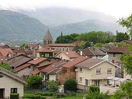
Goncelin
| Goncelin | ||
|---|---|---|
 | ||
| ||
 Goncelin | ||
|
Location within Auvergne-Rhône-Alpes region  Goncelin | ||
| Coordinates: 45°20′37″N 5°58′47″E / 45.3436°N 5.9797°ECoordinates: 45°20′37″N 5°58′47″E / 45.3436°N 5.9797°E | ||
| Country | France | |
| Region | Auvergne-Rhône-Alpes | |
| Department | Isère | |
| Arrondissement | Grenoble | |
| Canton | Goncelin | |
| Intercommunality | CIAGE | |
| Government | ||
| • Mayor (2014–2020) | Françoise Midali | |
| Area1 | 14 km2 (5 sq mi) | |
| Population (2011)2 | 2,208 | |
| • Density | 160/km2 (410/sq mi) | |
| Time zone | CET (UTC+1) | |
| • Summer (DST) | CEST (UTC+2) | |
| INSEE/Postal code | 38181 / 38570 | |
| Elevation | 235–1,278 m (771–4,193 ft) | |
|
1 French Land Register data, which excludes lakes, ponds, glaciers > 1 km² (0.386 sq mi or 247 acres) and river estuaries. 2 Population without double counting: residents of multiple communes (e.g., students and military personnel) only counted once. | ||

Goncelin is a commune in the Isère department in southeastern France.
Population
| Historical population | ||
|---|---|---|
| Year | Pop. | ±% |
| 1793 | 1,481 | — |
| 1806 | 1,650 | +11.4% |
| 1821 | 1,641 | −0.5% |
| 1831 | 1,638 | −0.2% |
| 1841 | 1,547 | −5.6% |
| 1851 | 1,650 | +6.7% |
| 1861 | 1,634 | −1.0% |
| 1872 | 1,561 | −4.5% |
| 1881 | 1,545 | −1.0% |
| 1891 | 1,521 | −1.6% |
| 1901 | 1,355 | −10.9% |
| 1911 | 1,255 | −7.4% |
| 1931 | 1,102 | −12.2% |
| 1946 | 923 | −16.2% |
| 1954 | 950 | +2.9% |
| 1962 | 884 | −6.9% |
| 1968 | 1,136 | +28.5% |
| 1975 | 1,506 | +32.6% |
| 1982 | 1,467 | −2.6% |
| 1990 | 1,771 | +20.7% |
| 1999 | 1,937 | +9.4% |
| 2008 | 2,176 | +12.3% |
| 2011 | 2,208 | +1.5% |
See also
References
| Wikimedia Commons has media related to Goncelin. |
This article is issued from Wikipedia - version of the 10/28/2016. The text is available under the Creative Commons Attribution/Share Alike but additional terms may apply for the media files.