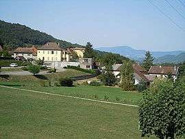
Saint-Bueil
| Saint-Bueil | |
|---|---|
 | |
 Saint-Bueil | |
|
Location within Auvergne-Rhône-Alpes region  Saint-Bueil | |
| Coordinates: 45°28′38″N 5°40′59″E / 45.4772°N 5.6831°ECoordinates: 45°28′38″N 5°40′59″E / 45.4772°N 5.6831°E | |
| Country | France |
| Region | Auvergne-Rhône-Alpes |
| Department | Isère |
| Arrondissement | La Tour-du-Pin |
| Canton | Saint-Geoire-en-Valdaine |
| Intercommunality | Pays Voironnais |
| Government | |
| • Mayor (2014–2020) | Jean-Pierre Loconte |
| Area1 | 3.81 km2 (1.47 sq mi) |
| Population (2011)2 | 691 |
| • Density | 180/km2 (470/sq mi) |
| Time zone | CET (UTC+1) |
| • Summer (DST) | CEST (UTC+2) |
| INSEE/Postal code | 38372 / 38620 |
| Elevation |
293–570 m (961–1,870 ft) (avg. 320 m or 1,050 ft) |
|
1 French Land Register data, which excludes lakes, ponds, glaciers > 1 km² (0.386 sq mi or 247 acres) and river estuaries. 2 Population without double counting: residents of multiple communes (e.g., students and military personnel) only counted once. | |
Saint-Bueil is a commune in the Isère department in southeastern France.
Population
| Historical population | ||
|---|---|---|
| Year | Pop. | ±% |
| 1800 | 222 | — |
| 1806 | 206 | −7.2% |
| 1821 | 230 | +11.7% |
| 1831 | 260 | +13.0% |
| 1841 | 656 | +152.3% |
| 1851 | 541 | −17.5% |
| 1861 | 430 | −20.5% |
| 1872 | 555 | +29.1% |
| 1881 | 673 | +21.3% |
| 1891 | 760 | +12.9% |
| 1901 | 755 | −0.7% |
| 1911 | 748 | −0.9% |
| 1921 | 725 | −3.1% |
| 1931 | 614 | −15.3% |
| 1946 | 498 | −18.9% |
| 1954 | 512 | +2.8% |
| 1962 | 540 | +5.5% |
| 1968 | 534 | −1.1% |
| 1975 | 516 | −3.4% |
| 1982 | 585 | +13.4% |
| 1990 | 559 | −4.4% |
| 1999 | 628 | +12.3% |
| 2006 | 694 | +10.5% |
| 2011 | 691 | −0.4% |
See also
References
| Wikimedia Commons has media related to Saint-Bueil. |
This article is issued from Wikipedia - version of the 10/28/2016. The text is available under the Creative Commons Attribution/Share Alike but additional terms may apply for the media files.