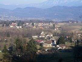
Saint-Martin-de-Vaulserre
| Saint-Martin-de-Vaulserre | |
|---|---|
 | |
 Saint-Martin-de-Vaulserre | |
|
Location within Auvergne-Rhône-Alpes region  Saint-Martin-de-Vaulserre | |
| Coordinates: 45°29′41″N 5°41′00″E / 45.4947°N 5.6833°ECoordinates: 45°29′41″N 5°41′00″E / 45.4947°N 5.6833°E | |
| Country | France |
| Region | Auvergne-Rhône-Alpes |
| Department | Isère |
| Arrondissement | La Tour-du-Pin |
| Canton | Chartreuse-Guiers |
| Intercommunality | Les Vallons du Guiers |
| Government | |
| • Mayor (2014–2020) | Joëlle Martin |
| Area1 | 3.92 km2 (1.51 sq mi) |
| Population (2011)2 | 255 |
| • Density | 65/km2 (170/sq mi) |
| Time zone | CET (UTC+1) |
| • Summer (DST) | CEST (UTC+2) |
| INSEE/Postal code | 38420 / 38480 |
| Elevation |
320–584 m (1,050–1,916 ft) (avg. 320 m or 1,050 ft) |
|
1 French Land Register data, which excludes lakes, ponds, glaciers > 1 km² (0.386 sq mi or 247 acres) and river estuaries. 2 Population without double counting: residents of multiple communes (e.g., students and military personnel) only counted once. | |
Saint-Martin-de-Vaulserre is a commune in the Isère department in southeastern France.
Population
| Historical population | ||
|---|---|---|
| Year | Pop. | ±% |
| 1793 | 1,142 | — |
| 1806 | 353 | −69.1% |
| 1821 | 428 | +21.2% |
| 1831 | 468 | +9.3% |
| 1841 | 462 | −1.3% |
| 1851 | 442 | −4.3% |
| 1861 | 387 | −12.4% |
| 1872 | 349 | −9.8% |
| 1881 | 324 | −7.2% |
| 1891 | 294 | −9.3% |
| 1901 | 269 | −8.5% |
| 1911 | 250 | −7.1% |
| 1921 | 215 | −14.0% |
| 1931 | 188 | −12.6% |
| 1946 | 183 | −2.7% |
| 1954 | 182 | −0.5% |
| 1962 | 172 | −5.5% |
| 1968 | 164 | −4.7% |
| 1975 | 134 | −18.3% |
| 1982 | 155 | +15.7% |
| 1990 | 191 | +23.2% |
| 1999 | 208 | +8.9% |
| 2006 | 218 | +4.8% |
| 2011 | 255 | +17.0% |
See also
References
| Wikimedia Commons has media related to Saint-Martin-de-Vaulserre. |
This article is issued from Wikipedia - version of the 10/28/2016. The text is available under the Creative Commons Attribution/Share Alike but additional terms may apply for the media files.