Sarcenas
| Sarcenas | |
|---|---|
 | |
 Sarcenas | |
|
Location within Auvergne-Rhône-Alpes region  Sarcenas | |
| Coordinates: 45°16′29″N 5°45′31″E / 45.2747°N 5.7586°ECoordinates: 45°16′29″N 5°45′31″E / 45.2747°N 5.7586°E | |
| Country | France |
| Region | Auvergne-Rhône-Alpes |
| Department | Isère |
| Arrondissement | Grenoble |
| Canton | Saint-Égrève |
| Intercommunality | Balcon Sud de la Chartreuse |
| Government | |
| • Mayor (2014–2020) | Jean Lovera |
| Area1 | 8 km2 (3 sq mi) |
| Population (2011)2 | 201 |
| • Density | 25/km2 (65/sq mi) |
| Time zone | CET (UTC+1) |
| • Summer (DST) | CEST (UTC+2) |
| INSEE/Postal code | 38472 / 38700 |
| Elevation |
892–2,079 m (2,927–6,821 ft) (avg. 1,100 m or 3,600 ft) |
|
1 French Land Register data, which excludes lakes, ponds, glaciers > 1 km² (0.386 sq mi or 247 acres) and river estuaries. 2 Population without double counting: residents of multiple communes (e.g., students and military personnel) only counted once. | |
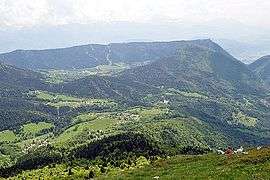
Sarcenas is a commune in the Isère department in southeastern France.
Population
| Historical population | ||
|---|---|---|
| Year | Pop. | ±% |
| 1793 | 106 | — |
| 1806 | 149 | +40.6% |
| 1821 | 132 | −11.4% |
| 1831 | 131 | −0.8% |
| 1841 | 103 | −21.4% |
| 1851 | 98 | −4.9% |
| 1861 | 93 | −5.1% |
| 1872 | 89 | −4.3% |
| 1881 | 100 | +12.4% |
| 1891 | 91 | −9.0% |
| 1901 | 81 | −11.0% |
| 1911 | 70 | −13.6% |
| 1921 | 84 | +20.0% |
| 1931 | 82 | −2.4% |
| 1946 | 77 | −6.1% |
| 1954 | 62 | −19.5% |
| 1962 | 69 | +11.3% |
| 1968 | 80 | +15.9% |
| 1975 | 90 | +12.5% |
| 1982 | 98 | +8.9% |
| 1990 | 128 | +30.6% |
| 1999 | 141 | +10.2% |
| 2006 | 171 | +21.3% |
| 2011 | 201 | +17.5% |
See also
References
| Wikimedia Commons has media related to Sarcenas. |
This article is issued from Wikipedia - version of the 2/18/2016. The text is available under the Creative Commons Attribution/Share Alike but additional terms may apply for the media files.