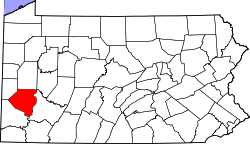
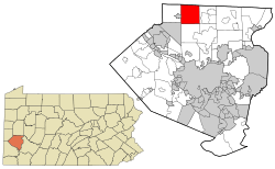
Pine Township, Allegheny County, Pennsylvania
| Township of Pine, Allegheny County, Pennsylvania | |
|---|---|
| Township | |
|
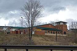
Fire station in Wexford | |
 Location in Allegheny County and state of Pennsylvania | |
| Coordinates: 40°37′10″N 80°01′29″W / 40.61944°N 80.02472°WCoordinates: 40°37′10″N 80°01′29″W / 40.61944°N 80.02472°W | |
| Country | United States |
| State | Pennsylvania |
| County | Allegheny |
| Established | 1796 |
| Government | |
| • Type | Board of Supervisors |
| Area | |
| • Total | 16.8 sq mi (43.5 km2) |
| • Land | 16.8 sq mi (43.5 km2) |
| Elevation | 1,129 ft (344 m) |
| Population (2010) | |
| • Total | 11,497 |
| • Density | 680/sq mi (260/km2) |
| Time zone | Eastern (EST) (UTC-5) |
| • Summer (DST) | EDT (UTC-4) |
| ZIP code | 15090 |
| Area code(s) | 724 |
| Website | Township of Pine |
Pine Township is a township in Allegheny County, Pennsylvania, United States. The population was 11,497 at the 2010 census.[1]
Pine Township was named for the abundance of pine trees.[2]
Geography
According to the United States Census Bureau, the township has a total area of 16.8 square miles (44 km2), of which 0.06% is water.
Demographics
| Historical population | |||
|---|---|---|---|
| Census | Pop. | %± | |
| 1850 | 2,209 | — | |
| 1860 | 1,021 | −53.8% | |
| 1870 | 718 | −29.7% | |
| 1880 | 773 | 7.7% | |
| 1890 | 746 | −3.5% | |
| 1900 | 658 | −11.8% | |
| 1910 | 698 | 6.1% | |
| 1920 | 685 | −1.9% | |
| 1930 | 937 | 36.8% | |
| 1940 | 1,191 | 27.1% | |
| 1950 | 1,732 | 45.4% | |
| 1960 | 3,613 | 108.6% | |
| 1970 | 4,259 | 17.9% | |
| 1980 | 3,908 | −8.2% | |
| 1990 | 4,048 | 3.6% | |
| 2000 | 7,683 | 89.8% | |
| 2010 | 11,497 | 49.6% | |
| Est. 2012 | 11,878 | 3.3% | |
| Sources:[3][4][5][6][7][8][9] | |||
As of the census[8] of 2000, there were 7,683 people, 2,411 households, and 2,119 families residing in the township. The population density was 457.7 people per square mile (176.7/km²). There were 2,500 housing units at an average density of 148.9 per square mile (57.5/km²). The racial makeup of the township was 97.16% White, 0.79% African American, 0.07% Native American, 1.12% Asian, 0.03% Pacific Islander, 0.16% from other races, and 0.68% from two or more races. Hispanic or Latino of any race were 0.74% of the population.
There were 2,411 households, out of which 51.6% had children under the age of 18 living with them, 82.2% were married couples living together, 4.0% had a female householder with no husband present, and 12.1% were non-families. 10.5% of all households were made up of individuals, and 4.4% had someone living alone who was 65 years of age or older. The average household size was 3.14 and the average family size was 3.40.
In the township the population was spread out, with 34.5% under the age of 18, 3.3% from 18 to 24, 30.3% from 25 to 44, 22.3% from 45 to 64, and 9.6% who were 65 years of age or older. The median age was 37 years. For every 100 females there were 96.1 males. For every 100 females age 18 and over, there were 92.1 males.
The median income for a household in the township was $85,817, and the median income for a family was $93,201. Males had a median income of $75,418 versus $35,909 for females. The per capita income for the township was $35,202. About 3.6% of families and 3.8% of the population were below the poverty line, including 3.9% of those under age 18 and 7.2% of those age 65 or over.
References
- ↑ "Race, Hispanic or Latino, Age, and Housing Occupancy: 2010 Census Redistricting Data (Public Law 94-171) Summary File (QT-PL), Pine township, Allegheny County, Pennsylvania". U.S. Census Bureau, American FactFinder 2. Retrieved September 29, 2011.
- ↑ "What's in a name? For some, a bit of history". Pittsburgh Post-Gazette. May 10, 1984. p. 2. Retrieved 16 May 2015.
- ↑ "Population of Civil Divisions Less than Counties" (PDF). 1880 United States Census. U.S. Census Bureau. Retrieved 24 November 2013.
- ↑ "Population-Pennsylvania" (PDF). U.S. Census 1910. U.S. Census Bureau. Retrieved 22 November 2013.
- ↑ "Number and Distribution of Inhabitants:Pennsylvania-Tennessee" (PDF). Fifteenth Census. U.S. Census Bureau.
- ↑ "Number of Inhabitants: Pennsylvania" (PDF). 18th Census of the United States. U.S. Census Bureau. Retrieved 22 November 2013.
- ↑ "Pennsylvania: Population and Housing Unit Counts" (PDF). U.S. Census Bureau. Retrieved 22 November 2013.
- 1 2 "American FactFinder". United States Census Bureau. Retrieved 2008-01-31.
- ↑ "Incorporated Places and Minor Civil Divisions Datasets: Subcounty Population Estimates: April 1, 2010 to July 1, 2012". U.S. Census Bureau. Archived from the original on June 17, 2013. Retrieved 25 November 2013.
External links
| Counties |  Map of the Pittsburgh Tri-State with green counties in the metropolitan area and yellow counties in the combined area. | |
|---|---|---|
| Major cities | ||
| Cities and towns 15k-50k (in 2010) | ||
| Airports | ||
| Topics | ||
| ||