Aspinwall, Pennsylvania
| Aspinwall | |
| Borough | |
 The Sauer Buildings Historic District located between 607–717 Center Avenue in Aspinwall. | |
| Official name: Borough of Aspinwall | |
| Named for: George Aspinwall | |
| Motto: The Town That Pride Built | |
| Country | United States |
|---|---|
| State | Pennsylvania |
| County | Allegheny |
| Elevation | 758 ft (231 m) |
| Coordinates | 40°29′35″N 79°54′11″W / 40.49306°N 79.90306°WCoordinates: 40°29′35″N 79°54′11″W / 40.49306°N 79.90306°W |
| Area | 0.4 sq mi (1.0 km2) |
| - land | 0.3 sq mi (0.8 km2) |
| - water | 0.04 sq mi (0.1 km2) |
| Population | 2,801 (2010) |
| Density | 7,002.5/sq mi (2,703.7/km2) |
| Incorporated | December 28, 1892 |
| Mayor | Joseph Giuffré Sr. |
| Timezone | EST (UTC-5) |
| - summer (DST) | EDT (UTC-4) |
| ZIP code | 15215 |
| Area code | 412 |
| School District | Fox Chapel Area |
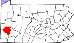
 Location in Allegheny County and the state of Pennsylvania
| |
| Website: http://www.aspinwallpa.com | |
Aspinwall is a borough on the Allegheny River in Allegheny County, Pennsylvania, United States, and is part of the Pittsburgh Metro Area. It is essentially a residential place. In 1900, 1,231 people resided in Aspinwall, and that number rose to 2,592 in 1910, and 3,170 by 1920. The population was 2,801 at the 2010 census.[1]
Geography
Aspinwall is located at 40°29′35″N 79°54′11″W / 40.49306°N 79.90306°W.[2]
According to the United States Census Bureau, the borough has a total area of 0.4 square miles (1.0 km2), of which 0.3 square miles (0.78 km2) is land and 0.04 square miles (0.10 km2) is water. Its average elevation is 758 feet (231 m) above sea level.[3]
Surrounding communities
History

In the mid-1880s, the area which is now Aspinwall was primarily owned by the descendants of James Ross, but as the steel industry was thriving in Pittsburgh, Henry Warner, superintendent of the Allegheny County Workhouse, had the idea of creating a residential community along the bank of a river.
Warner traveled to New York to discuss the idea with Annie Aspinwall. He purchased 155 acres (0.63 km2) of land from her and formed the Aspinwall Land Company in 1890. Pittsburghers, mostly from the upper-middle class, purchased lots from the 60 available home sites. By 1890, the town had 400 residents, most of whom were young couples with children. The existing government of O'Hara Township was having difficulty providing services to the rapidly growing area and, in 1892, 40 residents of the new community signed a petition requesting incorporation as "The Borough of Aspinwall, a self-governing unit."[4]
Aspinwall was officially incorporated as a borough on December 28, 1892, from O'Hara Township.[5]
Aspinwall was served by Pittsburgh Railways streetcar service 94 Aspinwall from c. 1910 until November 12, 1960, when the service was discontinued on the closure of the 62nd Street Sharpsburg Bridge. This was replaced by the Senator Robert D. Fleming Bridge which did not have streetcar tracks.[6]
From 1893 to 1905, Aspinwall developed in three phases, beginning with the area closest to the Allegheny River. On September 25, 1905, a group of Aspinwall residents purchased 200 acres (0.81 km2) from the Delafield Plan and annexed this additional land to the borough.
Early recreational facilities in the borough included tennis courts and water fountains. During World War I, the Patriots Committee of Aspinwall purchased wristwatches from a watch factory in Canton, Ohio, which they presented to the approximately 164 Aspinwall men entering the service. Aspinwall held their own victory parade and memorial service for the soldiers of their borough.[4]
Demographics
| Historical population | |||
|---|---|---|---|
| Census | Pop. | %± | |
| 1900 | 1,231 | — | |
| 1910 | 2,592 | 110.6% | |
| 1920 | 3,170 | 22.3% | |
| 1930 | 4,263 | 34.5% | |
| 1940 | 4,716 | 10.6% | |
| 1950 | 4,084 | −13.4% | |
| 1960 | 3,727 | −8.7% | |
| 1970 | 3,541 | −5.0% | |
| 1980 | 3,284 | −7.3% | |
| 1990 | 2,880 | −12.3% | |
| 2000 | 2,960 | 2.8% | |
| 2010 | 2,801 | −5.4% | |
| Est. 2015 | 2,763 | [7] | −1.4% |
| Sources:[8][9][10][11][12][13] | |||
As of the census[12] of 2000, there were 2,960 people, 1,499 households, and 728 families residing in the borough. The population density was 8,904.9 people per square mile (3,463.2/km²). There were 1,584 housing units at an average density of 4,765.3 per square mile (1,853.3/km²). The racial makeup of the borough was 98.11% White, 0.27% African American, 0.03% Native American, 0.91% Asian, 0.17% from other races, and 0.51% from two or more races. Hispanic or Latino of any race were 1.01% of the population.
There were 1,499 households, out of which 18.7% had children under the age of 18 living with them, 38.3% were married couples living together, 8.5% had a female householder with no husband present, and 51.4% were non-families. 46.0% of all households were made up of individuals, and 15.9% had someone living alone who was 65 years of age or older. The average household size was 1.97 and the average family size was 2.84.
In the borough the population was spread out, with 18.3% under the age of 18, 5.3% from 18 to 24, 34.1% from 25 to 44, 23.1% from 45 to 64, and 19.2% who were 65 years of age or older. The median age was 40 years. For every 100 females there were 76.5 males. For every 100 females age 18 and over, there were 73.4 males.
The median income for a household in the borough was $41,993, and the median income for a family was $58,750. Males had a median income of $45,231 versus $34,180 for females. The per capita income for the borough was $31,344. About 6.6% of families and 5.9% of the population were below the poverty line, including 3.1% of those under age 18 and 10.0% of those age 65 or over.
Notable people
- Moe Barr, former NBA player
- Philip Beard, novelist
- Robert Lepper, artist and Carnegie Mellon University professor
- Frederick C. Sauer, architect
References
- ↑ "Race, Hispanic or Latino, Age, and Housing Occupancy: 2010 Census Redistricting Data (Public Law 94-171) Summary File (QT-PL), Aspinwall borough, Pennsylvania". U.S. Census Bureau, American FactFinder 2. Archived from the original on September 11, 2013. Retrieved September 9, 2011.
- ↑ "US Gazetteer files: 2010, 2000, and 1990". United States Census Bureau. 2011-02-12. Retrieved 2011-04-23.
- ↑ "US Board on Geographic Names". United States Geological Survey. 2007-10-25. Retrieved 2008-01-31.
- 1 2 "History of The Borough of Aspinwall, Pennsylvania". Archived from the original on August 24, 2007. Retrieved 2007-08-19.
- ↑ "Allegheny County – 2nd Class" (PDF). Archived (PDF) from the original on August 10, 2007. Retrieved 2007-08-19.
- ↑ "Sharpsburg Bridge c1900-1962". December 22, 2008. Archived from the original on August 30, 2009. Retrieved August 14, 2009.
- ↑ "Annual Estimates of the Resident Population for Incorporated Places: April 1, 2010 to July 1, 2015". Retrieved July 2, 2016.
- ↑ "Population-Pennsylvania" (PDF). U.S. Census 1910. U.S. Census Bureau. Retrieved 22 November 2013.
- ↑ "Number and Distribution of Inhabitants:Pennsylvania-Tennessee" (PDF). Fifteenth Census. U.S. Census Bureau.
- ↑ "Number of Inhabitants: Pennsylvania" (PDF). 18th Census of the United States. U.S. Census Bureau. Retrieved 22 November 2013.
- ↑ "Pennsylvania: Population and Housing Unit Counts" (PDF). U.S. Census Bureau. Retrieved 22 November 2013.
- 1 2 "American FactFinder". United States Census Bureau. Archived from the original on September 11, 2013. Retrieved 2008-01-31.
- ↑ "Annual Estimates of the Resident Population". U.S. Census Bureau. Retrieved 22 November 2013.
External links
| Wikimedia Commons has media related to Aspinwall, Pennsylvania. |
- Borough of Aspinwall official website
- Aspinwall History
- Aspinwall High School History
- Aspinwall Volunteer Fire Department
| Counties |  Map of the Pittsburgh Tri-State with green counties in the metropolitan area and yellow counties in the combined area. | |
|---|---|---|
| Major cities | ||
| Cities and towns 15k-50k (in 2010) | ||
| Airports | ||
| Topics | ||
| ||