Bellevue, Pennsylvania
| Bellevue | ||
| Borough | ||
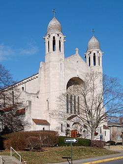 Catholic Church of the Assumption | ||
|
||
| Official name: Borough of Bellevue | ||
| Name origin: belle vue, French for beautiful view | ||
| Country | United States | |
|---|---|---|
| State | Pennsylvania | |
| County | Allegheny | |
| Elevation | 997 ft (304 m) | |
| Coordinates | 40°29′38″N 80°3′13″W / 40.49389°N 80.05361°WCoordinates: 40°29′38″N 80°3′13″W / 40.49389°N 80.05361°W | |
| Area | 1.1 sq mi (2.8 km2) | |
| - land | 1.0 sq mi (2.6 km2) | |
| - water | 0.1 sq mi (0.3 km2), 9.09% | |
| Population | 8,370 (2010) | |
| Density | 8,370/sq mi (3,231.7/km2) | |
| Settled | 1796–1804 | |
| - Incorporated | September 7, 1867 (149 years ago) | |
| Mayor | Paul Cusick | |
| Timezone | EST (UTC-5) | |
| - summer (DST) | EDT (UTC-4) | |
| ZIP code | 15202 | |
| Area code | 412 | |
| School District | Northgate | |
 Location in Allegheny County and the state of Pennsylvania
| ||
 Location of Pennsylvania in the United States
| ||
| Website: bellevuepa.org | ||

Bellevue is a borough in Allegheny County, Pennsylvania, along the Ohio River, adjoining Pittsburgh. The population was 8,370 at the 2010 census.[1] The borough was incorporated in 1867. It is located in the Northgate School District. There is a public park and library, the Andrew Bayne Memorial Library.
History
The land on which the borough currently sits was once part of the Depreciation Lands reserved for Revolutionary War veterans.[2] The first landowners in the area were James Robinson and Hugh Henry Brackenridge, purchasing parcels in 1799 and 1792 respectively.[2] At the time of its organization as a borough, Bellevue had exactly the minimum population for such a designation: 300 residents.[3]
Residents of the area tried unsuccessfully to obtain improvements from Ross Township, but officials were opposed to development along Venango Trail (today Route 19).[2] In response, Bellevue was incorporated as a borough independent of Ross on September 7, 1867.[4] The name of the borough was chosen by J. J. East, a linguist and early resident of the borough, and means "beautiful view."[2]
Geography
Bellevue is located at 40°29′38″N 80°3′13″W / 40.49389°N 80.05361°W.[5]
According to the United States Census Bureau, the borough has a total area of 1.1 square miles (2.8 km2), of which 1.0 square mile (2.6 km2) is land and 0.1 square miles (0.26 km2), or 9.09%, is water. Its average elevation is 997 feet (304 m) above sea level.[6]
Surrounding communities
- Pittsburgh neighborhoods
- Brighton Heights (southeast)
- Avalon (northwest)
- Kilbuck Township (northwest)
- Ross Township (north and east)
Demographics
| Historical population | |||
|---|---|---|---|
| Census | Pop. | %± | |
| 1870 | 384 | — | |
| 1880 | 915 | 138.3% | |
| 1890 | 1,418 | 55.0% | |
| 1900 | 3,416 | 140.9% | |
| 1910 | 6,323 | 85.1% | |
| 1920 | 8,198 | 29.7% | |
| 1930 | 10,252 | 25.1% | |
| 1940 | 10,488 | 2.3% | |
| 1950 | 11,604 | 10.6% | |
| 1960 | 11,412 | −1.7% | |
| 1970 | 11,586 | 1.5% | |
| 1980 | 10,128 | −12.6% | |
| 1990 | 9,126 | −9.9% | |
| 2000 | 8,770 | −3.9% | |
| 2010 | 8,370 | −4.6% | |
| Est. 2015 | 8,252 | [7] | −1.4% |
| Sources:[8][9][10][11] | |||
As of the census of 2000, there were 8,770 people, 4,389 households, and 1,953 families residing in the borough.[10] The population density was 8,768.1 people per square mile (3,386.1/km²). There were 4,770 housing units at an average density of 4,769.0 per square mile (1,841.7/km²). The racial makeup of the borough was 72.36% White, 22.40% African American, 0.17% Native American, 0.65% Asian, 0.16% from other races, and 1.25% from two or more races. Hispanic or Latino of any race were 3.81% of the population.
There were 4,389 households, out of which 19.8% had children under the age of 18 living with them, 30.6% were married couples living together, 11.0% had a female householder with no husband present, and 55.5% were non-families. 48.1% of all households were made up of individuals, and 13.4% had someone living alone who was 65 years of age or older. The average household size was 1.97 and the average family size was 2.92.
In the borough the population was spread out, with 19.5% under the age of 18, 8.9% from 18 to 24, 35.0% from 25 to 44, 20.6% from 45 to 64, and 16.0% who were 65 years of age or older. The median age was 37 years. For every 100 females there were 80.7 males. For every 100 females age 18 and over, there were 76.9 males.
The median income for a household in the borough was $31,481, and the median income for a family was $42,382. Males had a median income of $30,683 versus $26,596 for females. The per capita income for the borough was $19,246. About 7.8% of families and 18.3% of the population were below the poverty line, including 11.2% of those under age 18 and 9.7% of those age 65 or over.
"Dry" status
After the end of Prohibition, Bellevue opted to remain a "dry" town, meaning that the sale of alcohol in stores or restaurants is legally restricted by the Pennsylvania Liquor Control Board (PLCB).[12] A referendum to overturn this status by allowing limited alcohol sales at certain establishments was included in the borough-wide primary elections, with voting held May 17, 2011. The referendum was defeated 849–761.[13] Under state law, a similar referendum cannot be placed on the ballot again for at least four years.[13]
On May 19, 2015, the town voted yes 897 to 526 the referendum and the dry status was overturned.[14]
Notable people
- Thomas McKee Bayne (1836–1894), former member of the United States House of Representatives
- Matt Driscoll, head men's basketball coach for University of North Florida
- Ron Frenz (born 1960), comic book artist for Marvel Comics
- Jerry Interval (1923–2006), portrait photographer
- Sam Parks, Jr. (1909–1997), golfer, 1935 U.S. Open champion
- Tom Sherman (born 1945), former NFL quarterback
- Ron Coder (American football) former National Football Leage (NFL) offensive lineman
See also
References
- ↑ "Race, Hispanic or Latino, Age, and Housing Occupancy: 2010 Census Redistricting Data (Public Law 94-171) Summary File (QT-PL), Bellevue borough, Pennsylvania". U.S. Census Bureau, American FactFinder 2. Archived from the original on September 11, 2013. Retrieved September 9, 2011.
- 1 2 3 4 "Borough of Bellevue". Pittsburgh Post-Gazette. Retrieved July 17, 2011.
- ↑ "Salute to Bellevue". Pittsburgh Press. September 13, 1942. pp. 8–9.
- ↑ "Allegheny County – 2nd Class" (PDF). Pennsylvania Historical and Museum Commission. Archived (PDF) from the original on 9 June 2011. Retrieved July 7, 2011.
- ↑ "US Gazetteer files: 2010, 2000, and 1990". United States Census Bureau. 2011-02-12. Retrieved 2011-04-23.
- ↑ "US Board on Geographic Names". United States Geological Survey. 2007-10-25. Retrieved 2008-01-31.
- ↑ "Annual Estimates of the Resident Population for Incorporated Places: April 1, 2010 to July 1, 2015". Retrieved July 2, 2016.
- ↑ "Number of Inhabitants: Pennsylvania" (PDF). 18th Census of the United States. U.S. Census Bureau. Retrieved 22 November 2013.
- ↑ "Pennsylvania: Population and Housing Unit Counts" (PDF). U.S. Census Bureau. Retrieved 22 November 2013.
- 1 2 "American FactFinder". United States Census Bureau. Archived from the original on 2013-09-11. Retrieved 2008-01-31.
- ↑ "Annual Estimates of the Resident Population". U.S. Census Bureau. Retrieved 22 November 2013.
- ↑ Kurutz, Daveen Rae (February 19, 2009). "Bellevue barber wants to end dry-town status". Pittsburgh Tribune-Review. Retrieved July 7, 2011.
- 1 2 Rankin, Connie (May 20, 2011). "Bellevue voters defeat referendum". The Citizen. Bellevue, Penna. Retrieved July 7, 2011.
- ↑ http://www.alleghenycounty.us/elect/201505pri/el45b.htm
External links
| Wikimedia Commons has media related to Bellevue. |
| Counties |  Map of the Pittsburgh Tri-State with green counties in the metropolitan area and yellow counties in the combined area. | |
|---|---|---|
| Major cities | ||
| Cities and towns 15k-50k (in 2010) | ||
| Airports | ||
| Topics | ||
| ||