Butler County, Pennsylvania
| Butler County, Pennsylvania | |
|---|---|
|
| |
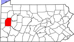 Location in the U.S. state of Pennsylvania | |
 Pennsylvania's location in the U.S. | |
| Founded | March 12, 1800 |
| Named for | Richard Butler |
| Seat | Butler |
| Largest city | Butler |
| Area | |
| • Total | 795 sq mi (2,059 km2) |
| • Land | 789 sq mi (2,044 km2) |
| • Water | 6.1 sq mi (16 km2), 0.8% |
| Population (est.) | |
| • (2015) | 186,818 |
| • Density | 237/sq mi (92/km²) |
| Congressional district | 3rd |
| Time zone | Eastern: UTC-5/-4 |
| Website |
www |
|
Footnotes: | |
| Designated | June 11, 1982[1] |
Butler County is a county located in the U.S. state of Pennsylvania. As of the 2010 census, the population was 183,862.[2] Its county seat is Butler.[3] Butler County was created on March 12, 1800, from part of Allegheny County and named in honor of General Richard Butler, a hero of the American Revolution.
Butler County is included in the Pittsburgh, PA Metropolitan Statistical Area.
History
Some famous inventions and discoveries were made in Butler County. It was in Saxonburg, that the designer of the Brooklyn Bridge, John Roebling, invented his revolutionary "wire rope." At what is now known as Oil Creek, Butler County resident William Smith and Edwin Drake first proved that oil could be tapped from underground for consistent supply. The Jeep was developed in Butler County by American Bantam in 1941.
Famous politicians have lived in and traveled through Butler County. George Washington passed through during the French and Indian War. Butler's only U.S. Senator, Walter Lowrie, built a home in 1828 that still stands behind the Butler County Courthouse. The Butler County Historical Society's office is located in this home. Butler's highest ranked federal official ever is William J. Perry, Secretary of Defense under President Bill Clinton from 1994-1997. He graduated from Butler High School in 1945. In 1923, President Warren G. Harding's funeral train passed through Butler County on its way back to Washington D.C. John F. Kennedy delivered a speech in front of the Butler County Courthouse during the United States presidential election, 1960. Hubert Humphrey also spoke in Butler during this time period. Then in 2004, Vice President Dick Cheney delivered a speech in Saxonburg to rally support for President George W. Bush during the United States presidential election, 2004. Bret Michaels, lead singer of the rock band Poison was also born here in 1963.
Geography
According to the U.S. Census Bureau, the county has a total area of 795 square miles (2,060 km2), of which 789 square miles (2,040 km2) is land and 6.1 square miles (16 km2) (0.8%) is water.[4]
It is the location of Moraine State Park, with the 3,000-acre (12 km2) glacial lake, Lake Arthur. Lake Arthur is used for fishing and sailing, and the surrounding park is used for hiking and hunting.
Waterways
- Allegheny River (The river touches Butler County at its northeast and southeast corners. It is both a recreational and industrial waterway.)
- Connoquenessing Creek (recreational canoeing and kayaking)
- Lake Arthur at Moraine State Park (recreational boating, canoeing and kayaking)
- Slippery Rock Creek (recreational canoeing and kayaking)
- Little Connoquenessing Creek
- Bull Creek
- Muddy Creek
- Sullivan Run
- Semiconon Run
- Mulligan Run
Adjacent counties
- Venango County (north)
- Clarion County (northeast)
- Armstrong County (east)
- Westmoreland County (southeast)
- Allegheny County (south)
- Beaver County (southwest)
- Lawrence County (west)
- Mercer County (northwest)
Demographics
| Historical population | |||
|---|---|---|---|
| Census | Pop. | %± | |
| 1800 | 3,916 | — | |
| 1810 | 7,346 | 87.6% | |
| 1820 | 10,193 | 38.8% | |
| 1830 | 14,581 | 43.0% | |
| 1840 | 22,378 | 53.5% | |
| 1850 | 30,346 | 35.6% | |
| 1860 | 35,594 | 17.3% | |
| 1870 | 36,510 | 2.6% | |
| 1880 | 52,536 | 43.9% | |
| 1890 | 55,339 | 5.3% | |
| 1900 | 56,962 | 2.9% | |
| 1910 | 72,689 | 27.6% | |
| 1920 | 77,270 | 6.3% | |
| 1930 | 80,480 | 4.2% | |
| 1940 | 87,590 | 8.8% | |
| 1950 | 97,320 | 11.1% | |
| 1960 | 114,639 | 17.8% | |
| 1970 | 127,941 | 11.6% | |
| 1980 | 147,912 | 15.6% | |
| 1990 | 152,013 | 2.8% | |
| 2000 | 174,083 | 14.5% | |
| 2010 | 183,862 | 5.6% | |
| Est. 2015 | 186,818 | [5] | 1.6% |
| U.S. Decennial Census[6] 1790-1960[7] 1900-1990[8] 1990-2000[9] 2010-2013[2] | |||
As of the census[10] of 2000, there were 174,083 people, 65,862 households, and 46,827 families residing in the county. The population density was 221 people per square mile (85/km²). There were 69,868 housing units at an average density of 89 per square mile (34/km²). The racial/ethnic makeup of the county is 96.5% White, 0.9% Black or African American, 0.09% Native American, 0.8% Asian, 0.03% Pacific Islander, 0.17% from other races, 0.7% from two or more races; and 0.9% Hispanic or Latino of any race. 35% were of German, 12% Irish, 11% Italian, 7% English, 6% American 5% Polish, and 4% Scotch-Irish ancestry according to Census 2000.
There were 65,862 households out of which 32.90% had children under the age of 18 living with them, 59.80% were married couples living together, 8.10% had a female householder with no husband present, and 28.90% were non-families. 24.20% of all households were made up of individuals and 10.40% had someone living alone who was 65 years of age or older. The average household size was 2.55 and the average family size was 3.04.
In the county, the population was spread out with 24.60% under the age of 18, 8.80% from 18 to 24, 29.40% from 25 to 44, 23.00% from 45 to 64, and 14.30% who were 65 years of age or older. The median age was 38 years. For every 100 females there were 95.40 males. For every 100 females age 18 and over, there were 91.80 males.
Law and government
Elected county officials
- Commissioner Kim Geyer, Republican
- Commissioner Leslie Osche (chairman), Republican
- Commissioner Kevin Boozel, Democrat
- District Attorney: Richard Goldinger, Republican
- Controller: Ben Holland, Republican
- Treasurer: Diane Marburger, Republican
- Prothonotary: Glenna Walters, Republican
- Clerk of Courts: Sara Edwards, Republican
- Sheriff: Michael Slupe, Republican
- Recorder of Deeds: Michele Mustello, Republican
- Register of Wills: Judith Moser, Republican
County judges
- Thomas Doerr (President Judge)
- Marilyn Horan
- Timothy McCune
- Kelly Streib
- William Shaffer
- S. Michael Yeager
District judges
- Kevin P. O'Donnell
- Bill O'Donnell
- Lewis Stoughton
- Sue Elaine Haggerty
- David Kovach
- B.T. Fullerton
- Wayne Seibel
State Senate
- Scott Hutchinson, Republican, Pennsylvania's 21st Senatorial District
- Donald C. White, Republican, Pennsylvania's 41st Senatorial District
- Elder Vogel, Republican, Pennsylvania's 47th Senatorial District
State House of Representatives
- Tedd Nesbit, Republican, Pennsylvania's 8th Representative District
- Jaret Gibbons, Democrat, Pennsylvania's 10th Representative District at PA House
- Brian Ellis, Republican, Pennsylvania's 11th Representative District
- Daryl D. Metcalfe, Republican, Pennsylvania's 12th Representative District
- Jim Marshall, Republican, Pennsylvania's 14th Representative District
- R. Lee James, Republican, Pennsylvania's 64th Representative District
- Jeff Pyle, Republican, Pennsylvania's 60th Representative District
United States House of Representatives
United States Senate
Politics
Unlike the rest of traditionally Democratic Western Pennsylvania, Butler County has leaned towards the Republican Party. The last Democratic presidential candidate to win Butler was Lyndon Johnson in 1964. In the 2000 U.S. presidential election, the county was carried by Republican George W. Bush 62% to Democrat Al Gore 35%. In the 2004 U.S. presidential election, the county was carried by Republican George W. Bush 64% to Democrat John Kerry 35%. In the 2008 U.S. presidential election, the county was carried by Republican John McCain 63% to Democrat Barack Obama 35%. Additionally, John McCain carried every Western Pennsylvania county except for Allegheny County and Erie County, in sharp contrast to previous years, like 2004, in which Democratic candidate John Kerry carried 5 counties in Western Pennsylvania. As of May 2007, there are 121,719 registered voters in Butler County.[11]
- Democratic: 42,630 (33.35%)
- Republican: 61,621 (51.36%)
- Other Parties / Independent: 6,529 (5.44%)
Education

Colleges and universities
Technical schools
- Butler County Vo-Tech at bcvt.tec.pa.us
Public school districts
- Allegheny-Clarion Valley School District (part) ranked - 396th
- Butler Area School District - 147th
- Freeport Area School District (part) - 72nd
- Karns City Area School District (part) - 270th
- Mars Area School District - 111th
- Moniteau School District - 361st
- Seneca Valley School District - 81st
- Slippery Rock Area School District - 217th
- South Butler County School District - 133rd
In 2008, Pennsylvania School Districts were ranked by the Pittsburgh Business Times. The ranking was based on student academic performance as demonstrated in 3 years of PSSA results.[12]
Media
- Butler Eagle daily newspaper
- WBUT-AM
- WISR-AM
- WLER-FM
- Butler Acorn - online newspaper serving Butler County
Recreation
Parks
There are 2 Pennsylvania state parks in Butler County.
- Jennings Environmental Education Center is the home of the only protected relict prairie in Pennsylvania.
- Moraine State Park The gently rolling hills, lush forests and sparkling waters disguise a land that has endured the effects of continental glaciers and massive mineral extraction. Each year over one million people visit the 16,725-acre (67.68 km2) park, yet never realize that many people helped restore the park from prior coal mining and oil and gas drilling practices. Today, the park is an outstanding example of environmental engineering achievement. During the third great ice advance about 140,000 years ago, a continental glacier dammed area creeks making three glacial lakes. To the north, Slippery Rock Creek filled giant Lake Edmund. To the southeast, extinct McConnells Run filled tiny Lake Prouty. In the middle, Muddy Creek filled the medium-sized Lake Watts.
Before the glacier dam. Slippery Rock and Muddy creeks flowed north while extinct McConnells Run flowed south. The glacier dammed Lake Prouty on the edge of the drainage divide. Eventually Lake Pouty spilled over and rushed to the south, carving Slippery Rock Creek Gorge. Lakes Watts and Edmund drained into the gorge, digging it deeper and making Slippery Rock and Muddy creeks flow south. Areas of the 400-foot (120 m) deep Slippery Rock Gorge may be seen at nearby McConnells Mill State Park.
The glacier created a landscape of rolling hills topped with hardwood trees and swamps in the valley bottoms. Moraines containing gravel, sand and clay were draped upon the landscape and silt was left on the extinct lake bottoms. Reference to: http://www.dcnr.state.pa.us/stateParks/parks/moraine/moraine_history.aspx
Trails
- Butler-Freeport Trail The trail is a rail trail that connects the city of Butler with the borough of Freeport.
- North Country Trail- The trail passes through Jennings Environmental Education Center and Moraine State Park, as well as several State Game Lands.
- There is also a trail in Slippery Rock Township that connects with McConnells Mill State Park in Lawrence County.
Transportation
Airports
- Butler County Airport
- Butler Farm Show Airport
- Lakehill Airport
Major highways
-
 Interstate 76 (the Pennsylvania Turnpike)
 -
 Interstate 79
 -
 Interstate 80
 -
 US Route 19
 -
 US Route 422
 -
 Pennsylvania Route 8
 -
 Pennsylvania Route 38
 -
 Pennsylvania Route 58
 -
 Pennsylvania Route 68
 -
 Pennsylvania Route 108
 -
 Pennsylvania Route 138
 -
 Pennsylvania Route 173
 -
 Pennsylvania Route 228
 -
 Pennsylvania Route 258
 -
 Pennsylvania Route 268
 -
 Pennsylvania Route 288
 -
 Pennsylvania Route 308
 -
 Pennsylvania Route 356
 -
 Pennsylvania Route 488
 -
 Pennsylvania Route 528
 -
 Pennsylvania Route 588
 - Mars-Evans City Road (formerly Pennsylvania Route 855)
Transit
Communities

Under Pennsylvania law, there are four types of incorporated municipalities: cities, boroughs, townships, and, in at most two cases, towns. The following cities, boroughs and townships are located in Butler County:
City
- Butler (county seat)
Boroughs
Townships
Census-designated places
Census-designated places are geographical areas designated by the U.S. Census Bureau for the purposes of compiling demographic data. They are not actual jurisdictions under Pennsylvania law. Other unincorporated communities, such as villages, may be listed here as well.
Unincorporated communities
Several of these communities, most notably Renfrew, Lyndora, Herman, Sarver, Cabot, Boyers, and Forestville, have post offices and zip codes, but aren't officially incorporated under Pennsylvania law, and exist entirely within townships.
Population ranking
The population ranking of the following table is based on the 2010 census of Butler County.[13]
† county seat
| Rank | City/Town/etc. | Municipal type | Population (2010 Census) |
|---|---|---|---|
| 1 | † Butler | City | 13,757 |
| 2 | Fernway (former CDP) | CDP | 12,414 |
| 3 | Homeacre-Lyndora | CDP | 6,906 |
| 4 | Shanor-Northvue | CDP | 5,051 |
| 5 | Meridian | CDP | 3,881 |
| 6 | Zelienople | Borough | 3,812 |
| 7 | Slippery Rock | Borough | 3,625 |
| 8 | Fox Run (former CDP) | CDP | 3,282 |
| 9 | Seven Fields | Borough | 2,887 |
| 10 | Meadowood | CDP | 2,693 |
| 11 | Oak Hills | CDP | 2,333 |
| 12 | Slippery Rock University | CDP | 1,898 |
| 13 | Evans City | Borough | 1,833 |
| 14 | Mars | Borough | 1,699 |
| 15 | Saxonburg | Borough | 1,525 |
| 16 | Nixon | CDP | 1,373 |
| 17 | Prospect | Borough | 1,169 |
| 18 | Chicora | Borough | 1,043 |
| 19 | Unionville | CDP | 962 |
| 20 | Harrisville | Borough | 897 |
| 21 | Harmony | Borough | 890 |
| 22 | East Butler | Borough | 732 |
| 23 | Lake Arthur Estates | CDP | 594 |
| 24 | Valencia | Borough | 551 |
| 25 | Connoquenessing | Borough | 528 |
| 26 | Bruin | Borough | 524 |
| 27 | Callery | Borough | 394 |
| 28 | West Liberty | Borough | 343 |
| 29 | Eau Claire | Borough | 316 |
| 30 | Portersville | Borough | 235 |
| 31 | Petrolia | Borough | 212 |
| 32 | Karns City | Borough | 209 |
| 33 | Fairview | Borough | 198 |
| 34 | West Sunbury | Borough | 192 |
| 35 | Cherry Valley | Borough | 66 |
In popular culture
Butler County has often been used as a setting for films shot in the North Pittsburgh area. Such films include:
- Night of the Living Dead (1968)
- The Crazies (1973)
- The Prince of Pennsylvania (1988)
- Iron Maze (1991)
- Kingpin (1996)
- The Haunting Hour Volume One: Don't Think About It (2007)
- Homecoming (2008)
- Staunton Hill (2008)
- The Road (2008)
- I Am Number Four (2011) [14]
- Death from Above (2011) [15]
- The Avengers (2012)
- A Separate Life (2012) [16]
- Foxcatcher (2013)
Films set in Butler County, but not necessarily filmed there.
- Mrs. Soffel (1984)
- Night of the Living Dead (1990)
- Snow Angels (2008)
Novels set in Butler County.
Benjamin's Field, a trilogy by local author J. J. Knights[17]
See also
References
- ↑ "PHMC Historical Markers Search" (Searchable database). Pennsylvania Historical and Museum Commission. Commonwealth of Pennsylvania. Retrieved 2014-01-25.
- 1 2 "State & County QuickFacts". United States Census Bureau. Retrieved November 16, 2013.
- ↑ "Find a County". National Association of Counties. Archived from the original on 2011-05-31. Retrieved 2011-06-07.
- ↑ "2010 Census Gazetteer Files". United States Census Bureau. August 22, 2012. Retrieved March 5, 2015.
- ↑ "County Totals Dataset: Population, Population Change and Estimated Components of Population Change: April 1, 2010 to July 1, 2015". Retrieved July 2, 2016.
- ↑ "U.S. Decennial Census". United States Census Bureau. Archived from the original on May 11, 2015. Retrieved March 5, 2015.
- ↑ "Historical Census Browser". University of Virginia Library. Retrieved March 5, 2015.
- ↑ Forstall, Richard L., ed. (March 24, 1995). "Population of Counties by Decennial Census: 1900 to 1990". United States Census Bureau. Retrieved March 5, 2015.
- ↑ "Census 2000 PHC-T-4. Ranking Tables for Counties: 1990 and 2000" (PDF). United States Census Bureau. April 2, 2001. Retrieved March 5, 2015.
- ↑ "American FactFinder". United States Census Bureau. Archived from the original on 2013-09-11. Retrieved 2008-01-31.
- ↑ "Running for Office" (PDF). Dos.state.pa.us. Retrieved 2010-07-22.
- ↑ Pennsylvania Public School Rankings, Pittsburgh Business Times. May 23, 2007.
- ↑ "Archived copy". Archived from the original on 2013-12-21. Retrieved 2015-05-25.
- ↑ Keener, Craig (2010-07-22). "Stone Church site of sci-fi film" Butler Eagle. Retrieved 2010-08-12.
- ↑ Stonesifer, Jared (2010-06-09). "Angle Action in Valencia" Butler Eagle. Retrieved 2010-06-12.
- ↑ "'A Separate Life' Mars actress, director takes film to Cannes festival". Butler Eagle. May 26, 2011.
- ↑ http://www.butlereagle.com/article/20150730/ARTSENTERTAINMENT02/707309915
External links
| Wikimedia Commons has media related to Butler County, Pennsylvania. |
Coordinates: 40°55′N 79°55′W / 40.91°N 79.91°W
 |
Mercer County | Venango County | Clarion County | |
| Lawrence County | |
Armstrong County | ||
| ||||
| | ||||
| Beaver County | Allegheny County | Westmoreland County |
Municipalities and communities of Butler County, Pennsylvania, United States | ||
|---|---|---|
| City | | |
| Boroughs | ||
| Townships | ||
| CDPs | ||
| Unincorporated communities | ||
| Footnotes | ‡This populated place also has portions in an adjacent county or counties | |
| Counties |  Map of the Pittsburgh Tri-State with green counties in the metropolitan area and yellow counties in the combined area. | |
|---|---|---|
| Major cities | ||
| Cities and towns 15k-50k (in 2010) | ||
| Airports | ||
| Topics | ||
| ||