Mount Oliver, Pennsylvania
| Mount Oliver | |
|---|---|
| Borough | |
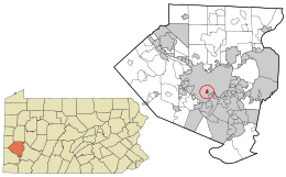 Location in Allegheny County and the state of Pennsylvania | |
| Coordinates: 40°24′41″N 79°59′12″W / 40.41139°N 79.98667°WCoordinates: 40°24′41″N 79°59′12″W / 40.41139°N 79.98667°W | |
| Country | United States |
| State | Pennsylvania |
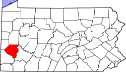
| County | Allegheny |
| Area | |
| • Total | 0.3 sq mi (0.8 km2) |
| • Land | 0.3 sq mi (0.8 km2) |
| Population (2010) | |
| • Total | 3,403 |
| • Density | 11,343.3/sq mi (4,379.7/km2) |
| Time zone | Eastern (EST) (UTC-5) |
| • Summer (DST) | EDT (UTC-4) |
Mount Oliver is a borough in Allegheny County, Pennsylvania, United States. It is a largely residential area situated atop a crest about 3 miles (5 km) west of the Monongahela River. The borough is surrounded entirely by the city of Pittsburgh, having resisted annexations by the city, as it prefers to manage its own local needs and finances.[1]
It is named for Oliver Ormsby, son of John Ormsby, who held the original land grant for the area from George III. Mount Oliver has experienced some tough times of late which are associated with the slippage of the steel-making capacity of the Pittsburgh region. The population was 3,403 at the 2010 census.[2]
Geography
Mount Oliver is located at 40°24′41″N 79°59′12″W / 40.41139°N 79.98667°W (40.411319, -79.986571).[3]
According to the United States Census Bureau, the borough has a total area of 0.3 square miles (0.9 km²), all of it land.
Mount Oliver is completely surrounded by the city of Pittsburgh. The borough's business district runs across the length of the neighborhood, from the South Side Slopes to Carrick. Brownsville Road runs along this ridge, and connects South Eighteenth Street in Pittsburgh with the neighborhood of Carrick and communities further east. Mount Oliver Borough borders the neighborhood of Mount Oliver in Pittsburgh.
Demographics
| Historical population | |||
|---|---|---|---|
| Census | Pop. | %± | |
| 1880 | 1,883 | — | |
| 1900 | 2,295 | — | |
| 1910 | 4,241 | 84.8% | |
| 1920 | 5,575 | 31.5% | |
| 1930 | 7,071 | 26.8% | |
| 1940 | 6,981 | −1.3% | |
| 1950 | 6,646 | −4.8% | |
| 1960 | 5,980 | −10.0% | |
| 1970 | 5,509 | −7.9% | |
| 1980 | 4,576 | −16.9% | |
| 1990 | 4,160 | −9.1% | |
| 2000 | 3,970 | −4.6% | |
| 2010 | 3,403 | −14.3% | |
| Est. 2015 | 3,354 | [4] | −1.4% |
| Sources:[5][6][7][8][9][10] | |||
As of the census[9] of 2000, there were 3,970 people, 1,681 households, and 983 families residing in the borough. The population density was 11,720.0 people per square mile (4,508.3/km²). There were 1,864 housing units at an average density of 5,502.8 per square mile (2,116.7/km²). The racial makeup of the borough was 83.75% White, 11.74% African American, 0.23% Native American, 1.64% Asian, 0.03% Pacific Islander, 0.68% from other races, and 1.94% from two or more races. Hispanic or Latino of any race were 1.08% of the population.

There were 1,681 households, out of which 28.2% had children under the age of 18 living with them, 33.8% were married couples living together, 18.3% had a female householder with no husband present, and 41.5% were non-families. 34.0% of all households were made up of individuals, and 12.4% had someone living alone who was 65 years of age or older. The average household size was 2.36 and the average family size was 3.04.
In the borough the population was spread out, with 24.0% under the age of 18, 10.0% from 18 to 24, 30.0% from 25 to 44, 21.9% from 45 to 64, and 14.1% who were 65 years of age or older. The median age was 36 years. For every 100 females there were 91.3 males. For every 100 females age 18 and over, there were 85.8 males.
The median income for a household in the borough was $27,990, and the median income for a family was $32,388. Males had a median income of $30,394 versus $25,255 for females. The per capita income for the borough was $15,104. About 14.7% of families and 19.3% of the population were below the poverty line, including 34.5% of those under age 18 and 12.2% of those age 65 or over.
Taxation
Residents of Mount Oliver Borough pay a 2% tax on earned income to the Pittsburgh Public Schools district and 1% tax on earned income to the Borough of Mount Oliver. This means that Mount Oliver residents with earned income must file two different local tax forms for two different municipalities, and have two different due dates. The City of Pittsburgh gives residents until April 15 (or the first business day afterwards) to file, but the Borough of Mount Oliver imposes delinquent fees and penalties after January 31.
Mount Oliver Economic Development Team
This organization formed in recent years to address the needs of this business community. Maria DiSimone Praczak, a local artist, has donated her time and talent to beautifying the empty storefronts as they await new occupants. The murals she has created can be observed in several storefront display windows.
References
- ↑ Flohr, Jeffrey (1999). "Why Is Mt. Oliver Not Part of the City of Pittsburgh". Western Pennsylvania History. 82 (3): 143.
- ↑ "Race, Hispanic or Latino, Age, and Housing Occupancy: 2010 Census Redistricting Data (Public Law 94-171) Summary File (QT-PL), Mount Oliver borough, Pennsylvania". U.S. Census Bureau, American FactFinder 2. Retrieved September 21, 2011.
- ↑ "US Gazetteer files: 2010, 2000, and 1990". United States Census Bureau. 2011-02-12. Retrieved 2011-04-23.
- ↑ "Annual Estimates of the Resident Population for Incorporated Places: April 1, 2010 to July 1, 2015". Retrieved July 2, 2016.
- ↑ "Population-Pennsylvania" (PDF). U.S. Census 1910. U.S. Census Bureau. Retrieved 22 November 2013.
- ↑ "Number and Distribution of Inhabitants:Pennsylvania-Tennessee" (PDF). Fifteenth Census. U.S. Census Bureau.
- ↑ "Number of Inhabitants: Pennsylvania" (PDF). 18th Census of the United States. U.S. Census Bureau. Retrieved 22 November 2013.
- ↑ "Pennsylvania: Population and Housing Unit Counts" (PDF). U.S. Census Bureau. Retrieved 22 November 2013.
- 1 2 "American FactFinder". United States Census Bureau. Retrieved 2008-01-31.
- ↑ "Annual Estimates of the Resident Population". U.S. Census Bureau. Retrieved 22 November 2013.
External links
| Counties |  Map of the Pittsburgh Tri-State with green counties in the metropolitan area and yellow counties in the combined area. | |
|---|---|---|
| Major cities | ||
| Cities and towns 15k-50k (in 2010) | ||
| Airports | ||
| Topics | ||
| ||