Ingram, Pennsylvania
| Ingram | |
|---|---|
| Borough | |
|
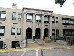
Ingram Public School | |
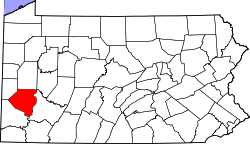
 Location in Allegheny County and the state of Pennsylvania | |
| Coordinates: 40°26′43″N 80°4′1″W / 40.44528°N 80.06694°WCoordinates: 40°26′43″N 80°4′1″W / 40.44528°N 80.06694°W | |
| Country | United States |
| State | Pennsylvania |
| County | Allegheny |
| Area | |
| • Total | 0.4 sq mi (1 km2) |
| • Land | 0.4 sq mi (1 km2) |
| Population (2010) | |
| • Total | 3,330 |
| • Density | 8,300/sq mi (3,200/km2) |
| Time zone | Eastern (EST) (UTC-5) |
| • Summer (DST) | EDT (UTC-4) |
| Website | Borough of Ingram |
Ingram is a borough in Allegheny County, Pennsylvania, United States. The population was 3,330 at the 2010 census.[1]
It is located in the Montour School District, which educates the children of Kennedy Township, Robinson Township, Pennsbury Village, Thornburg, and the borough of Ingram.
Geography
Ingram is located at 40°26′43″N 80°4′1″W / 40.44528°N 80.06694°W (40.445254, -80.067043).[2]
According to the United States Census Bureau, the borough has a total area of 0.4 square miles (1.0 km2), all of it land.
Surrounding neighborhoods
- North – Windgap (a Pittsburgh neighborhood)
- East – Crafton Heights (a Pittsburgh neighborhood)
- South – Crafton (an Allegheny county borough)
- West – Fairywood (a Pittsburgh neighborhood)
Demographics
| Historical population | |||
|---|---|---|---|
| Census | Pop. | %± | |
| 1910 | 2,037 | — | |
| 1920 | 2,900 | 42.4% | |
| 1930 | 3,866 | 33.3% | |
| 1940 | 3,904 | 1.0% | |
| 1950 | 4,236 | 8.5% | |
| 1960 | 4,730 | 11.7% | |
| 1970 | 4,902 | 3.6% | |
| 1980 | 4,346 | −11.3% | |
| 1990 | 3,901 | −10.2% | |
| 2000 | 3,712 | −4.8% | |
| 2010 | 3,330 | −10.3% | |
| Est. 2015 | 3,281 | [3] | −1.5% |
| Sources:[4][5][6][7][8] | |||
As of the census[7] of 2000, there were 3,712 people, 1,565 households, and 971 families residing in the borough. The population density was 8,525.1 people per square mile (3,257.3/km²). There were 1,650 housing units at an average density of 3,789.4 per square mile (1,447.9/km²). The racial makeup of the borough was 95.42% White, 3.07% African American, 0.22% Native American, 0.54% Asian, 0.22% from other races, and 0.54% from two or more races. Hispanic or Latino of any race were 0.57% of the population.
There were 1,565 households, out of which 28.8% had children under the age of 18 living with them, 45.8% were married couples living together, 12.5% had a female householder with no husband present, and 37.9% were non-families. 33.1% of all households were made up of individuals, and 12.3% had someone living alone who was 65 years of age or older. The average household size was 2.33 and the average family size was 3.01.
In the borough the population was spread out, with 22.7% under the age of 18, 8.4% from 18 to 24, 30.9% from 25 to 44, 21.8% from 45 to 64, and 16.2% who were 65 years of age or older. The median age was 38 years. For every 100 females there were 88.2 males. For every 100 females age 18 and over, there were 84.8 males.
The median income for a household in the borough was $35,308, and the median income for a family was $45,824. Males had a median income of $32,500 versus $27,417 for females. The per capita income for the borough was $18,668. About 7.4% of families and 8.2% of the population were below the poverty line, including 9.9% of those under age 18 and 6.5% of those age 65 or over.
References
- ↑ "Race, Hispanic or Latino, Age, and Housing Occupancy: 2010 Census Redistricting Data (Public Law 94-171) Summary File (QT-PL), Ingram borough, Pennsylvania". U.S. Census Bureau, American FactFinder 2. Retrieved September 20, 2011.
- ↑ "US Gazetteer files: 2010, 2000, and 1990". United States Census Bureau. 2011-02-12. Retrieved 2011-04-23.
- ↑ "Annual Estimates of the Resident Population for Incorporated Places: April 1, 2010 to July 1, 2015". Retrieved July 2, 2016.
- ↑ "Number and Distribution of Inhabitants:Pennsylvania-Tennessee" (PDF). Fifteenth Census. U.S. Census Bureau.
- ↑ "Number of Inhabitants: Pennsylvania" (PDF). 18th Census of the United States. U.S. Census Bureau. Retrieved 22 November 2013.
- ↑ "Pennsylvania: Population and Housing Unit Counts" (PDF). U.S. Census Bureau. Retrieved 22 November 2013.
- 1 2 "American FactFinder". United States Census Bureau. Retrieved 2008-01-31.
- ↑ "Annual Estimates of the Resident Population". U.S. Census Bureau. Retrieved 22 November 2013.
| Counties |  Map of the Pittsburgh Tri-State with green counties in the metropolitan area and yellow counties in the combined area. | |
|---|---|---|
| Major cities | ||
| Cities and towns 15k-50k (in 2010) | ||
| Airports | ||
| Topics | ||
| ||