Baldwin Township, Allegheny County, Pennsylvania
| Baldwin Township, Pennsylvania | ||
| Township | ||
 The Baldwin Township municipal building | ||
|
||
| Named for: Henry Baldwin | ||
| Country | United States | |
|---|---|---|
| State | Pennsylvania | |
| County | Allegheny | |
| Elevation | 1,171 ft (357 m) | |
| Coordinates | 40°22′50″N 80°00′59″W / 40.38056°N 80.01639°WCoordinates: 40°22′50″N 80°00′59″W / 40.38056°N 80.01639°W | |
| Area | 0.5 sq mi (1.3 km2) | |
| - land | 0.5 sq mi (1.3 km2) | |
| - water | 0.0 sq mi (0.0 km2), 0% | |
| Population | 1,992 (2010) | |
| Density | 3,984/sq mi (1,538.2/km2) | |
| Settled | c. 1780 | |
| - Incorporated | February 24, 1844 | |
| Timezone | EST (UTC-5) | |
| - summer (DST) | EDT (UTC-4) | |
| ZIP code | 15234 | |
| Area code | 412 | |
| School District | Baldwin-Whitehall | |
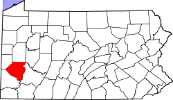
 Location in Allegheny County and state of Pennsylvania
| ||
 Location of Pennsylvania in the United States
| ||
| Website: http://www.baldwintownship.com | ||

Baldwin Township is a township in Allegheny County, Pennsylvania, United States. The population was 1,992 at the 2010 census.[1]
Geography
According to the United States Census Bureau, the township has a total area of 0.5 square miles (1.3 km2), all of it land. Its average elevation is 1,171 feet (357 m) above sea level.[2]
Surrounding communities
- Pittsburgh neighborhoods
- Castle Shannon (southeast)
- Mt. Lebanon (southwest)
History
The area that would become Baldwin Township was originally settled around 1780. The Allegheny County Court of Quarter Sessions established Baldwin Township on February 24, 1844, from Upper St. Clair, Lower St. Clair, Jefferson, and Mifflin townships.[3] The area was named for Henry Baldwin, a Pittsburgh lawyer who served as an Associate Justice of the United States Supreme Court from 1830 until his death in 1844.
Baldwin Township was originally 10,550 acres (43 km²) and consisted of the present-day Pittsburgh neighborhoods of Carrick, Hays, Brookline, and Overbrook, along with the present-day municipalities of Brentwood, Whitehall, Castle Shannon, and Baldwin Borough.
The coal seam lying underneath Baldwin Township made mining the township's largest industry. The township was also home to the first glass factories in Allegheny County. Agriculture was an important part of Baldwin Township's economy from 1753 to 1876. Its most well-known agricultural exports were cherries and whiskey (many citizens of Baldwin Township were part of the Whiskey Rebellion).
The township continued to thrive until the late 19th century, when its size became too cumbersome to handle. Due to the lack of maintenance throughout the township's roads, residents of many areas broke off to form their own municipalities. In 1901, 201 acres (0.8 km²) became the Pittsburgh neighborhood of Hays. Three years later in 1904, Carrick and Brookline became Pittsburgh wards, taking with them 1,058 acres (4 km²) and 138 acres (0.6 km²), respectively. From 1915 - 1951, approximately 8,700 acres (35 km²) of the original Baldwin Township broke off to become the municipalities of Brentwood, Castle Shannon, Mt. Lebanon, Whitehall, and Baldwin Borough. The City of Pittsburgh annexed an additional area of land that is now the city's Overbrook neighborhood.
Today, only 400 of the township's original 10,550 acres (43 km²) remain. Historians calculate that if Baldwin Township had never been divided, it would now be the second largest community in Allegheny County, with a population of over 100,000.[4]
Demographics

| Historical population | |||
|---|---|---|---|
| Census | Pop. | %± | |
| 1850 | 1,610 | — | |
| 1860 | 2,746 | 70.6% | |
| 1870 | 3,104 | 13.0% | |
| 1880 | 4,373 | 40.9% | |
| 1890 | 4,860 | 11.1% | |
| 1900 | 8,212 | 69.0% | |
| 1910 | 8,230 | 0.2% | |
| 1920 | 4,928 | −40.1% | |
| 1930 | 6,371 | 29.3% | |
| 1940 | 7,738 | 21.5% | |
| 1950 | 10,743 | 38.8% | |
| 1960 | 3,004 | −72.0% | |
| 1970 | 3,026 | 0.7% | |
| 1980 | 2,680 | −11.4% | |
| 1990 | 2,479 | −7.5% | |
| 2000 | 2,244 | −9.5% | |
| 2010 | 1,992 | −11.2% | |
| Est. 2012 | 1,986 | −0.3% | |
| Sources:[5][6][7][8][9][10][11][12] | |||
As of the census[11] of 2000, there were 2,244 people, 869 households, and 637 families residing in the township. The population density was 4,148.9 people per square mile (1,604.5/km²). There were 880 housing units at an average density of 1,627.0/sq mi (629.2/km²). The racial makeup of the township was 98.62% White, 0.27% African American, 0.58% Asian, 0.13% from other races, and 0.40% from two or more races. Hispanic or Latino of any race were 0.40% of the population.
There were 869 households, out of which 28.7% had children under the age of 18 living with them, 61.3% were married couples living together, 9.9% had a female householder with no husband present, and 26.6% were non-families. 23.8% of all households were made up of individuals, and 9.9% had someone living alone who was 65 years of age or older. The average household size was 2.50 and the average family size was 2.98.
In the township the population was spread out, with 22.7% under the age of 18, 4.3% from 18 to 24, 29.2% from 25 to 44, 23.8% from 45 to 64, and 19.9% who were 65 years of age or older. The median age was 41 years. For every 100 females there were 88.7 males. For every 100 females age 18 and over, there were 83.5 males.
The median income for a household in the township was $45,071, and the median income for a family was $52,200. Males had a median income of $38,750 versus $29,342 for females. The per capita income for the township was $20,918. About 3.3% of families and 4.7% of the population were below the poverty line, including 6.3% of those under age 18 and 3.1% of those age 65 or over.
References
- ↑ "Race, Hispanic or Latino, Age, and Housing Occupancy: 2010 Census Redistricting Data (Public Law 94-171) Summary File (QT-PL), Baldwin township, Allegheny County, Pennsylvania". U.S. Census Bureau, American FactFinder 2. Archived from the original on September 11, 2013. Retrieved September 27, 2011.
- ↑ "US Board on Geographic Names". United States Geological Survey. 2007-10-25. Retrieved 2008-01-31.
- ↑ "Allegheny County - 2nd Class" (PDF). Archived (PDF) from the original on 10 August 2007. Retrieved 2007-08-25.
- ↑ "History". baldwintownship.com.
- ↑ "Population of Civil Divisions Less than Counties" (PDF). 1870 United States Census. U.S. Census Bureau. Retrieved 25 November 2013.
- ↑ "Population of Civil Divisions Less than Counties" (PDF). 1880 United States Census. U.S. Census Bureau. Retrieved 24 November 2013.
- ↑ "Population-Pennsylvania" (PDF). U.S. Census 1910. U.S. Census Bureau. Retrieved 22 November 2013.
- ↑ "Number and Distribution of Inhabitants:Pennsylvania-Tennessee" (PDF). Fifteenth Census. U.S. Census Bureau.
- ↑ "Number of Inhabitants: Pennsylvania" (PDF). 18th Census of the United States. U.S. Census Bureau. Retrieved 22 November 2013.
- ↑ "Pennsylvania: Population and Housing Unit Counts" (PDF). U.S. Census Bureau. Retrieved 22 November 2013.
- 1 2 "American FactFinder". United States Census Bureau. Archived from the original on 2013-09-11. Retrieved 2008-01-31.
- ↑ "Incorporated Places and Minor Civil Divisions Datasets: Subcounty Population Estimates: April 1, 2010 to July 1, 2012". U.S. Census Bureau. Archived from the original on 17 June 2013. Retrieved 25 November 2013.
External links
- Township website
- History of Allegheny County, Pennsylvania, Volume II, Chapter V
- Historic Pittsburgh Map Collections
| Counties |  Map of the Pittsburgh Tri-State with green counties in the metropolitan area and yellow counties in the combined area. | |
|---|---|---|
| Major cities | ||
| Cities and towns 15k-50k (in 2010) | ||
| Airports | ||
| Topics | ||
| ||