Hancock County, West Virginia
| Hancock County, West Virginia | |
|---|---|
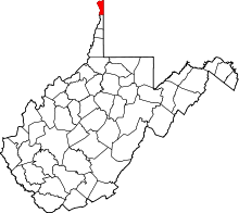 Location in the U.S. state of West Virginia | |
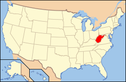 West Virginia's location in the U.S. | |
| Founded | January 15, 1848 |
| Named for | John Hancock |
| Seat | New Cumberland |
| Largest city | Weirton |
| Area | |
| • Total | 88 sq mi (228 km2) |
| • Land | 83 sq mi (215 km2) |
| • Water | 5.4 sq mi (14 km2), 6.1% |
| Population (est.) | |
| • (2015) | 29,815 |
| • Density | 363/sq mi (140/km²) |
| Congressional district | 1st |
| Time zone | Eastern: UTC-5/-4 |
| Website |
www |
Hancock County is a county located in the U.S. state of West Virginia. As of the 2010 census, the population was 30,676.[1] Its county seat is New Cumberland.[2] The county was created from Brooke County in 1848 and named for John Hancock, first signer of the Declaration of Independence.[3][4] Hancock County is the farthest north in the state, being at the tip of the state's Northern Panhandle.
Hancock County is part of the Weirton-Steubenville, WV-OH Metropolitan Statistical Area, which is also included in the Pittsburgh-New Castle-Weirton, PA-OH-WV Combined Statistical Area.[5]
History
Hancock County was formed from Brooke County in 1848, some 15 years before West Virginia became a state. Both counties were once part of Ohio County, Virginia, which had been formed from West Augusta District in 1776. Hancock County has significant Revolutionary-period roots due to its location on the Ohio River south of Fort Pitt and north of Fort Henry in Wheeling. It was the site of the infamous massacre of Chief Logan's family in 1774 (at Baker's Tavern across the Ohio River from the mouth of Yellow Creek, the current site of Mountaineer Race Track and Casino), an event that sparked Lord Dunmore's War. Adam Poe had his famous fight with the Indian known as Big Foot at the mouth of Tomlinson Run in 1781. Historical markers commemorate both events. Significant Revolutionary War forts and blockhouses in Hancock County included Holliday's Cove Fort (now downtown Weirton) and Chapman's Blockhouse (New Cumberland). Source: "Every Home a Fort, Every Man a Warrior," Michael Edward Nogay, ISBN 978-0-578-01862-1 [Tri-State Publishing Co., 2009].
Geography
According to the U.S. Census Bureau, the county has a total area of 88 square miles (230 km2), of which 83 square miles (210 km2) is land and 5.4 square miles (14 km2) (6.1%) is water.[6] It is the smallest county in West Virginia by area. The highest point of elevation in Hancock County is approximately 1363 ft. and located about 1800 ft. ESE of Emmanuel Mission Church.
Major highways
Adjacent counties
- Columbiana County, Ohio (northwest)
- Beaver County, Pennsylvania (east)
- Washington County, Pennsylvania (southeast)
- Brooke County (south)
- Jefferson County, Ohio (west)
Demographics
| Historical population | |||
|---|---|---|---|
| Census | Pop. | %± | |
| 1850 | 4,050 | — | |
| 1860 | 4,445 | 9.8% | |
| 1870 | 4,363 | −1.8% | |
| 1880 | 4,882 | 11.9% | |
| 1890 | 6,414 | 31.4% | |
| 1900 | 6,693 | 4.3% | |
| 1910 | 10,465 | 56.4% | |
| 1920 | 19,975 | 90.9% | |
| 1930 | 28,511 | 42.7% | |
| 1940 | 31,572 | 10.7% | |
| 1950 | 34,388 | 8.9% | |
| 1960 | 39,615 | 15.2% | |
| 1970 | 39,749 | 0.3% | |
| 1980 | 40,418 | 1.7% | |
| 1990 | 35,233 | −12.8% | |
| 2000 | 32,667 | −7.3% | |
| 2010 | 30,676 | −6.1% | |
| Est. 2015 | 29,815 | [7] | −2.8% |
| U.S. Decennial Census[8] 1790–1960[9] 1900–1990[10] 1990–2000[11] 2010–2015[1] | |||
2000 census
As of the census[12] of 2000, there were 32,667 people, 13,678 households, and 9,506 families residing in the county. The population density was 394 people per square mile (152/km²). There were 14,728 housing units at an average density of 178 per square mile (69/km²). The racial makeup of the county was 96.42% White, 2.30% Black or African American, 0.12% Native American, 0.35% Asian, 0.01% Pacific Islander, 0.12% from other races, and 0.69% from two or more races. 0.74% of the population were Hispanic or Latino of any race.
There were 13,678 households out of which 26.40% had children under the age of 18 living with them, 54.70% were married couples living together, 10.70% had a female householder with no husband present, and 30.50% were non-families. 26.60% of all households were made up of individuals and 12.50% had someone living alone who was 65 years of age or older. The average household size was 2.36 and the average family size was 2.83.
In the county, the population was spread out with 20.80% under the age of 18, 7.20% from 18 to 24, 27.10% from 25 to 44, 26.40% from 45 to 64, and 18.40% who were 65 years of age or older. The median age was 42 years. For every 100 females there were 92.40 males. For every 100 females age 18 and over, there were 89.40 males.
The median income for a household in the county was $33,759, and the median income for a family was $40,719. Males had a median income of $34,813 versus $19,100 for females. The per capita income for the county was $17,724. About 9.00% of families and 11.10% of the population were below the poverty line, including 16.10% of those under age 18 and 7.10% of those age 65 or over.
2010 census
As of the 2010 United States Census, there were 30,676 people, 13,297 households, and 8,732 families residing in the county.[13] The population density was 371.3 inhabitants per square mile (143.4/km2). There were 14,541 housing units at an average density of 176.0 per square mile (68.0/km2).[14] The racial makeup of the county was 95.7% white, 2.3% black or African American, 0.3% Asian, 0.1% American Indian, 0.2% from other races, and 1.3% from two or more races. Those of Hispanic or Latino origin made up 1.0% of the population.[13] In terms of ancestry, 21.1% were German, 18.7% were Irish, 15.6% were Italian, 12.5% were English, 8.0% were Polish, and 6.2% were American.[15]
Of the 13,297 households, 26.6% had children under the age of 18 living with them, 48.9% were married couples living together, 12.2% had a female householder with no husband present, 34.3% were non-families, and 29.5% of all households were made up of individuals. The average household size was 2.29 and the average family size was 2.80. The median age was 45.3 years.[13]
The median income for a household in the county was $38,565 and the median income for a family was $46,978. Males had a median income of $40,961 versus $28,915 for females. The per capita income for the county was $23,118. About 11.2% of families and 14.8% of the population were below the poverty line, including 23.2% of those under age 18 and 7.0% of those age 65 or over.[16]
Government
Hancock County is governed by a three-member County Commission who each serve in rotating 6-year terms. The terms are designed such that one seat is up for election in even years. The County Commission annually chooses its own president. The Hancock County Commissioners in 2015 are Joe Barnabei, Jeff Davis and Commission President Michael Swartzmiller.
Additionally, Hancock County is part of the First Judicial Circuit of West Virginia, which also includes Brooke and Ohio Counties. In West Virginia, Circuit Judges are elected in non-partisan elections to eight-year terms. The current judges of the First Judicial Circuit are the Hon. Jason A. Cuomo, the Hon. James Mazzone, the Hon. David J. Sims, and the Hon. Ronald E. Wilson.
Hancock County is part of the First Family Court Circuit of West Virginia, which also includes Brooke and Ohio Counties. In West Virginia, Family Court Judges were first elected to six-year terms beginning in 2002 and were elected to eight-year terms beginning in 2008. The current judges of the First Family Court Circuit are the Hon. Joyce Chernenko and the Hon. William Sinclair, both of whom were elected to eight-year terms in November 2008.
Magistrates are elected in partisan elections serving four-year terms. Vacancies occurring in unexpired terms can be filled by a respective Circuit Court Judge. Unlike Circuit Court judges or Family Court judges, magistrates are not required to be attorneys. Hancock County currently has three magistrates: Mike White, William S. Hicks and Michael Powell.
Other elected officials are Sheriff Ralph Fletcher, Circuit Clerk Brenda Jackson, County Clerk George Foley, Assessor Joe Alongi and Prosecuting Attorney James Davis.
| Year | Republican | Democrat |
|---|---|---|
| 2016 | 69.61% 8,870 | 25.48% 3,247 |
| 2012 | 59.47% 7,226 | 38.08% 4,627 |
| 2008 | 56.87% 7,518 | 41.63% 5,504 |
| 2004 | 50.96% 7,298 | 48.22% 6,906 |
| 2000 | 47.94% 6,458 | 46.39% 6,249 |
Communities
Cities
- Chester
- New Cumberland (county seat)
- Weirton (part)
Census-designated place
Unincorporated communities
- Congo
- Fairhaven
- Kings Creek
- Lawrenceville
- Lennyville
- Moscow
- New Manchester
- Sun Valley
- Vermont Terrace
See also
- Hillcrest Wildlife Management Area
- National Register of Historic Places listings in Hancock County, West Virginia
- Ohio River Trail
- Tomlinson Run State Park
References
- 1 2 "State & County QuickFacts". United States Census Bureau. Retrieved January 10, 2014.
- ↑ "Find a County". National Association of Counties. Retrieved 2011-06-07.
- ↑ http://www.wvculture.org/history/counties/hancock.html
- ↑ Gannett, Henry (1905). The Origin of Certain Place Names in the United States. Govt. Print. Off. p. 148.
- ↑ http://www.whitehouse.gov/sites/default/files/omb/bulletins/2013/b13-01.pdf
- ↑ "2010 Census Gazetteer Files". United States Census Bureau. August 22, 2012. Retrieved July 24, 2015.
- ↑ "County Totals Dataset: Population, Population Change and Estimated Components of Population Change: April 1, 2010 to July 1, 2015". Retrieved July 2, 2016.
- ↑ "U.S. Decennial Census". United States Census Bureau. Retrieved January 10, 2014.
- ↑ "Historical Census Browser". University of Virginia Library. Retrieved January 10, 2014.
- ↑ "Population of Counties by Decennial Census: 1900 to 1990". United States Census Bureau. Retrieved January 10, 2014.
- ↑ "Census 2000 PHC-T-4. Ranking Tables for Counties: 1990 and 2000" (PDF). United States Census Bureau. Retrieved January 10, 2014.
- ↑ "American FactFinder". United States Census Bureau. Retrieved 2011-05-14.
- 1 2 3 "DP-1 Profile of General Population and Housing Characteristics: 2010 Demographic Profile Data". United States Census Bureau. Retrieved 2016-04-03.
- ↑ "Population, Housing Units, Area, and Density: 2010 - County". United States Census Bureau. Retrieved 2016-04-03.
- ↑ "DP02 SELECTED SOCIAL CHARACTERISTICS IN THE UNITED STATES – 2006-2010 American Community Survey 5-Year Estimates". United States Census Bureau. Retrieved 2016-04-03.
- ↑ "DP03 SELECTED ECONOMIC CHARACTERISTICS – 2006-2010 American Community Survey 5-Year Estimates". United States Census Bureau. Retrieved 2016-04-03.
- ↑ "Dave Leip's Atlas of U.S. Presidential Elections". Retrieved 2016-11-18.
External links
- Hancock County government official website
- Top of WV CVB, the Convention & Visitors Bureau for Brooke and Hancock Counties and the City of Weirton
- WVGenWeb Hancock County
- Hancock County Economic Development Homepage
 |
Columbiana County, Ohio | | ||
| Columbiana County, Ohio and Jefferson County, Ohio | |
Beaver County, Pennsylvania | ||
| ||||
| | ||||
| Brooke County | Washington County, Pennsylvania |
Municipalities and communities of Hancock County, West Virginia, United States | ||
|---|---|---|
| Cities | | |
| CDP | ||
| Unincorporated communities | ||
| Footnotes | ‡This populated place also has portions in an adjacent county or counties | |
| Counties |  Map of the Pittsburgh Tri-State with green counties in the metropolitan area and yellow counties in the combined area. | |
|---|---|---|
| Major cities | ||
| Cities and towns 15k-50k (in 2010) | ||
| Airports | ||
| Topics | ||
| ||
Coordinates: 40°31′N 80°35′W / 40.52°N 80.58°W