Steubenville, Ohio
| Steubenville, Ohio | ||
|---|---|---|
| City | ||
| City of Steubenville | ||
|
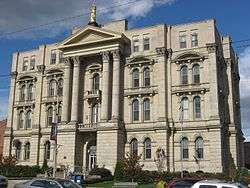
Jefferson County Courthouse, 2007 | ||
| ||
| Nickname(s): "City of Murals"[1] | ||
| Motto: Where you always have a home | ||
 Location of Steubenville in Jefferson County and state of Ohio. | ||
| Coordinates: 40°21′30″N 80°37′0″W / 40.35833°N 80.61667°WCoordinates: 40°21′30″N 80°37′0″W / 40.35833°N 80.61667°W[2] | ||
| Country | United States | |
| State | Ohio | |
| County | Jefferson | |
| Founded | 1795 | |
| Government | ||
| • Type | Council-Manager[3] | |
| • Mayor | Domenick Mucci, Jr. (D) | |
| Area[4] | ||
| • City | 10.63 sq mi (27.53 km2) | |
| • Land | 10.55 sq mi (27.32 km2) | |
| • Water | 0.08 sq mi (0.21 km2) | |
| Elevation[2] | 1,050 ft (320 m) | |
| Population (2010)[5] | ||
| • City | 18,659 | |
| • Estimate (2015[6]) | 18,219 | |
| • Density | 1,768.6/sq mi (682.9/km2) | |
| • Metro | 128,000 (Shared with Weirton, WV) | |
| Time zone | EST (UTC-5) | |
| • Summer (DST) | EDT (UTC-4) | |
| ZIP codes | 43952-43953 [7] | |
| Area code(s) | 740, 220 | |
| FIPS code | 39-74608 [2] | |
| GNIS feature ID | 1065383 [2] | |
| Website |
cityofsteubenville | |


Steubenville is a city in and the county seat of Jefferson County, Ohio, United States.[2] Located along the Ohio River, it had a population of 18,659 at the 2010 census.
The city's name is derived from Fort Steuben, a 1786 fort that sat within the city's current limits and was named for German-Prussian military officer Baron Friedrich Wilhelm von Steuben. Today, a replica of the fort is open to the public.[8]
Steubenville is known as the "City of Murals", after its more than 25 downtown murals.[1] It is home to Franciscan University of Steubenville and Eastern Gateway Community College (formerly Jefferson Community College).[9]
History

In 1786-87, the soldiers of the 1st American Regiment built Fort Steuben to protect the government surveyors mapping the land west of the Ohio River, and named the fort in honor of Baron Friedrich Wilhelm von Steuben. When the surveyors completed their task a few years later, the fort was abandoned. In the meantime, settlers had built homes around the fort; they named their settlement Steubenville. The name Steubenville was derived from Fort Steuben to honor Baron von Steuben (the fort was named for the Baron). The town was sometimes referred to as La Belle City, a franglais interpretation of "The Beautiful City."[10]
On July 29, 1797, Jefferson County was organized by a proclamation of Governor Arthur St. Clair, and Steubenville was selected as the County seat and was platted in the same year by Bezaliel (Bezaleel) Wells and James Ross, the city's co-founders. Wells, a government surveyor born in Baltimore, received about 1,000 acres (4 km2) of land west of the Ohio River; Ross, a lawyer from Pittsburgh, owned land north of his.[10]
On March 1, 1803, Ohio was admitted to the Union as the 17th state.[11] During the first half of the nineteenth century, Steubenville was primarily a port town, and the rest of the county was small villages and farms. Steubenville received a city charter in 1851. In 1856, Frazier, Kilgore and Company erected a rolling mill (the forerunner of steel mills) and the Steubenville Coal and Mining Company sank a coal shaft. The city was a stop along the Pittsburgh, Cincinnati, Chicago and St. Louis Railroad, which connected Pittsburgh to Chicago and St. Louis.
In 1946, the College of Steubenville was founded by the Franciscan Friars of the Third Order Regular.[12] In 1980, its name was changed to University of Steubenville, and finally in 1985 to Franciscan University of Steubenville.[13]
In 1966, the Jefferson County Technical Institute was founded. In 1977, its name was changed to Jefferson Technical College. In 1995, it became a community college and was renamed Jefferson Community College. In 2009, the college expanded its service district by three Ohio counties, and was renamed again: Eastern Gateway Community College.
Geography
Steubenville is located at 40°21′30″N 80°37′0″W / 40.35833°N 80.61667°W (40.359, -80.614).[14] According to the United States Census Bureau, the city has a total area of 10.63 square miles (27.53 km2), of which 10.55 square miles (27.32 km2) is land and 0.08 square miles (0.21 km2) is water.[4] The city lies along the Ohio River, with the city spreading west from the floodplains to the hills that surround the city. It lies within the ecoregion of the Western Allegheny Plateau.[15]
Demographics
| Historical population | |||
|---|---|---|---|
| Census | Pop. | %± | |
| 1800 | 731 | — | |
| 1810 | 1,617 | 121.2% | |
| 1820 | 2,479 | 53.3% | |
| 1830 | 2,987 | 20.5% | |
| 1840 | 4,247 | 42.2% | |
| 1850 | 6,140 | 44.6% | |
| 1860 | 6,154 | 0.2% | |
| 1870 | 8,107 | 31.7% | |
| 1880 | 12,093 | 49.2% | |
| 1890 | 13,394 | 10.8% | |
| 1900 | 14,349 | 7.1% | |
| 1910 | 22,391 | 56.0% | |
| 1920 | 28,508 | 27.3% | |
| 1930 | 35,422 | 24.3% | |
| 1940 | 37,651 | 6.3% | |
| 1950 | 35,872 | −4.7% | |
| 1960 | 32,495 | −9.4% | |
| 1970 | 30,771 | −5.3% | |
| 1980 | 26,400 | −14.2% | |
| 1990 | 22,125 | −16.2% | |
| 2000 | 19,015 | −14.1% | |
| 2010 | 18,659 | −1.9% | |
| Est. 2015 | 18,219 | [16] | −2.4% |
| Sources:[17][18][19][20] | |||
The city's population peaked in 1940 and has been in continuous decline since. The 2010 census found 18,659 residents, down 1.8 percent from the 2000 census, while the 2011 estimate put the population at 18,440, a drop of another 1.2 percent since 2010. The poverty rate increased to 27.5 percent of the population. The proportion of the population that is white remained at 79.5 percent, while the Hispanic proportion more than doubled to 2.4 percent as the black population dropped to 15.9 percent.[21]
From 1980 to 2000, census figures show that the Weirton–Steubenville population decreased faster than any other urban area in the United States.[22]
Steubenville is a principal city of the Weirton-Steubenville, WV-OH Metropolitan Statistical Area, part of the Pittsburgh Combined Statistical Area.[23]
2010 census
As of the census[5] of 2010, there were 18,659 people, 7,548 households, and 4,220 families residing in the city. The population density was 1,768.6 inhabitants per square mile (682.9/km2). There were 8,857 housing units at an average density of 839.5 per square mile (324.1/km2). The racial makeup of the city was 79.0% White, 15.9% African American, 3.5% from two or more races, 2.4% Hispanic or Latin of any race, 0.8% Asian, 0.6% from other races, and 0.2% Native American.
There were 7,548 households of which 25.3% had children under the age of 18 living with them, 34.8% were married couples living together, 16.2% had a female householder with no husband present, 4.8% had a male householder with no wife present, and 44.1% were non-families. 37.1% of all households were made up of individuals and 15.7% had someone living alone who was 65 years of age or older. The average household size was 2.22 and the average family size was 2.91.
The median age in the city was 38.8 years. 20.3% of residents were under the age of 18; 16.1% were between the ages of 18 and 24; 20.3% were from 25 to 44; 25.9% were from 45 to 64; and 17.5% were 65 years of age or older. The gender makeup of the city was 46.1% male and 53.9% female.
2000 census
As of the census[19] of 2000, there were 19,015 people, 8,342 households, and 4,880 families residing in the city. The population density was 1,842.2 people per square mile (711.4/km²). There were 9,449 housing units at an average density of 915.4 per square mile (353.5/km²). The racial makeup of the city was 79.55% White, 17.25% African American, 1.70% from two or more races, 0.97% Hispanic or Latin of any race, 0.73% Asian, 0.53% from other races, 0.22% Native American, and 0.01% Pacific Islander.
There were 8,342 households out of which 23.4% had children under the age of 18 living with them, 40.2% were married couples living together, 14.9% had a female householder, and 41.5% were non-families. 36.4% of all households were made up of individuals and 18.0% had someone living alone who was 65 years of age or older. The average household size was 2.19 and the average family size was 2.86.
In the city the population was spread out with 21.2% under the age of 18, 8.1% from 18 to 24, 24.3% from 25 to 44, 24.2% from 45 to 64, and 22.2% who were 65 years of age or older. The median age was 43 years. For every 100 females there were 85.6 males. For every 100 females age 18 and over, there were 80.8 males.
The median income for a household in the city was $26,516, and the median income for a family was $36,597. Males had a median income of $36,416 versus $21,819 for females. The per capita income for the city was $17,830. About 15.3% of families and 20.4% of the population were below the poverty line, including 29.2% of those under the age of 18 and 11.0% of those aged 65 and older.
Economy


Steubenville and the communities that surround it, especially Weirton, West Virginia, have experienced sluggish economies since the steel industry waned during the 1980s. Corporations such as Weirton Steel have had to reduce their workforce in order to become more efficient and competitive against other steel producers and lower steel prices worldwide.
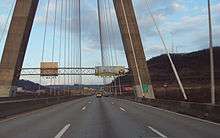
The new Findlay Connector has been built in western Pennsylvania as a toll-access highway between Pittsburgh International Airport at Interstate 376 and U.S. Route 22 in northwestern Washington County. Travel time between the Pittsburgh International Airport and the city of Steubenville is now approximately 25 minutes.
Steubenville is located near two large shale formations - the Marcellus and Utica formations.
Culture
Historic sites
Fort Steuben, located downtown on South Third Street, is a reconstructed 18th century fort on its original location overlooking the Ohio River. Built in 1787 to protect the government surveyors of the Seven Ranges of the Northwest Territory, Fort Steuben housed 150 men of the 1st American Regiment. The non-profit organization that worked to rebuild the fort also developed the surrounding block into Fort Steuben Park that includes the Veterans Memorial Fountain and the Berkman Amphitheater. The Fort Steuben Visitors center is home to the Museum Shop and the Steubenville Convention & Visitors Bureau and is an official site on the Ohio River Scenic Byway.
Adjacent to the fort is the First Federal Land Office with its original logs from 1801. After the Ohio country was surveyed, it could be sold or given away as land grants; the settlers brought their deeds to be registered at the Land Office to David Hoge, the Registrar of Lands and Titles for the Northwest Territory.
"Ohio Valley Steelworker" Statue was created by artist Dimitri Akis as a tribute to the Ohio Valley Steelworkers. The life-size figure carries a long-handled dipping ladle and is wearing the hooded fire-proof suit worn in the steel mills. The statue was located at the junction of Hwy 22 (University Blvd) and Hwy 7 (Dean Martin Blvd). In the fall of 2014, the statue was moved to its new home, displayed on South Fourth Street at the site of the Public Library of Steubenville and Jefferson County.[24]
There is a statue downtown commemorating Edwin Stanton, President Abraham Lincoln's secretary of war. Stanton was born and raised in Steubenville.
Sports
As of 2012, the Steubenville High School football team, Big Red, has the twentieth-most wins among U.S. high school football teams. The team had a 15–0 record in the 2005 season, ending as Ohio Div-III State Champions. The team went 15-0 in the 2006 season, repeating as state champions. The streak of regular-season victories eventually reached 68 games, and ended on October 23, 2009, with a loss to the Inkster (Michigan) Vikings.[25]
Big Red also won the 1984 Division II State Championship in football and were runners-up in Division II in 1987 and 1988, and runners-up in Division IV in 2008.
Steubenville High has the second-most victories in the state for baseball state poll champions 1994, 1998, and 2011. and twelfth-most wins in the state for basketball.
The city is also home to Steubenville Catholic Central High School, 1993 Div-V State Champion and 2005 Div-VI State runner-up.
The Steubenville Stampede was a member of the Continental Indoor Football League.
Parks and recreation
City parks
Steubenville Board of Parks and Recreation maintains four parks within the City. Belleview Park is the main park, where the Steubenville Little League holds all of their games. Belleview also has a swimming pool, tennis courts, and picnic areas. The golf course that once was part of Belleview Park is now the property of Franciscan University. The grounds are open to the public during daylight hours and students at the University frequent the hills for cross country practice runs. Beatty Park, located in the south side of Steubenville, was reopened for public use in September 2007. A newly installed Disc Golf Course was the focus for the Park's reopening. Other activities for Beatty Park may include hiking trails, a dog park, and bird watching. Thanks to efforts by local individuals working with the Steubenville Parks and Recreation Department, the idea of Beatty Park in “state of disrepair for sometime“ is no longer the theme. North End Park maintains a softball diamond (for use by Steubenville High School), playgrounds, and a picnic area. Jim Woods Park, in the west end of Steubenville, has a walking/jogging track, baseball diamond, and a picnic area. The newest elementary school in Steubenville is located at Jim Woods Park. The Steubenville City Council has successfully sold the Belleview Golf Course along with the "Green Strip" to Franciscan University of Steubenville. This move will allow the University to expand its operations and attract more potential students. The sale has come under scrutiny as the Belleview Golf Course was the only public course in the city. Smaller Parks Exist within the city as well The Flats Park on Highland Ave. and Maple Way, Linda Way Park at the end of Linda Way, Piece of Pie Park at the end of Maryland Ave., Veterans Memorial Park near the Pleasant Heights Fire Station, Pico Park at the corner of Pico Street and Cherry Street, and Murphy's Field and Playground also on Pleasant Height. Also there is a rec center located downtown called the Martin Luther King center where they host basketball games due to the courts, weight lifting and also zumba. (Update 10/2014) Piece of Pie park was closed in late September 2014 due to increase shootings near the park, and city officials have noted it will be only temporary closure to protect the citizens. Piece of Pie park swings, tables, and all activities have all been removed at the end of September 2014.
Climate
The climate in this area is characterized by relatively high temperatures and evenly distributed precipitation throughout the year. According to the Köppen Climate Classification system, Steubenville has a Humid subtropical climate, abbreviated "Cfa" on climate maps.[26]
| Climate data for Steubenville, Ohio | |||||||||||||
|---|---|---|---|---|---|---|---|---|---|---|---|---|---|
| Month | Jan | Feb | Mar | Apr | May | Jun | Jul | Aug | Sep | Oct | Nov | Dec | Year |
| Average high °C (°F) | 3 (37) |
5 (41) |
11 (51) |
17 (63) |
23 (73) |
27 (81) |
29 (84) |
28 (83) |
24 (76) |
18 (65) |
11 (52) |
5 (41) |
17 (62) |
| Average low °C (°F) | −6 (21) |
−6 (22) |
−1 (30) |
4 (39) |
9 (49) |
14 (58) |
17 (62) |
16 (61) |
13 (55) |
6 (43) |
1 (34) |
−4 (24) |
6 (42) |
| Average precipitation cm (inches) | 8 (3) |
6.4 (2.5) |
9.4 (3.7) |
8.9 (3.5) |
10.4 (4.1) |
10.7 (4.2) |
10.7 (4.2) |
8.9 (3.5) |
8.1 (3.2) |
7.1 (2.8) |
8 (3) |
8 (3) |
103.1 (40.6) |
| Source: Weatherbase [27] | |||||||||||||
Government

City Officials
| Steubenville Elected Officials: | |
|---|---|
| Mayor: | Domenick Mucci |
| City Council: | Kimberly Hahn(At-Large) Gerald DiLoreto (1) Mike Johnson (2) Eric Timmons (3) Scott Dressel (4) Willie Paul (5) Bob Villamagna (6) |
| Municipal Judge: | John J. Mascio, Jr. |
| Officials Appointed by Steubenville City Council | |
| City Manager: | Jim Mavromatis |
| Fire Chief: | Carlo Capaldi |
| Police Chief: | William McCafferty |
| Law Director: | Gary Repella |
Politics
The City of Steubenville is part of the 6th Congressional district of Ohio and is represented by Bill Johnson. The 6th district is the longest US House district in Ohio and runs along the southeast state borders of Ohio.
Political corruption
Steubenville has had a reputation for political corruption. Over a period of 20 years the city lost, or settled out of court, 48 civil rights lawsuits involving its police force. The city paid out more than $800,000, including $400,000 between 1990 and 1996.
In 1997, the U.S. Department of Justice alleged that the city and police force had subjected numerous individuals to "excessive force, false arrests, charges, and reports" and had engaged in practices regarding "improper stops, searches, and seizures." The report from the Department also stated that excessive force was levied against individuals who witnessed incidents of police misconduct, and against those who were known critics of the city and its police force. Those individuals were also falsely detained if the city and the police agreed that they were "likely to complain of abuse." It also stated that the officers involved also falsified reports and tampered with official police recorders so that "misconduct would not be recorded."[28]
As a result, the city's police force became the second city in the United States to sign a consent decree with the federal government due to an excessive number of civil rights lawsuits. The decree was signed on September 4, 1997, under the "pattern or practice" provision. Under this agreement, the city agreed to improve the training of its police officers, implement new guidelines and procedures, establish an internal affairs unit, and establish an "early warning system."[29]
Speed camera lawsuit
The speed camera program began in 2005 and earned the city $600,000 in revenues, as nearly 7,000 tickets at $85 each were issued during that time period. In March 2006, the Jefferson County Court of Common Pleas ruled that the city ordinance of supporting the speed camera program was illegal and unconstitutional. The city refused to remove the cameras, however, because it stated it was "bound by contract to continue the services" of Traffipax, Inc., the US subsidiary of ROBOT Visual Systems, a German corporation. Despite attempts to remove the cameras, the city continued to defy the judge's order and reinstated an identical ordinance to continue issuing citations. Councilman at Large Michael Hernon cast the sole dissenting vote against reinstating the traffic cameras.[30]
In mid-2006, an attorney filed a class-action lawsuit against the city of Steubenville for illegally collecting fines and generating unnecessary revenue from motorists. He won the case in December 2007 and the city was forced to refund thousands of tickets totaling $258,000.[31] Stern also gathered enough signatures from the residents of the city to put forth a referendum that posed the question of whether the city's ordinance authorizing the speed camera program should continue. On November 8, 2006, city residents voted to end the city's speed camera program with a 76.2 percent majority.[32]
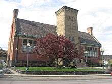
Education
_1911.jpg)
Colleges and universities
Steubenville is home to two institutions of higher education. The Franciscan University of Steubenville is a private, four-year university affiliated with the Roman Catholic Church. It was founded in 1946.
The second institution is Eastern Gateway Community College. It is a public, two-year college that opened its doors in 1968; its service district includes Columbiana, Mahoning, and Trumbull Counties as well as Jefferson County.
On July 24, 2012, after being threatened with a lawsuit from the atheist Freedom from Religion Foundation, the Steubenville city council decided to remove the image of Franciscan University from its town logo rather than pay for a lawsuit.[33] The city later proposed a logo that included a chapel and cross.[34]
Public schools
Public schools in Steubenville are operated by the Steubenville City School District. There are a total of five schools in the district: Wells Academy, West Pugliese, Garfield, Harding Middle, and Steubenville High School. A portion of far western Steubenville is served by the Indian Creek Local School District.
Private schools
Several private schools are located in Steubenville. The Roman Catholic Diocese of Steubenville operates Bishop John King Mussio Central Elementary School, Bishop John King Mussio Central Junior High School and Steubenville Catholic Central High School.
Notable people
References
- 1 2 City of Steubenville
- 1 2 3 4 5 Geographic Names Information System (GNIS) details for Steubenville, Ohio; United States Geological Survey (USGS); July 12, 1979.
- ↑ "City Manager". City of Steubenville. Retrieved 2015-08-12.
- 1 2 "US Gazetteer files 2010". United States Census Bureau. Retrieved 2013-01-06.
- 1 2 "American FactFinder". United States Census Bureau. Retrieved 2013-01-06.
- ↑ "Population Estimates". United States Census Bureau. Retrieved 2016-06-05.
- ↑ United States Postal Service (2012). "USPS - Look Up a ZIP Code". Retrieved 2012-02-15.
- ↑ "Historic Fort Steuben".
- ↑ "About Eastern Gateway". Eastern Gateway Community College.
- 1 2 Andrews, J.H. (1897). Centennial Souvenir of Steubenville and Jefferson County Ohio 1797-1897. Steubenville, OH: Herald Publishing Company.
- ↑ Stockwell, Mary (2006). The Ohio Adventure. Layton, UT: Gibbs Smith. p. 88.
- ↑ "Franciscan University of Steubenville". Ohio Historical Society. Retrieved 2006-11-07.
- ↑ "History of Franciscan University of Steubenville". Retrieved 2013-01-18.
- ↑ "US Gazetteer files: 2010, 2000, and 1990". United States Census Bureau. 2011-02-12. Retrieved 2011-04-23.
- ↑ "Level III Ecoregions of Ohio". National Health and Environmental Effects Research Laboratory. U.S. Environmental Protection Agency. Retrieved 28 September 2013.
- ↑ "Annual Estimates of the Resident Population for Incorporated Places: April 1, 2010 to July 1, 2015". Retrieved July 2, 2016.
- ↑ "Number of Inhabitants: Ohio" (PDF). 18th Census of the United States. U.S. Census Bureau. Retrieved 22 November 2013.
- ↑ "Ohio: Population and Housing Unit Counts" (PDF). U.S. Census Bureau. Retrieved 22 November 2013.
- 1 2 "American FactFinder". United States Census Bureau. Retrieved 2008-01-31.
- ↑ "Incorporated Places and Minor Civil Divisions Datasets: Subcounty Population Estimates: April 1, 2010 to July 1, 2012". U.S. Census Bureau. Retrieved 25 November 2013.
- ↑ "V". State & County QuickFacts. United States Census Bureau.
- ↑ Barringer, Felicity (27 September 2006). "As a Test Lab on Dirty Air, an Ohio Town Has Changed". The New York Times.
- ↑ "Revised Delineations of Metropolitan Statistical Areas, Micropolitan Statistical Areas, and Combined Statistical Areas, and Guidance on Uses of the Delineations of These Areas" (PDF). Executive Office of the President. 28 February 2013.
- ↑ Gossett, Dave (13 November 2014). "Steelworker on the Move". Herald-Star.
- ↑ "Big Red Suffers First Regular-Season Home Loss Since 2001". WTOV9.com. 24 October 2009.
- ↑ Climate Summary for Steubenville, Ohio
- ↑ "Weatherbase.com". Weatherbase. 2013. Retrieved on September 14, 2013.
- ↑ 1997 DoJ complaint against Steubenville
- ↑ Abad-Santos, Alexander (7 January 2013). "Why Nobody Trusts Steubenville". The Atlantic Wire.
- ↑ "Steubenville Reinstates Traffic Cameras" 20 June. 2006. WTOV9
- ↑ Law, Mark (2007-05-04). "Traffic camera case returns". Herald Star. Archived from the original on 2007-09-28. Retrieved 2007-05-08.
- ↑ "Steubenville, Ohio Voters Overwhelmingly Reject Speed Cameras." 8 November 2006. theNewspaper. 8 November 2006 .
- ↑ "FFRF victory: Cross removed from Steubenville logo". Freedom from Religion Foundation. July 25, 2012. Retrieved June 17, 2013.
- ↑ "Atheists Threaten To Sue Steubenville, Ohio". KDKA-AM. August 3, 2012. Retrieved June 17, 2013.
External links
| Wikisource has the text of the Encyclopaedia Britannica (9th ed.) article Steubenville. |
| Wikimedia Commons has media related to Steubenville, Ohio. |
Municipalities and communities of Jefferson County, Ohio, United States | ||
|---|---|---|
| Cities | 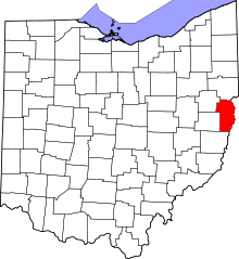 | |
| Villages | ||
| Townships | ||
| CDPs |
| |
| Unincorporated communities |
| |
| Ghost town | ||
| Footnotes | ‡This populated place also has portions in an adjacent county or counties | |
| Counties |  Map of the Pittsburgh Tri-State with green counties in the metropolitan area and yellow counties in the combined area. | |
|---|---|---|
| Major cities | ||
| Cities and towns 15k-50k (in 2010) | ||
| Airports | ||
| Topics | ||
| ||