List of mountain peaks of Arizona
This article comprises three sortable tables of major mountain peaks[1] of the U.S. State of Arizona.
The summit of a mountain or hill may be measured in three principal ways:
- The topographic elevation of a summit measures the height of the summit above a geodetic sea level.[2][3] The first table below ranks the 20 highest major summits of Arizona by elevation.
- The topographic prominence of a summit is a measure of how high the summit rises above its surroundings.[4][3] The second table below ranks the 20 most prominent summits of Arizona.
- The topographic isolation (or radius of dominance) of a summit measures how far the summit lies from its nearest point of equal elevation.[5] The third table below ranks the 20 most isolated major summits of Arizona.
Highest major summits
Of the highest major summits of Arizona, Humphreys Peak exceeds 3500 meters (11,483 feet) of elevation, five peaks exceed 3000 meters (9843 feet), and 14 peaks exceed 2500 meters (8202 feet) of elevation.
Most prominent summits
Of the most prominent summits of Arizona, five peaks are ultra-prominent summits with more than 1500 meters (4921 feet) of topographic prominence and 18 peaks exceed 1000 meters (3281 feet) of topographic prominence.
Most isolated major summits
Of the most isolated major summits of Arizona, Humphreys Peak and Baldy Peak exceed 200 kilometers (124.3 miles) of topographic isolation and seven peaks exceed 100 kilometers (62.14 miles) of topographic isolation.
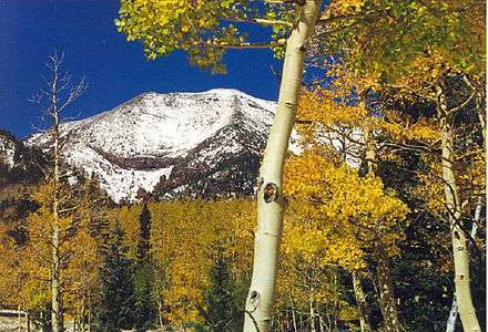
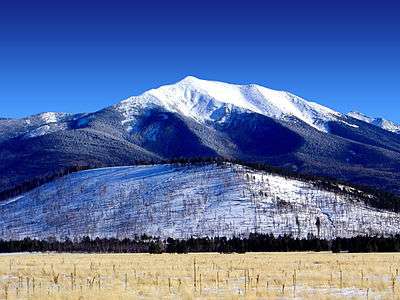
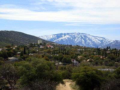
Gallery
.jpg)


See also
- List of mountain peaks of North America
- List of mountain peaks of Greenland
- List of mountain peaks of Canada
- List of mountain peaks of the Rocky Mountains
- List of mountain peaks of the United States
- List of mountain peaks of Alaska
- List of mountain peaks of Arizona
- List of mountain peaks of California
- List of mountain peaks of Colorado
- List of mountain peaks of Hawaiʻi
- List of mountain peaks of Idaho
- List of mountain peaks of Montana
- List of mountain peaks of Nevada
- List of mountain peaks of New Mexico
- List of mountain peaks of Oregon
- List of mountain peaks of Utah
- List of mountain peaks of Washington
- List of mountain peaks of Wyoming
- List of mountain peaks of México
- List of mountain peaks of Central America
- List of mountain peaks of the Caribbean
- Arizona
- Geography of Arizona
- Category:Mountains of Arizona
- Geography of Arizona
- Physical geography
References
- ↑ This article defines a significant summit as a summit with at least 100 meters (328.1 feet) of topographic prominence, and a major summit as a summit with at least 500 meters (1640 feet) of topographic prominence. All summits in this article have at least 500 meters of topographic prominence. An ultra-prominent summit is a summit with at least 1500 meters (4921 feet) of topographic prominence.
- ↑ All elevations in this article include an elevation adjustment from the National Geodetic Vertical Datum of 1929 (NGVD 29) to the North American Vertical Datum of 1988 (NAVD 88). For further information, please see this United States National Geodetic Survey note.
- 1 2 If the elevation or prominence of a summit is calculated as a range of values, the arithmetic mean is shown.
- ↑ The topographic prominence of a summit is the topographic elevation difference between the summit and its highest or key col to a higher summit. The summit may be near its key col or quite far away. The key col for Denali in Alaska is the Isthmus of Rivas in Nicaragua, 7642 kilometers (4749 miles) away.
- ↑ The topographic isolation of a summit is the great-circle distance to its nearest point of equal elevation.
- 1 2 3 The summit of Humphreys Peak is the highest point of the San Francisco Peaks and the U.S. State of Arizona.
- 1 2 3 "Humphreys Peak". Geographic Names Information System. United States Geological Survey.
- 1 2 3 The elevation of Humphreys Peak includes an adjustment of +1.345 m (+4.41 ft) from NGVD 29 to NAVD 88.
- 1 2 3 "Humphreys Peak". Peakbagger.com. Retrieved 14 June 2016.
- 1 2 3 "Humphreys Peak". Bivouac.com. Retrieved 14 June 2016.
- 1 2 3 The summit of Baldy Peak is the highest point of the White Mountains.
- 1 2 3 "BALDY". Datasheet for NGS Station DT0788. United States National Geodetic Survey. Retrieved 14 June 2016.
- 1 2 3 "Baldy Peak". Geographic Names Information System. United States Geological Survey.
- 1 2 3 "Baldy Peak". Peakbagger.com. Retrieved 14 June 2016.
- 1 2 3 "Baldy Peak". Bivouac.com. Retrieved 14 June 2016.
- ↑ "ESCUDILLA". Datasheet for NGS Station DT0715. United States National Geodetic Survey. Retrieved 14 June 2016.
- ↑ "Escudilla Mountain". Geographic Names Information System. United States Geological Survey.
- ↑ "Escudilla Mountain". Peakbagger.com. Retrieved 14 June 2016.
- ↑ "Escudilla Mountain". Bivouac.com. Retrieved 14 June 2016.
- 1 2 3 The summit of Mount Graham is the highest point of the Pinaleño Mountains.
- 1 2 3 "GRAHAM". Datasheet for NGS Station CY1235. United States National Geodetic Survey. Retrieved 14 June 2016.
- 1 2 3 "Mount Graham". Geographic Names Information System. United States Geological Survey.
- 1 2 3 "Mount Graham". Peakbagger.com. Retrieved 14 June 2016.
- 1 2 3 "Mount Graham". Bivouac.com. Retrieved 14 June 2016.
- ↑ "KENDRICK". Datasheet for NGS Station FQ0560. United States National Geodetic Survey. Retrieved 14 June 2016.
- ↑ "Kendrick Peak". Geographic Names Information System. United States Geological Survey.
- ↑ "Kendrick Peak". Peakbagger.com. Retrieved 14 June 2016.
- ↑ "Kendrick Peak". Bivouac.com. Retrieved 14 June 2016.
- 1 2 3 The summit of Roof Butte is the highest point of the Chuska Mountains.
- 1 2 3 "ROOF". Datasheet for NGS Station GO0270. United States National Geodetic Survey. Retrieved 14 June 2016.
- 1 2 3 "Roof Butte". Geographic Names Information System. United States Geological Survey.
- 1 2 3 "Roof Butte". Peakbagger.com. Retrieved 14 June 2016.
- 1 2 3 "Roof Butte". Bivouac.com. Retrieved 14 June 2016.
- 1 2 3 The summit of Chiricahua Peak is the highest point of the Chiricahua Mountains.
- 1 2 3 "Chiricahua Peak". Geographic Names Information System. United States Geological Survey.
- 1 2 3 The elevation of Chiricahua Peak includes an adjustment of +1.173 m (+3.85 ft) from NGVD 29 to NAVD 88.
- 1 2 3 "Chiricahua Peak". Peakbagger.com. Retrieved 14 June 2016.
- 1 2 3 "Chiricahua Peak". Bivouac.com. Retrieved 14 June 2016.
- 1 2 3 The summit of Miller Peak is the highest point of the Huachuca Mountains.
- 1 2 3 "Miller Peak". Geographic Names Information System. United States Geological Survey.
- 1 2 3 The elevation of Miller Peak includes an adjustment of +1.067 m (+3.50 ft) from NGVD 29 to NAVD 88.
- 1 2 3 "Miller Peak". Peakbagger.com. Retrieved 14 June 2016.
- 1 2 3 "Miller Peak". Bivouac.com. Retrieved 14 June 2016.
- 1 2 3 The summit of Mount Wrightson is the highest point of the Santa Rita Mountains.
- 1 2 3 "Mount Wrightson". Geographic Names Information System. United States Geological Survey.
- 1 2 3 The elevation of Mount Wrightson includes an adjustment of +1.073 m (+3.52 ft) from NGVD 29 to NAVD 88.
- 1 2 3 "Mount Wrightson". Peakbagger.com. Retrieved 14 June 2016.
- 1 2 3 "Mount Wrightson". Bivouac.com. Retrieved 14 June 2016.
- 1 2 3 The elevation of Kaibab Plateau high point includes an adjustment of +1.301 m (+4.27 ft) from NGVD 29 to NAVD 88.
- 1 2 3 "Kaibab Plateau high point". Peakbagger.com. Retrieved 14 June 2016.
- 1 2 3 "Kaibab Plateau high point". Bivouac.com. Retrieved 14 June 2016.
- 1 2 3 The summit of Mount Lemmon is the highest point of the Santa Catalina Mountains.
- 1 2 3 "Mount Lemmon". Geographic Names Information System. United States Geological Survey.
- 1 2 3 The elevation of Mount Lemmon includes an adjustment of +1.004 m (+3.29 ft) from NGVD 29 to NAVD 88.
- 1 2 3 "Mount Lemmon". Peakbagger.com. Retrieved 14 June 2016.
- 1 2 3 "Mount Lemmon". Bivouac.com. Retrieved 14 June 2016.
- 1 2 The summit of Mica Mountain is the highest point of the Rincon Mountains.
- 1 2 "Mica Mountain". Geographic Names Information System. United States Geological Survey.
- 1 2 The elevation of Mica Mountain includes an adjustment of +0.960 m (+3.15 ft) from NGVD 29 to NAVD 88.
- 1 2 "Mica Mountain". Peakbagger.com. Retrieved 14 June 2016.
- 1 2 "Mica Mountain". Bivouac.com. Retrieved 14 June 2016.
- 1 2 3 The summit of Hualapai Peak is the highest point of the Hualapai Mountains.
- 1 2 3 "HUALPAI". Datasheet for NGS Station FR0973. United States National Geodetic Survey. Retrieved 14 June 2016.
- 1 2 3 "Hualapai Peak". Geographic Names Information System. United States Geological Survey.
- 1 2 3 "Hualapai Peak". Peakbagger.com. Retrieved 14 June 2016.
- 1 2 3 "Hualapai Peak". Bivouac.com. Retrieved 14 June 2016.
- 1 2 The summit of Mount Turnbull is the highest point of the Santa Teresa Mountains.
- 1 2 "Mount Turnbull". Geographic Names Information System. United States Geological Survey.
- 1 2 The elevation of Mount Turnbull includes an adjustment of +0.747 m (+2.45 ft) from NGVD 29 to NAVD 88.
- 1 2 "Mount Turnbull". Peakbagger.com. Retrieved 14 June 2016.
- 1 2 "Mount Turnbull". Bivouac.com. Retrieved 14 June 2016.
- 1 2 The summit of Mount Trumbull is the highest point of the Unikaret Plateau.
- 1 2 "TRUMBULL". Datasheet for NGS Station GQ0367. United States National Geodetic Survey. Retrieved 14 June 2016.
- 1 2 "Mount Trumbull". Geographic Names Information System. United States Geological Survey.
- 1 2 "Mount Trumbull". Peakbagger.com. Retrieved 14 June 2016.
- 1 2 "Mount Trumbull". Bivouac.com. Retrieved 14 June 2016.
- 1 2 The summit of Mount Union is the highest point of the Bradshaw Mountains.
- 1 2 "UNION". Datasheet for NGS Station ET0939. United States National Geodetic Survey. Retrieved 14 June 2016.
- 1 2 "Mount Union". Geographic Names Information System. United States Geological Survey.
- 1 2 "Mount Union". Peakbagger.com. Retrieved 14 June 2016.
- 1 2 "Mount Union". Bivouac.com. Retrieved 14 June 2016.
- 1 2 The summit of Mazatzal Peak is the highest point of the Mazatzal Mountains.
- 1 2 "MAZATZAL". Datasheet for NGS Station ES0981. United States National Geodetic Survey. Retrieved 14 June 2016.
- 1 2 "Mazatzal Peak". Geographic Names Information System. United States Geological Survey.
- 1 2 "Mazatzal Peak". Peakbagger.com. Retrieved 14 June 2016.
- 1 2 "Mazatzal Peak". Bivouac.com. Retrieved 14 June 2016.
- 1 2 3 The summit of Pinal Peak is the highest point of the Pinal Mountains.
- 1 2 3 "Pinal Peak". Geographic Names Information System. United States Geological Survey.
- 1 2 3 The elevation of Pinal Peak includes an adjustment of +0.759 m (+2.49 ft) from NGVD 29 to NAVD 88.
- 1 2 3 "Pinal Peak". Peakbagger.com. Retrieved 14 June 2016.
- 1 2 3 "Pinal Peak". Bivouac.com. Retrieved 14 June 2016.
- 1 2 The summit of Aztec Peak is the highest point of the Sierra Ancha.
- 1 2 "Aztec Peak". Geographic Names Information System. United States Geological Survey.
- 1 2 The elevation of Aztec Peak includes an adjustment of +0.805 m (+2.64 ft) from NGVD 29 to NAVD 88.
- 1 2 "Aztec Peak". Peakbagger.com. Retrieved 14 June 2016.
- 1 2 "Aztec Peak". Bivouac.com. Retrieved 14 June 2016.
- 1 2 The summit of Baboquivari Peak is the highest point of the Baboquivari Mountains.
- 1 2 "Baboquivari Peak". Geographic Names Information System. United States Geological Survey.
- 1 2 The elevation of Baboquivari Peak includes an adjustment of +0.864 m (+2.83 ft) from NGVD 29 to NAVD 88.
- 1 2 "Baboquivari Peak". Peakbagger.com. Retrieved 14 June 2016.
- 1 2 "Baboquivari Peak". Bivouac.com. Retrieved 14 June 2016.
- ↑ The summit of Mount Tipton is the highest point of the Cerbat Mountains.
- ↑ "TIPTON". Datasheet for NGS Station FS1023. United States National Geodetic Survey. Retrieved 14 June 2016.
- ↑ "Mount Tipton". Geographic Names Information System. United States Geological Survey.
- ↑ "Mount Tipton". Peakbagger.com. Retrieved 14 June 2016.
- 1 2 The summit of Signal Peak is the highest point of the Kofa Mountains.
- 1 2 "KOFA 2". Datasheet for NGS Station DW0905. United States National Geodetic Survey. Retrieved 14 June 2016.
- 1 2 "Signal Peak". Geographic Names Information System. United States Geological Survey.
- 1 2 "Signal Peak". Peakbagger.com. Retrieved 14 June 2016.
- 1 2 "Signal Peak". Bivouac.com. Retrieved 14 June 2016.
- 1 2 The summit of Harquahala Mountain is the highest point of the Harquahala Mountains.
- 1 2 "Harquahala Mountain". Geographic Names Information System. United States Geological Survey.
- 1 2 The elevation of Harquahala Mountain includes an adjustment of +0.768 m (+2.52 ft) from NGVD 29 to NAVD 88.
- 1 2 "Harquahala Mountain". Peakbagger.com. Retrieved 14 June 2016.
- ↑ "FOUR PEAKS". Datasheet for NGS Station DU2275. United States National Geodetic Survey. Retrieved 14 June 2016.
- ↑ "Browns Peak". Geographic Names Information System. United States Geological Survey.
- ↑ "Browns Peak". Peakbagger.com. Retrieved 14 June 2016.
- ↑ "Browns Peak". Bivouac.com. Retrieved 14 June 2016.
- 1 2 The elevation of Sierra Estrella high point includes an adjustment of +0.657 m (+2.16 ft) from NGVD 29 to NAVD 88.
- 1 2 "Sierra Estrella high point". Peakbagger.com. Retrieved 14 June 2016.
- ↑ "Mount Ajo". Geographic Names Information System. United States Geological Survey.
- ↑ The elevation of Mount Ajo includes an adjustment of +0.793 m (+2.60 ft) from NGVD 29 to NAVD 88.
- ↑ "Mount Ajo". Peakbagger.com. Retrieved 14 June 2016.
External links
- United States Geological Survey (USGS)
- United States National Geodetic Survey (NGS)
- Bivouac.com
- Peakbagger.com
- Peaklist.org
- Peakware.com
- Summitpost.org

Coordinates: 35°20′47″N 111°40′41″W / 35.3464°N 111.6780°W