Yavapai County, Arizona
| Yavapai County, Arizona | ||
|---|---|---|
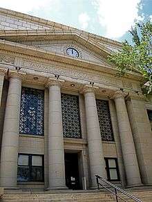 Yavapai County Courthouse in Prescott | ||
| ||
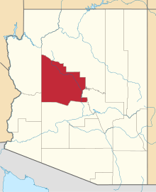 Location in the U.S. state of Arizona | ||
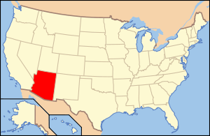 Arizona's location in the U.S. | ||
| Founded | November 9, 1864 | |
| Named for | Yavapai people | |
| Seat | Prescott | |
| Largest city | Prescott Valley | |
| Area | ||
| • Total | 8,128 sq mi (21,051 km2) | |
| • Land | 8,123 sq mi (21,038 km2) | |
| • Water | 4.4 sq mi (11 km2), 0.05% | |
| Population (est.) | ||
| • (2015) | 222,255 | |
| • Density | 27/sq mi (10/km²) | |
| Congressional districts | 1st, 4th | |
| Time zone | Mountain: UTC-7 | |
| Website |
www | |

Yavapai County is near the center of the U.S. state of Arizona. As of the 2010 census, its population was 211,073.[1] The county seat is Prescott.[2]
Yavapai County comprises the Prescott, AZ Metropolitan Statistical Area.
History

Yavapai County was one of the four original Arizona Counties created by the 1st Arizona Territorial Legislature. The county territory was defined as being east of longitude 113° 20' and north of the Gila River.[3] Soon thereafter, the counties of Apache, Coconino, Maricopa, and Navajo were carved from the original Yavapai County. Yavapai County's present boundaries were established in 1891.
The county is named after the Yavapai people, who were the principal inhabitants at the time the United States annexed the area.
Geography
According to the U.S. Census Bureau, the county has a total area of 8,128 square miles (21,050 km2), of which 8,123 square miles (21,040 km2) is land and 4.4 square miles (11 km2) (0.05%) is water.[4] It has about 93% of the area of the U.S. state of New Jersey. It is larger than three U.S. States; Rhode Island, Delaware & Connecticut, and the District of Columbia.
The county's topography makes a dramatic transition from the lower Sonoran Desert to the south to the heights of the Coconino Plateau to the north, and the Mogollon Rim to the east. The highest point above sea level (MSL) in Yavapai County is Mount Union at an elevation of 7,979 ft (2,432 m) and the lowest is Agua Fria River drainage, now under Lake Pleasant.
Adjacent counties
- Mohave County — west
- La Paz County — southwest
- Maricopa County — south
- Gila County — east
- Coconino County — north/northeast
Major highways
National protected areas
- Agua Fria National Monument
- Coconino National Forest (part)
- Kaibab National Forest (part)
- Montezuma Castle National Monument
- Prescott National Forest (part)
- Tonto National Forest (part)
- Tuzigoot National Monument
There are 19 official wilderness areas in Yavapai County that are part of the National Wilderness Preservation System. Fourteen of these are integral parts of National Forests listed above, whereas five are managed by the Bureau of Land Management. Some of these extend into neighboring counties (as indicated below):
- Apache Creek Wilderness (Prescott NF)
- Arrastra Mountain Wilderness (BLM) mostly in Mohave County; also partly in La Paz County
- Castle Creek Wilderness (Prescott NF)
- Cedar Bench Wilderness (Prescott NF)
- Fossil Springs Wilderness (Coconino NF) mostly in Coconino County
- Granite Mountain Wilderness (Arizona) (Prescott NF)
- Hassayampa River Canyon Wilderness (BLM)
- Hells Canyon Wilderness (Arizona) (BLM) partly in Maricopa County
- Juniper Mesa Wilderness (Prescott NF)
- Mazatzal Wilderness (Tonto NF / Coconino NF) partly in Gila County; Maricopa County
- Munds Mountain Wilderness (Coconino NF) mostly in Coconino County
- Pine Mountain Wilderness (Tonto NF/Prescott NF)
- Red Rock-Secret Mountain Wilderness (Coconino NF) partly in Coconino County
- Sycamore Canyon Wilderness (Prescott NF/Coconino NF / Kaibab NF) mostly in Coconino County
- Tres Alamos Wilderness (BLM)
- Upper Burro Creek Wilderness (BLM) partly in Mohave County
- West Clear Creek Wilderness (Coconino NF) partly in Coconino County
- Wet Beaver Wilderness (Coconino NF) partly in Coconino County
- Woodchute Wilderness (Prescott NF)
Land ownership and management
- Private ownership: about 25% of Yavapai County's land (by area) is privately owned.
- Public land: about 75% of the county's area is publicly owned, including
- Federal ownership: about 50% of the county's area is owned by the Federal government of the United States, including
- National Forest lands, managed by the US Forest Service: 38% of the county's area
- Federal lands managed by the U.S. Bureau of Land Management: 11.6% of the county's area
- Small areas of Federal land are managed by the U.S. Bureau of Indian Affairs and the National Park Service: less than 0.5% of the county's area.
- Yavapai-Prescott Tribe 1,413 acres (572 ha)
- Yavapai-Apache Nation 685 acres (277 ha)
- About 25% of Yavapai County is owned by the State of Arizona as state trust lands, managed by the Arizona State Land Department.
Source: Yavapai County Profile
Flora and fauna
There are numerous flora and fauna species within Yavapai County. For example, a number of plants within the genus Ephedra and Coreopsis are found in the county.[5] Yavapai County is also the location of several groves of the near-threatened California Fan Palm, Washingtonia filifera.[6]
Demographics
| Historical population | |||
|---|---|---|---|
| Census | Pop. | %± | |
| 1870 | 2,142 | — | |
| 1880 | 5,013 | 134.0% | |
| 1890 | 8,685 | 73.2% | |
| 1900 | 13,799 | 58.9% | |
| 1910 | 15,996 | 15.9% | |
| 1920 | 24,016 | 50.1% | |
| 1930 | 28,470 | 18.5% | |
| 1940 | 26,511 | −6.9% | |
| 1950 | 24,991 | −5.7% | |
| 1960 | 28,912 | 15.7% | |
| 1970 | 36,733 | 27.1% | |
| 1980 | 68,145 | 85.5% | |
| 1990 | 107,714 | 58.1% | |
| 2000 | 167,517 | 55.5% | |
| 2010 | 211,073 | 26.0% | |
| Est. 2015 | 222,255 | [7] | 5.3% |
| U.S. Decennial Census[8] 1790–1960[9] 1900–1990[10] 1990–2000[11] 2010–2015[1] | |||
2000 census
As of the 2000 census, there were 167,517 people, 70,171 households, and 46,733 families residing in the county. The population density was 21 people per square mile (8/km²). There were 81,730 housing units at an average density of 10 per square mile (4/km²). The racial makeup of the county was 91.89% White, 0.39% Black or African American, 1.60% Native American, 0.51% Asian, 0.08% Pacific Islander, 3.58% from other races, and 1.95% from two or more races. 9.78% of the population were Hispanic or Latino of any race.
There were 70,171 households out of which 23.80% had children under the age of 18 living with them, 55.00% were married couples living together, 8.10% had a female householder with no husband present, and 33.40% were non-families. 26.70% of all households were made up of individuals and 12.40% had someone living alone who was 65 years of age or older. The average household size was 2.33 and the average family size was 2.79.
In the county the population was spread out with 21.10% under the age of 18, 7.10% from 18 to 24, 22.40% from 25 to 44, 27.40% from 45 to 64, and 22.00% who were 65 years of age or older. The median age was 44 years. For every 100 females there were 96.20 males. For every 100 females age 18 and over, there were 93.50 males.
The median income for a household in the county was $34,901, and the median income for a family was $40,910. Males had a median income of $30,738 versus $22,114 for females. The per capita income for the county was $19,727. About 7.90% of families and 11.90% of the population were below the poverty line, including 15.90% of those under age 18 and 6.70% of those age 65 or over.
By 2015 Census Bureau Estimates placed the population of Yavapai County at 222,255. This represented a 24.2% growth in the population since 2000.[12]
Yavapai County is defined as the Prescott Metropolitan Statistical Area by the United States Census Bureau.[13]
2010 census
As of the 2010 United States Census, there were 211,033 people, 90,903 households, and 57,597 families residing in the county.[14] The population density was 26.0 inhabitants per square mile (10.0/km2). There were 110,432 housing units at an average density of 13.6 per square mile (5.3/km2).[15] The racial makeup of the county was 89.3% white, 1.7% American Indian, 0.8% Asian, 0.6% black or African American, 0.1% Pacific islander, 4.9% from other races, and 2.5% from two or more races. Those of Hispanic or Latino origin made up 13.6% of the population.[14] In terms of ancestry, 22.5% were German, 16.0% were Irish, 15.8% were English, 5.4% were Italian, and 5.0% were American.[16]
Of the 90,903 households, 22.8% had children under the age of 18 living with them, 50.3% were married couples living together, 9.0% had a female householder with no husband present, 36.6% were non-families, and 29.1% of all households were made up of individuals. The average household size was 2.28 and the average family size was 2.78. The median age was 49.2 years.[14]
The median income for a household in the county was $43,290 and the median income for a family was $53,499. Males had a median income of $40,854 versus $31,705 for females. The per capita income for the county was $25,527. About 8.8% of families and 13.7% of the population were below the poverty line, including 20.1% of those under age 18 and 6.1% of those age 65 or over.[17]
Attractions
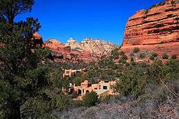
Yavapai County is home to Arcosanti, a prototype arcology, developed by Paolo Soleri, and under construction since 1970. Arcosanti is open Monday through Sunday from 9 a.m. to 5 p.m., and holds tours from 10 a.m. to 4 p.m. on the hour, every hour. Arcosanti is just north of Cordes Junction, Arizona.
Out of Africa Wildlife Park is a private zoo. The park moved to the Camp Verde area from the East Valley in 2005.
Approximately 10 miles (16 km) northwest of the town of Bagdad lies the Upper Burro Creek Wilderness Area, a 27,440-acre (11,105 ha) protected area home to at least 150 species of birds and featuring one of the Arizona desert's few undammed perennial streams.[18]
Communities
.jpg)
Cities
- Cottonwood
- Peoria (mostly in Maricopa County)
- Prescott (county seat)
- Sedona (partly in Coconino County)
Towns
- Camp Verde
- Chino Valley
- Clarkdale
- Dewey-Humboldt
- Jerome
- Prescott Valley
- Wickenburg (mostly in Maricopa County)
Census-designated places
Unincorporated communities
County population ranking
The population ranking of the following table is based on the 2010 census of Yavapai County.[19][20]
† county seat
| Rank | City/Town/etc. | Population (2010 Census) | Municipal type | Incorporated |
|---|---|---|---|---|
| 1 | Peoria (most of population in Maricopa County) | 154,065 | City | 1954 |
| 2 | † Prescott | 39,843 | City | 1883 |
| 3 | Prescott Valley | 38,822 | Town | 1978 |
| 4 | Verde Village | 11,605 | CDP | |
| 5 | Cottonwood | 11,265 | City | 1960 |
| 6 | Camp Verde | 10,873 | Town | 1986 |
| 7 | Chino Valley | 10,817 | Town | 1970 |
| 8 | Sedona (partly in Coconino County) | 10,031 | City | 1988 |
| 9 | Wickenburg (Most of population in Maricopa County) | 6,363 | Town | 1909 |
| 10 | Village of Oak Creek (Big Park) | 6,147 | CDP | |
| 11 | Williamson | 5,438 | CDP | |
| 12 | Paulden | 5,231 | CDP | |
| 13 | Lake Montezuma | 4,706 | CDP | |
| 14 | Clarkdale | 4,097 | Town | 1957 |
| 15 | Dewey-Humboldt | 3,894 | Town | 2004 |
| 16 | Cornville | 3,280 | CDP | |
| 17 | Black Canyon City | 2,837 | CDP | |
| 18 | Cordes Lakes | 2,633 | CDP | |
| 19 | Congress | 1,975 | CDP | |
| 20 | Bagdad | 1,876 | CDP | |
| 21 | Mayer | 1,497 | CDP | |
| 22 | Spring Valley | 1,148 | CDP | |
| 23 | Wilhoit | 868 | CDP | |
| 24 | Yarnell | 649 | CDP | |
| 25 | Seligman | 445 | CDP | |
| 26 | Jerome | 444 | Town | 1899 |
| 27 | Peeples Valley | 428 | CDP | |
| 28 | Ash Fork | 396 | CDP |
See also
References
- 1 2 "State & County QuickFacts". United States Census Bureau. Retrieved May 18, 2014.
- ↑ "Find a County". National Association of Counties. Retrieved 2011-06-07.
- ↑ Wagoner, Jay J. (1970). Arizona Territory 1863-1912: A Political history. Tucson: University of Arizona Press. p. 58. ISBN 0-8165-0176-9.
- ↑ "2010 Census Gazetteer Files". United States Census Bureau. August 23, 2012. Retrieved August 23, 2015.
- ↑ T. Kearney, Robert H. Peebles and Elizabeth McClintock. Arizona Flora. 2nd ed. Berkeley: U of California P, 1940, 61 et seq. ISBN 0-520-00637-2, ISBN 978-0-520-00637-9
- ↑ C. Michael Hogan. 2009. California Fan Palm: Washingtonia filifera, GlobalTwitcher.com, ed. Nicklas Stromberg
- ↑ "County Totals Dataset: Population, Population Change and Estimated Components of Population Change: April 1, 2010 to July 1, 2015". Retrieved July 2, 2016.
- ↑ "U.S. Decennial Census". United States Census Bureau. Retrieved May 18, 2014.
- ↑ "Historical Census Browser". University of Virginia Library. Retrieved May 18, 2014.
- ↑ "Population of Counties by Decennial Census: 1900 to 1990". United States Census Bureau. Retrieved May 18, 2014.
- ↑ "Census 2000 PHC-T-4. Ranking Tables for Counties: 1990 and 2000" (PDF). United States Census Bureau. Retrieved May 18, 2014.
- ↑ Yavapai County QuickFacts from the US Census Bureau
- ↑ "OMB Bulletin No. 07-01: Update of Statistical Area Definitions and Guidance on Their Uses" (PDF). United States Office of Management and Budget. 2006-12-18. Archived from the original (PDF) on 2007-03-17. Retrieved 2007-04-09.
- 1 2 3 "DP-1 Profile of General Population and Housing Characteristics: 2010 Demographic Profile Data". United States Census Bureau. Retrieved 2016-01-20.
- ↑ "Population, Housing Units, Area, and Density: 2010 - County". United States Census Bureau. Retrieved 2016-01-20.
- ↑ "DP02 SELECTED SOCIAL CHARACTERISTICS IN THE UNITED STATES – 2006-2010 American Community Survey 5-Year Estimates". United States Census Bureau. Retrieved 2016-01-20.
- ↑ "DP03 SELECTED ECONOMIC CHARACTERISTICS – 2006-2010 American Community Survey 5-Year Estimates". United States Census Bureau. Retrieved 2016-01-20.
- ↑ Upper Burro Creek Wilderness — Wilderness.net
- ↑ http://www.census.gov/2010census/
- ↑ http://www.census.gov/geo/maps-data/maps/block/2010/
Sources
- Fuis, G.S. (1996). The geology and mechanics of formation of the Fort Rock dome, Yavapai County, Arizona [U.S. Geological Survey Professional Paper 1266]. Washington, D.C.: U.S. Department of the Interior, U.S. Geological Survey.
External links
 Geographic data related to Yavapai County, Arizona at OpenStreetMap
- Yavapai County Profile by Arizona Department of Commerce
- Prescott eNews — original local news Web site for Prescott (the county seat) and the surrounding communities.
- Yavapai County government website
Coordinates: 34°33′41″N 112°32′24″W / 34.56139°N 112.54000°W