Guadalupe Peak
| Guadalupe Peak | |
|---|---|
 | |
| Highest point | |
| Elevation | 8,751 ft (2,667 m) NAVD 88[1] |
| Prominence | 3,029 ft (923 m) [2] |
| Listing | State high point 14th |
| Coordinates | 31°53′29″N 104°51′39″W / 31.891460742°N 104.860710292°WCoordinates: 31°53′29″N 104°51′39″W / 31.891460742°N 104.860710292°W [1] |
| Geography | |
 Guadalupe Peak Location of Guadalupe Peak in Texas | |
| Location | Culberson County, Texas, U.S. |
| Parent range | Guadalupe Mountains |
| Topo map | USGS Guadalupe Peak |
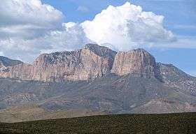
Guadalupe Peak, also known as Signal Peak,[3] is the highest natural point in Texas,[4] with an elevation of 8,751 feet (2,667 m) above sea level.[1] It is located in Guadalupe Mountains National Park, and is part of the Guadalupe Mountains range in southeastern New Mexico and West Texas. The mountain is about 90 miles (140 km) east of El Paso and about 50 miles (80 km) southwest of Carlsbad, New Mexico. The peak rises more than 3,000 feet (910 m) above the arid floor of the Chihuahuan Desert.
Trail and summit
The peak can be climbed by a maintained stony trail (4.25 miles or 6.8 kilometres each way) at any time of the year.[5] The trail is part of the network of hiking trails in the surrounding national park.
A stainless steel pyramid marks the summit. It was erected by American Airlines in 1958 to commemorate the 100th anniversary of the Butterfield Overland Mail, a stagecoach route that passed south of the mountain. One side of the pyramid has the American Airlines logo. The second side displays a U.S. Postal Service tribute to the Pony Express Riders of the Butterfield Stage. The third side displays a compass with the logo of the Boy Scouts of America. A summit register contained in a metal ammunition box is located at the base of the pyramid.
Gallery
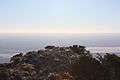 View west from top of peak.
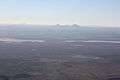 Salt Flats from summit.
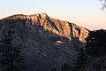 Guadalupe Mountains in sunset.
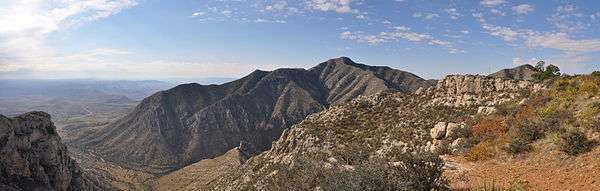
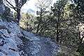 Hiking trail up the peak.
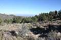 High elevation (8100 ft) campground near summit.
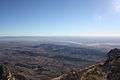 Culberson County, Texas, from the summit.
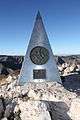 The pyramid at the summit.
See also
References
- 1 2 3 "El Capitan". NGS data sheet. U.S. National Geodetic Survey. Retrieved 2001-05-24.
- ↑ "Guadalupe Peak, Texas". Peakbagger.com. Retrieved 2001-05-24.
- ↑ "GUADALUPE PEAK". Handbook of Texas Online. Texas State Historical Association. 15 June 2010. Retrieved 7 April 2015.
- ↑ "Elevations and Distances in the United States". United States Geological Survey. April 29, 2005. Retrieved 2009-03-28.
- ↑ "Guadalupe Mountains: Guadalupe Peak Hike" (PDF). National Park Service. Retrieved 12 May 2015.
External links
- "Guadalupe Mountains National Park". National Park Service. Retrieved 2011-05-21.
- "Guadalupe Peak". Geographic Names Information System. United States Geological Survey. Retrieved 2001-05-24.
- "Guadalupe Peak". SummitPost.org. Retrieved 2011-05-21.
- "Guadalupe Peak Trip Report". High-Powered Planet. Retrieved 2011-11-14.
