Fairywood (Pittsburgh)
| Fairywood | |
|---|---|
| Neighborhood of Pittsburgh | |
 | |
| Coordinates: 40°26′56″N 80°04′55″W / 40.449°N 80.082°W | |
| Country | United States |
| State | Pennsylvania |
| County | Allegheny County |
| City | Pittsburgh |
| Area[1] | |
| • Total | 0.969 sq mi (2.51 km2) |
| Population (2010)[1] | |
| • Total | 1,002 |
| • Density | 1,000/sq mi (400/km2) |
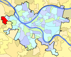
Fairywood is a neighborhood on Pittsburgh, Pennsylvania's west end. It has a zip code of 15205, and has representation on Pittsburgh City Council by the council member for District 2 (West Neighborhoods). It borders the city of Pittsburgh neighborhood of Windgap and the borough of Ingram. It is the westernmost neighborhood in the City of Pittsburgh.[2]
It was once home to several public housing developments, notably Broadhead Manor, which was torn down after the neighborhood largely depopulated and crime increased.[3] Another Section 8 development was Westgate Village, which was converted into a gated apartment community called Emerald Gardens.[4] Many homes have been demolished over the years after residents moved away and the buildings deteriorated from neglect, and Fairywood now consists of lots of Urban prairie.
During the 1960s and 1970s, construction began on a four-lane highway called the Industrial Highway, but it was never completed and has become an abandoned ghost highway. It was meant to connect PA 60 to PA 51 in the Esplen neighborhood of Pittsburgh.[5] Most commercial establishments have moved out of Fairywood; however, UPS does have a terminal there, along with the Pittsburgh division of ModCloth. There is also a Giant Eagle warehouse and an Amazon Distribution Center.
References
- 1 2 "PGHSNAP 2010 Raw Census Data by Neighborhood". Pittsburgh Department of City Planning PGHSNAP Utility. 2012. Retrieved 24 June 2013. External link in
|publisher=(help) - ↑ http://www.pittsburghcityliving.com/neighborhoodProfile.php?neighborhood=Fairywood
- ↑ http://www.pghcitypaper.com/pittsburgh/fairywood-tale/Content?oid=1342310
- ↑ http://triblive.com/x/pittsburghtrib/business/s_684573.html#axzz2il1RUKwh
- ↑ http://www.gribblenation.com/swparoads/coulda/industrial.html
Further reading
- Toker, Franklin (1994) [1986]. Pittsburgh: An Urban Portrait. Pittsburgh: University of Pittsburgh Press. ISBN 0-8229-5434-6.