Scotland, Connecticut
| Scotland, Connecticut | ||
|---|---|---|
| Town | ||
| ||
 Location in Windham County and the state of Connecticut. | ||
| Coordinates: 41°42′01″N 72°04′59″W / 41.70028°N 72.08306°WCoordinates: 41°42′01″N 72°04′59″W / 41.70028°N 72.08306°W | ||
| Country | United States | |
| State | Connecticut | |
| NECTA | None | |
| Region | Windham Region | |
| Incorporated | 1857 | |
| Government | ||
| • Type | Selectman-town meeting | |
| • First selectman | Daniel D. Syme (R) | |
| • Selectman | Clare D. D'Appollino (R) | |
| • Selectman | Rodney E. Perry (D) | |
| Area | ||
| • Total | 18.7 sq mi (48.4 km2) | |
| • Land | 18.6 sq mi (48.2 km2) | |
| • Water | 0.0 sq mi (0.1 km2) | |
| Elevation | 272 ft (83 m) | |
| Population (2010) | ||
| • Total | 1,726 | |
| • Density | 91/sq mi (35/km2) | |
| Time zone | Eastern (UTC-5) | |
| • Summer (DST) | Eastern (UTC-4) | |
| ZIP code | 06264 | |
| Area code(s) | 860 | |
| FIPS code | 09-67400 | |
| GNIS feature ID | 0213501 | |

Scotland is a town in Windham County, Connecticut, in the United States. As of the 2010 census, the town population was 1,726. Scotland is a predominantly rural town, with agriculture as the principal industry.Scotland is the least populated town in Windham County.
Geography
According to the United States Census Bureau, the town has a total area of 18.7 square miles (48.3 km²), of which, 18.6 square miles (48.2 km²) of it is land and 0.1 square miles (0.1 km²) of it (0.27%) is water. It was incorporated in 1857.
History
In 1700 Isaac Magoon purchased 1,950 acres (7.9 km2) of land from then Windham and thus began Scotland’s History. He named the town Scotland as a way of commemorating his ancestral home. Scotland was incorporated in May 1857. [1]
Government
The town still maintains the town meeting as its form of government with a board of selectmen. The town also has eight boards & commissions, including Inlands & Wetlands, Planning & Zoning and Board of Education.[2]
Education
Scotland Elementary School is located on Brook Rd, the school severs PK-6 for the whole town. The town is part of the Connecticut Education District 11.
Attractions
Scotland is home to the D'Elia Antique Tool Museum. The museum was built in 2005 and is housed in the same building as the Scotland Public Library. It is the home of over 1200 antique woodworking planes dating back to the mid-18th century. Another attraction is the Samuel Huntington house which located on Huntington Rd or Route 14
Transportation
Route 14 passes east-west through the town. Route 97 goes north-south through the town. The Providence and Worcester Railroad runs through the south-western part of the town, but doesn't stop.
On the National Register of Historic Places
- March Route of Rochambeau's Army: Palmer Road — Palmer Road, from intersection with Miller Road to East of junction with Pudding Hill Road (added July 6, 2003)
- Samuel Huntington Birthplace — Route 14, 2 miles (3.2 km) west of Route 97 (added December 11, 1971)
- Edward Waldo House — Waldo Rd., intersects with Route 97 (added 1978)
Demographics
| Historical population | |||
|---|---|---|---|
| Census | Pop. | %± | |
| 1860 | 720 | — | |
| 1870 | 643 | −10.7% | |
| 1880 | 590 | −8.2% | |
| 1890 | 506 | −14.2% | |
| 1900 | 471 | −6.9% | |
| 1910 | 476 | 1.1% | |
| 1920 | 391 | −17.9% | |
| 1930 | 402 | 2.8% | |
| 1940 | 478 | 18.9% | |
| 1950 | 513 | 7.3% | |
| 1960 | 684 | 33.3% | |
| 1970 | 1,022 | 49.4% | |
| 1980 | 1,072 | 4.9% | |
| 1990 | 1,215 | 13.3% | |
| 2000 | 1,556 | 28.1% | |
| 2010 | 1,726 | 10.9% | |
| Est. 2014 | 1,694 | [3] | −1.9% |
As of the census[5] of 2000, there were 1,556 people, 553 households, and 425 families residing in the town. The population density was 83.6 people per square mile (32.3/km²). There were 577 housing units at an average density of 31.0 per square mile (12.0/km²). The racial makeup of the town was 97.69% White, 0.45% African American, 0.06% Native American, 0.51% Asian, 0.19% Pacific Islander, 0.51% from other races, and 0.58% from two or more races. Hispanic or Latino of any race were 2.31% of the population.
There were 553 households out of which 37.4% had children under the age of 18 living with them, 67.5% were married couples living together, 6.9% had a female householder with no husband present, and 23.0% were non-families. 15.7% of all households were made up of individuals and 4.9% had someone living alone who was 65 years of age or older. The average household size was 2.81 and the average family size was 3.16.
In the town the population was spread out with 28.2% under the age of 18, 5.9% from 18 to 24, 31.7% from 25 to 44, 25.3% from 45 to 64, and 8.9% who were 65 years of age or older. The median age was 37 years. For every 100 females there were 100.8 males. For every 100 females age 18 and over, there were 98.0 males.
The median income for a household in the town was $56,848, and the median income for a family was $60,147. Males had a median income of $40,871 versus $29,830 for females. The per capita income for the town was $22,573. About 4.0% of families and 4.7% of the population were below the poverty line, including 4.7% of those under age 18 and 10.9% of those age 65 or over.
Notable people

- Samuel Huntington (1731–1796) a leading Patriot in the American Revolution who served as a delegate to the Continental Congress where he signed the Declaration of Independence, was born in Scotland.
First President of the United States of America in Congress Assembled, 1781-1776 President, Continental Congress, 1779-1781
References
- ↑ About Scotland, CT, ScotlandCT.org. Retrieved 2014-03-02.
- ↑
- ↑ "Annual Estimates of the Resident Population for Incorporated Places: April 1, 2010 to July 1, 2014". Retrieved June 4, 2015.
- ↑ "Census of Population and Housing". Census.gov. Retrieved June 4, 2015.
- ↑ "American FactFinder". United States Census Bureau. Retrieved 2008-01-31.
External links
 |
Chaplin | Hampton | Brooklyn | |
| Windham | |
Canterbury | ||
| ||||
| | ||||
| Franklin | Sprague | Sprague |

Municipalities and communities of Windham County, Connecticut, United States | ||
|---|---|---|
| Towns | 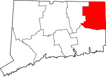 | |
| Borough | ||
| Other communities | ||