Morris, Connecticut
| Morris, Connecticut | ||
|---|---|---|
| Town | ||
| ||
 Location in Litchfield County, Connecticut | ||
| Coordinates: 41°41′38″N 73°12′38″W / 41.69389°N 73.21056°WCoordinates: 41°41′38″N 73°12′38″W / 41.69389°N 73.21056°W | ||
| Country | United States | |
| State | Connecticut | |
| NECTA | None | |
| Region | Litchfield Hills | |
| Incorporated | 1859 | |
| Government | ||
| • Type | Selectman-town meeting | |
| • First selectman | Tom Weik (R) | |
| • Selectman | Erica Dorsett-Mathews (R) | |
| • Selectman | Vincent Aiello (D) | |
| Area | ||
| • Total | 18.7 sq mi (48.4 km2) | |
| • Land | 17.2 sq mi (44.5 km2) | |
| • Water | 1.5 sq mi (4.0 km2) | |
| Elevation | 994 ft (303 m) | |
| Population (2005)[1] | ||
| • Total | 2,393 | |
| • Density | 139/sq mi (54/km2) | |
| Time zone | Eastern (UTC-5) | |
| • Summer (DST) | Eastern (UTC-4) | |
| ZIP code | 06763 | |
| Area code(s) | 860 | |
| FIPS code | 09-49460 | |
| GNIS feature ID | 0213465 | |
| Website |
www | |

Morris is a town in Litchfield County, Connecticut, United States. The population was 2,388 at the 2010 census. The town consists of rolling hill country surrounding Bantam Lake, the largest natural lake in the state, covering about 1,200.5 acres (4.858 km2).
History
Morris was settled about 1723 and organized in 1767 as the South Farms parish of Litchfield. Morris was initially a farming community. It was incorporated as a separate town in 1859 and named for James Morris (1752–1820) a Revolutionary War soldier, who opened an academy in town in 1790. The ruins of the academy sit adjacent to the current James Morris Elementary school. Morris played a role in the Revolutionary War with many homes serving as quarters for revolutionaries from Maine and Vermont during their journey south to battles in New York.
Geography
According to the United States Census Bureau, the town has a total area of 18.7 square miles (48 km2), of which, 17.2 square miles (45 km2) of it is land and 1.5 square miles (3.9 km2) of it (8.17%) is water.
Principal communities
- Lakeside
- Morris center
- West Morris
- East Morris
Government
Rather than a mayoral system, the local government of Morris is run by three Selectmen elected by the town at large. The First Selectman is the full-time chief executive and administrative officer responsible for the day-to-day operation of the town government. The Board of Selectmen establishes administrative and personnel policies and executes town policies and regulations.[2]
Demographics
| Historical population | |||
|---|---|---|---|
| Census | Pop. | %± | |
| 1860 | 769 | — | |
| 1870 | 701 | −8.8% | |
| 1880 | 627 | −10.6% | |
| 1890 | 584 | −6.9% | |
| 1900 | 535 | −8.4% | |
| 1910 | 681 | 27.3% | |
| 1920 | 499 | −26.7% | |
| 1930 | 481 | −3.6% | |
| 1940 | 606 | 26.0% | |
| 1950 | 799 | 31.8% | |
| 1960 | 1,190 | 48.9% | |
| 1970 | 1,609 | 35.2% | |
| 1980 | 1,899 | 18.0% | |
| 1990 | 2,039 | 7.4% | |
| 2000 | 2,301 | 12.8% | |
| 2010 | 2,388 | 3.8% | |
| Est. 2014 | 2,314 | [3] | −3.1% |
As of the census[5] of 2000, there were 2,301 people, 912 households, and 640 families residing in the town. The population density was 133.9 people per square mile (51.7/km²). There were 1,181 housing units at an average density of 68.7 per square mile (26.5/km²). The racial makeup of the town was 97.48% White, 0.70% African American, 0.13% Native American, 0.83% Asian, 0.17% from other races, and 0.70% from two or more races. Hispanic or Latino of any race were 0.87% of the population.
There were 912 households out of which 31.6% had children under the age of 18 living with them, 60.2% were married couples living together, 5.9% had a female householder with no husband present, and 29.8% were non-families. 24.5% of all households were made up of individuals and 9.3% had someone living alone who was 65 years of age or older. The average household size was 2.52 and the average family size was 3.03.
In the town the population was spread out with 24.6% under the age of 18, 4.9% from 18 to 24, 28.4% from 25 to 44, 27.9% from 45 to 64, and 14.2% who were 65 years of age or older. The median age was 41 years. For every 100 females there were 99.6 males. For every 100 females age 18 and over, there were 96.8 males.
The median income for a household in the town was $58,050, and the median income for a family was $63,293. Males had a median income of $49,063 versus $37,279 for females. The per capita income for the town was $29,233. About 3.4% of families and 6.3% of the population were below the poverty line, including 10.8% of those under age 18 and none of those age 65 or over.
| Voter registration and party enrollment as of October 25, 2005[6] | |||||
|---|---|---|---|---|---|
| Party | Active voters | Inactive voters | Total voters | Percentage | |
| Republican | 653 | 8 | 661 | 40.01% | |
| Democratic | 339 | 2 | 341 | 20.64% | |
| Unaffiliated | 639 | 11 | 650 | 39.35% | |
| Minor Parties | 0 | 0 | 0 | 0.0% | |
| Total | 1,631 | 21 | 1,652 | 100% | |
Transportation
Route 61 (connecting to Bethlehem) and Route 63 (connecting to Litchfield and Watertown) are the main north-south highways in the town. Route 109 runs east-west from Washington Depot through West Morris, Lakeside, Morris town center, and East Morris before finally ending in Thomaston, Connecticut. Route 209 runs between routes 109 and 202 along the west shore of Bantam Lake. U.S. Route 202 passes through the northwest corner of Morris.
Notable locations
- Winvian - a unique hotel and resort in town.
- Camp Columbia State Park and Forest - One of Connecticut's newest state parks.
- White Memorial Foundation- a 4,000 acre nature sanctuary, located partially in Morris
Notable people
- Chuck Aleksinas (1959-), former NBA basketball player lives in town.
- James Morris III (1752–1820), Revolutionary War and War of 1812 officer and educator, lived and died in the town which was named after him.
References
- ↑ U.S. Census Bureau Population Estimates
- ↑ http://www.townofmorrisct.com
- ↑ "Annual Estimates of the Resident Population for Incorporated Places: April 1, 2010 to July 1, 2014". Retrieved June 4, 2015.
- ↑ "Census of Population and Housing". Census.gov. Retrieved June 4, 2015.
- ↑ "American FactFinder". United States Census Bureau. Retrieved 2008-01-31.
- ↑ "Registration and Party Enrollment Statistics as of October 25, 2005" (PDF). Connecticut Secretary of State. Archived from the original (PDF) on 2006-09-23. Retrieved 2006-10-02.
External links
- Official Website for the Town of Morris, CT
- Northwest Connecticut Arts Council
- Northwest Connecticut Convention and Visitors Bureau
- Northwestern Connecticut Community College in Winsted

Municipalities and communities of Litchfield County, Connecticut, United States | ||
|---|---|---|
| Consolidated city | 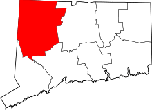 | |
| Towns | ||
| Non-consolidated city |
| |
| Boroughs | ||
| Other communities | ||