Union, Connecticut
| Union, Connecticut | ||
|---|---|---|
| Town | ||
|
The town green | ||
| ||
 Location in Tolland County, Connecticut | ||
| Coordinates: 41°59′17″N 72°09′41″W / 41.98806°N 72.16139°WCoordinates: 41°59′17″N 72°09′41″W / 41.98806°N 72.16139°W | ||
| Country | United States | |
| State | Connecticut | |
| NECTA | Hartford | |
| Region | Northeastern Connecticut | |
| Incorporated | 1734 | |
| Government | ||
| • Type | Selectman-town meeting | |
| • First selectman | Albert L. Goodhall, Jr. (R) | |
| • Selectman | Joseph L. Kratochvil (R) | |
| • Selectman | David Heck (D) | |
| Area | ||
| • Total | 29.8 sq mi (77.2 km2) | |
| • Land | 28.7 sq mi (74.3 km2) | |
| • Water | 1.1 sq mi (2.9 km2) | |
| Elevation | 981 ft (299 m) | |
| Population (2000) | ||
| • Total | 693 | |
| • Density | 24.1/sq mi (9.3/km2) | |
| Time zone | Eastern (UTC-5) | |
| • Summer (DST) | Eastern (UTC-4) | |
| ZIP code | 06076 (Stafford Springs) & 06242 (Eastford) | |
| Area code(s) | 860 | |
| FIPS code | 09-77830 | |
| GNIS feature ID | 0213519 | |
| Website |
www | |


Union is a town located in the northeastern part of Tolland County, Connecticut, United States and is part of the Quinebaug and Shetucket Rivers Valley National Heritage Corridor. The population was 854 at the 2010 census, making it the least populous town in Connecticut and the second-least populous municipality in Connecticut; only the Borough of Fenwick has fewer people. Union includes the village of Mashapaug located in the Eastern Uplands at the Massachusetts state line. Also, Union is located 33 miles (55 km) northeast of the state capital, Hartford and 67 miles (108 km) southwest of Boston as well as 153 miles (240 km) northeast of New York City.
History
The first white settlement in Union was in 1727, making Union the last Connecticut town east of the Connecticut River to be settled. The first settler was James McNall of Ireland. He was closely followed by his brother William.[1] The town was incorporated in October 1734.[2]
There were 500 people in the town in 1756. The population grew to 767 by 1800, but declined thereafter. There were just 431 people in Union in 1890.[3]
Notable people
- Alonzo Horton, considered the second founder of the city of San Diego, California, and the founder of Hortonville, Wisconsin, was born in Union on October 24, 1813. His family moved away from the area in 1815.[4]
- Moses G. Leonard (1809–1899), a United States Representative from New York, grew up in Union but was born in nearby Stafford.[5]
- Ebenezer Stoddard (1785–1847), a United States Representative from Connecticut and Lieutenant Governor of Connecticut, was born in Union.[5]
Geography
According to the United States Census Bureau, the town has a total area of 29.8 square miles (77 km2), of which 28.7 square miles (74 km2) is land and 1.1 square miles (2.8 km2) (3.75%) is water.
Union has the highest town center in eastern Connecticut at 1,015' and the 4th highest in the state.[6] The highest elevation in eastern Connecticut is 1,315' Burley Hill in the northwest part of town.[7] In addition, I-84 reaches its highest elevation in Connecticut (1,002') in Union.
Approximately one-third of the town is state park land, including Bigelow Hollow State Park, Nipmuck State Forest and the Mountain Laurel Sanctuary. A portion of the Yale-Myers Forest and Hull Foresters[8] are located in Union. All combined, there are nearly 34,000 acres of forestland in Union.[9]
Mashapaug Lake is a large lake in Union. The lake is used for fishing, boating, and swimming.
Demographics
| Historical population | |||
|---|---|---|---|
| Census | Pop. | %± | |
| 1820 | 757 | — | |
| 1850 | 728 | — | |
| 1860 | 732 | 0.5% | |
| 1870 | 627 | −14.3% | |
| 1880 | 539 | −14.0% | |
| 1890 | 431 | −20.0% | |
| 1900 | 428 | −0.7% | |
| 1910 | 322 | −24.8% | |
| 1920 | 267 | −17.1% | |
| 1930 | 196 | −26.6% | |
| 1940 | 234 | 19.4% | |
| 1950 | 261 | 11.5% | |
| 1960 | 383 | 46.7% | |
| 1970 | 443 | 15.7% | |
| 1980 | 546 | 23.3% | |
| 1990 | 612 | 12.1% | |
| 2000 | 693 | 13.2% | |
| 2010 | 854 | 23.2% | |
| Est. 2014 | 846 | [10] | −0.9% |
At the census[12] of 2000, there were 693 people, 285 households, and 200 families residing in the town. The population density was 24.1 people per square mile (9.3/km²). There were 332 housing units at an average density of 11.6 per square mile (4.5/km²). The racial makeup of the town was 98.56% White, 0.14% Asian, and 1.30% from two or more races.
There were 285 households out of which 27.4% had children under the age of 18 living with them, 64.6% were married couples living together, 4.6% had a female householder with no husband present, and 29.5% were non-families. 22.5% of all households were made up of individuals and 4.9% had someone living alone who was 65 years of age or older. The average household size was 2.43 and the average family size was 2.87.
In the town the population was spread out with 21.5% under the age of 18, 3.3% from 18 to 24, 34.6% from 25 to 44, 28.7% from 45 to 64, and 11.8% who were 65 years of age or older. The median age was 40 years. For every 100 females there were 103.2 males. For every 100 females age 18 and over, there were 103.0 males.
The median income for a household in the town was $58,214, and the median income for a family was $65,417. Males had a median income of $48,021 versus $35,469 for females. The per capita income for the town was $27,900. About 2.0% of families and 3.5% of the population were below the poverty line, including 5.9% of those under age 18 and none of those age 65 or over.
Education
Union residents are zoned to the Union School District for grades Kindergarten through 8. The only school in the district is Union Elementary School.
High Schoolers have the option of attending Stafford High School, Rockville Vocational-Agricultural School, Windham Regional Technical Vocational School or Woodstock Academy.
Recreation
With over 40,000 acres of forestland in and around town and a major interstate going through it, Union is known for outdoor recreation such as hunting, fishing, hiking & camping and picnicking.[6] The area's elevation and dominance of evergreen trees makes the area cooler than surrounding places.[13] Most activity is centered on Bigelow Hollow State Park, and especially at Mashapaug Lake.
Snowmobiling is also enjoyed in the area.[14]
Landmarks
The village of Mashapaug in Union is the site of the Traveler Restaurant, a unique eating establishment that gives away used books to its patrons.[15][16]
The Union Free Public Library is housed in one of the town's few public buildings. The library was established by a town meeting in November 1894, and opened March 25, 1895 in a private home. In 1912 it moved into a newly built building, which it still occupies.[17]
References
- ↑ Charles Hammond and Harvey Merrill Lawson (1893) The History of Union, Conn, Price, Lee, & Adkins Co., New Haven, Connecticut. Pages 36 and 43.
- ↑ Charles Hammond and Harvey Merrill Lawson (1893) The History of Union, Conn, Price, Lee, & Adkins Co., New Haven, Connecticut. Pages 48-50.
- ↑ Charles Hammond and Harvey Merrill Lawson (1893) The History of Union, Conn, Price, Lee, & Adkins Co., New Haven, Connecticut. Page 506.
- ↑ Charles Hammond and Harvey Merrill Lawson (1893) The History of Union, Conn, Price, Lee, & Adkins Co., New Haven, Connecticut. Pages 368-369.
- 1 2 Charles Hammond and Harvey Merrill Lawson (1893) The History of Union, Conn, Price, Lee, & Adkins Co., New Haven, Connecticut. Pages 469-470.
- 1 2 http://www.unionconnecticut.org/about.php
- ↑ http://docs.unh.edu/MA/wale52sw.jpg
- ↑ http://www.hullforest.com/forestry/forest_conservation.html
- ↑ http://www.nature.org/ourinitiatives/regions/northamerica/unitedstates/connecticut/placesweprotect/quinebaug-highlands.xml
- ↑ "Annual Estimates of the Resident Population for Incorporated Places: April 1, 2010 to July 1, 2014". Retrieved June 4, 2015.
- ↑ "Census of Population and Housing". Census.gov. Retrieved June 4, 2015.
- ↑ "American FactFinder". United States Census Bureau. Retrieved 2008-01-31.
- ↑ http://www.wunderground.com/cgi-bin/findweather/getForecast?query=06076&sp=MD8905
- ↑ http://www.nipmucktrailriders.com/index.html
- ↑ http://www.hiddenboston.com/TravelerRestaurant.html
- ↑ http://www.visitingnewengland.com/traveler-restaurant.html
- ↑ Union Free Public Library website, accessed June 25, 2009
External links
Municipalities and communities of Tolland County, Connecticut, United States | ||
|---|---|---|
| Towns | 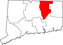 | |
| Other communities | ||
