Danbury, Connecticut
| Danbury, Connecticut | ||
|---|---|---|
| City | ||
| ||
| Nickname(s): The Hat City | ||
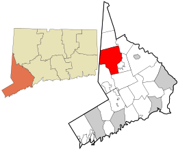 Location in Fairfield County and the state of Connecticut. | ||
| Coordinates: 41°24′08″N 73°28′16″W / 41.40222°N 73.47111°WCoordinates: 41°24′08″N 73°28′16″W / 41.40222°N 73.47111°W | ||
| Country | United States | |
| State | Connecticut | |
| County | Fairfield | |
| NECTA | Danbury | |
| Region | Housatonic Valley | |
| Incorporated (town) | 1702 | |
| Incorporated (city) | 1889 | |
| Consolidated | 1965 | |
| Government | ||
| • Type | Mayor-council | |
| • Mayor | Mark D. Boughton (R) | |
| Area | ||
| • City | 44.3 sq mi (114.7 km2) | |
| • Land | 42.1 sq mi (109.1 km2) | |
| • Water | 2.2 sq mi (5.7 km2) | |
| • Urban | 123.6 sq mi (320.1 km2) | |
| Elevation | 397 ft (121 m) | |
| Population (2011)[1] | ||
| • City | 81,671 | |
| • Density | 1,800/sq mi (710/km2) | |
| Time zone | Eastern (UTC-5) | |
| • Summer (DST) | Eastern (UTC-4) | |
| ZIP code | 06810, 06811, 06813 | |
| Area code(s) | 203; also future 475 | |
| FIPS code | 09-18430 | |
| GNIS feature ID | 0206580 | |
| Website |
www | |
Danbury is a city in northern Fairfield County, Connecticut, United States, approximately 70 miles from New York City. Danbury's population at the 2010 census was 80,893.[1] Danbury is the fourth most populous city in Fairfield County, and seventh among Connecticut cities. The city is located within the New York metropolitan area.
The city was named for the place of origin of many of the early settlers, Danbury, Essex, England, and is nicknamed the Hat City because of its prominent history in the hat industry. There is a mineral named for Danbury, danburite.
Danbury is home to Danbury Hospital, Western Connecticut State University, Danbury Fair Mall and Danbury Municipal Airport.
History
Danbury was settled by colonists in 1685, when eight families moved from what are now Norwalk and Stamford, Connecticut. The Danbury area was then called Pahquioque by its namesake, the Pahquioque Native Americans. One of the original settlers was Samuel Benedict, who bought land from the Paquioques in 1685, along with his brother James Benedict, James Beebe, and Judah Gregory. Also called Paquiack ("open plain" or "cleared land") by local Native Americans,[2] the settlers chose the name Swampfield for their town, but in October 1687, the general court decreed the name Danbury. The general court appointed a committee to lay out the boundaries of the new town. A survey was made in 1693, and a formal town patent was granted in 1702.
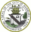
During the American Revolution, Danbury was an important military supply depot for the Continental Army. On April 26, 1777, the British, under Major General William Tryon, burned and looted the city. The central motto on the seal of the City of Danbury is Restituimus (Latin for "We have restored"), a reference to the destruction caused by the Loyalist army troops. The American General David Wooster was mortally wounded at the Battle of Ridgefield by the same British forces which had attacked Danbury. He is buried in Danbury's Wooster Cemetery; the private Wooster School in Danbury also was named in his honor.
In 1802, President Thomas Jefferson wrote a letter to the Danbury Baptist Association, a group expressing fear of persecution by the Congregationalists of that town, in which he used the expression "Separation of Church and State". It is the first known instance of the expression in American legal or political writing. The letter is on display at the Unitarian-Universalist Congregation of Danbury.
The first Danbury Fair was held in 1821. In 1869, it became a yearly event; the last edition was in 1981. The fairgrounds were cleared to make room for the Danbury Fair Mall, which opened in autumn 1986.[3]

In 1835, the Connecticut Legislature granted a rail charter to the Fairfield County Railroad, which saw no construction as investment was slow. In 1850, the organization's plans were scaled back, and renamed the Danbury and Norwalk Railroad. Work moved quickly on the 23 mi (37 km) railroad line. In 1852, it, the first railroad line in Danbury, opened,[4] with two trains making the 75-minute trip to Norwalk.
The central part of Danbury was incorporated as a borough in 1822. The borough was reincorporated as the city of Danbury on April 19, 1889. The city and town were consolidated on January 1, 1965.
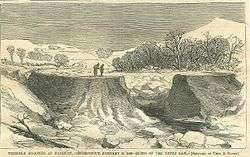
The Kohanza Reservoir, one of many reservoirs built to provide water to the hat factories, broke on January 31, 1869. The ensuing flood of icy water killed 11 people within 30 minutes, and caused major damage to homes and farms.[5]
Oglala Sioux tribesman Albert Afraid of Hawk died on June 29, 1900, in Danbury during a tour with Buffalo Bill's Wild West Show at age 21. His interment was at Wooster Cemetery. Afraid of Hawk's remains were discovered by Robert Young, an employee of Wooster one hundred and twelve years later. The corpse covered in a bison robe was relocated to Saint Mark's Episcopal Cemetery in Rockyford for reburial by tribal descendants.
A 60-acre (24 ha) tract near the Fairgrounds, known as Tucker's Field, was purchased by local pilots in 1928 and leased to the town. This became an airport, which is now Danbury Municipal Airport (ICAO: KDXR).
Connecticut's largest lake, Candlewood Lake (of which the extreme southern part is in Danbury), was created as a hydroelectric power facility in 1928 by building a dam where Wood Creek and the Rocky River meet near the Housatonic River in New Milford.
On August 18-19, 1955, the Still River, which normally meandered slowly through downtown Danbury, overflowed its banks when Hurricane Diane hit the area, dropping 6 inches of rain on the city. This was in addition to the 9 inches that fell from Hurricane Connie five days earlier.[6] The water flooded stores, factories and homes along the river from North Street to Beaver Brook, causing $3 million in damages. Stores downtown on White Street between Main and Maple were especially hard hit. On October 13-16, another 12 inches of rain fell on Danbury, causing the worst flooding in the City’s history. This time, the Still River damaged all bridges across it, effectively cutting the city in half for several days. Flooding was more widespread than in August, and the same downtown areas hit in August were devastated once again. The resulting damage was valued at $6 million, and two people lost their lives. The City determined the river in the downtown area had to be tamed. $4.5 million in federal and state funding were acquired as part of a greater urban renewal project to straighten, deepen, widen, and enclose the river in a concrete channel through the downtown. At the same time, roads were relocated and rebuilt, 123 major buildings were razed and 104 families were relocated. This began various efforts by the City through 1975 towards urban renewal, using another $22 million of federal funding. However, these efforts failed to reinvigorate the central business district.[7]
In the August 1988 issue of Money magazine, Danbury topped the magazine's list of the best U.S. cities to live in, mostly due to low crime, good schools, and location.[8]
Hat making in Danbury
In 1780, what is traditionally considered to be the first hat shop in Danbury was established by Zadoc Benedict (although hat making existed in Danbury before the Revolution); it had 3 employees, and made 18 hats weekly.[9][10][11] By 1800, Danbury was producing 20,000 hats annually, more than anywhere else in the U.S.[12] Due to the fur felt hat coming back into style for men and increasing mechanization in the 1850s, by 1859 hat production in Danbury had risen to 1.5 million annually. By 1887, thirty factories were producing 5 million hats per year.[13] Around this time, fur processing was separated from hat manufacturing when the P. Robinson Fur Cutting Company (1884) on Oil Mill Road and the White Brothers' factory began operation.[12]
By 1880, workers had unionized, beginning decades of labor unrest. Lockouts and strikes plagued the industry, affecting the economy of the entire town. In 1893, nineteen manufacturers locked out 4000 union hatters. In 1902, the American Federation of Labor union called for a nationwide boycott of a Danbury non-union hat manufacturer, Dietrich Loewe. The manufacturer sued the union under the Sherman Antitrust Act for unlawfully restraining trade. The U.S. Supreme Court, in 1908, held that the union was liable for damages. This also is known as the Danbury Hatters' case. In the '30's and '40's there were a number of violent incidents during several strikes, mostly involving scab workers.[14]
Beginning in 1892, the industry was revolutionized when the large hat factories began to shift to manufacturing unfinished hat bodies only, and supplying them to smaller hat shops for finishing. So while Danbury produced 24% of America's hats in 1904, the city supplied the industry with 75% of its hat bodies.[15] The turn of the century was the heyday of the hatting industry in Danbury, when it became known as the "Hat City" and the "Hatting Capitol of the World". Its motto was "Danbury Crowns Them All". But by the 1920s, the hat industry was in decline, and by 1923, only six manufacturers were left in Danbury. After WWII, returning GI's went hatless, a trend that accelerated through the 1950s, dooming the city's hat industry.[16] Stetson, the city's last major manufacturer, closed in 1965. The last hat was made in Danbury in 1987.
Social activism, desegregation, and conscientious objectors during World War II
During the Second World War, Danbury's prison was one of many sites used for the incarceration of conscientious objectors. One in six inmates in the United States' federal prisons was a conscientious objector, and prisons like Danbury found themselves suddenly filled with large numbers of highly educated men skilled in social activism. Due to the activism of inmates within the prison, and local laborers protesting in solidarity with the conscientious objectors, Danbury became one of the nation's first prisons to desegregate its inmates.[17][18][19]
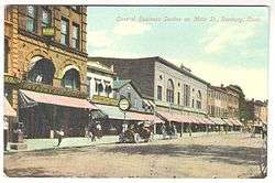
Historic pictures
-
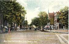
Main Street looking east from White Street, 1907
-

National Hat Factory, about 1912
-

View of a hat factory, 1911
-
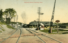
Danbury station, ca. 1910
-

Revolutionary Sycamore
Geography
According to the United States Census Bureau, Danbury has a total area of 44.3 square miles (115 km2), of which 42.1 square miles (109 km2) is land and 2.2 square miles (5.7 km2), or 4.94%, is water. The City is located in the foothills of the Berkshire Mountains on low-lying land just south of Candlewood Lake (the City includes the southern parts of the lake). Danbury borders Ridgefield to the southwest, Redding to the south, Bethel to the southeast, Brookfield to the northeast, New Fairfield to the north, and Southeast, New York to the west. The City's terrain includes rolling hills and not-very-tall mountains to the west and northwest called the Western Highland. Ground elevations in the City range from 378 feet to 1,050 feet above sea level.[20]
A geologic fault known as Cameron's Line runs through Danbury.
The Still River flows generally from west to east through Danbury.
Danbury has a humid continental climate (Köppen Dfa), with four distinct seasons, resembling Hartford more than coastal Connecticut or New York City. Summers are hot and humid, while winters are cold with significant snowfall. The monthly daily average temperature ranges from 26.8 °F (−2.9 °C) in January to 73.9 °F (23.3 °C) in July; on average, temperatures reaching 90 or 0 °F (32 or −18 °C) occur on 18 and 3.1 days of the year, respectively. The average annual precipitation is approximately 52.1 inches (1,320 mm), which is distributed fairly evenly throughout the year; snow averages 50 inches (127 cm) per season, although this total may vary considerably from year to year. Extremes in temperature range from 106 °F (41 °C) on July 22, 1926 and July 15, 1995 (the highest temperature recorded in Connecticut[21]) down to −18 °F (−28 °C) on February 9, 1934.
| Climate data for Danbury, Connecticut (1981–2010 normals, extremes 1937–present) | |||||||||||||
|---|---|---|---|---|---|---|---|---|---|---|---|---|---|
| Month | Jan | Feb | Mar | Apr | May | Jun | Jul | Aug | Sep | Oct | Nov | Dec | Year |
| Record high °F (°C) | 71 (22) |
77 (25) |
92 (33) |
95 (35) |
97 (36) |
105 (41) |
106 (41) |
104 (40) |
100 (38) |
91 (33) |
82 (28) |
80 (27) |
106 (41) |
| Average high °F (°C) | 35.3 (1.8) |
39.6 (4.2) |
48.5 (9.2) |
61.3 (16.3) |
72.1 (22.3) |
80.7 (27.1) |
85.0 (29.4) |
82.6 (28.1) |
74.6 (23.7) |
62.8 (17.1) |
51.4 (10.8) |
40.2 (4.6) |
61.2 (16.2) |
| Average low °F (°C) | 18.3 (−7.6) |
21.1 (−6.1) |
27.7 (−2.4) |
37.9 (3.3) |
47.8 (8.8) |
57.8 (14.3) |
62.8 (17.1) |
61.3 (16.3) |
52.7 (11.5) |
41.2 (5.1) |
33.1 (0.6) |
24.0 (−4.4) |
40.5 (4.7) |
| Record low °F (°C) | −18 (−28) |
−16 (−27) |
−9 (−23) |
14 (−10) |
25 (−4) |
35 (2) |
38 (3) |
37 (3) |
23 (−5) |
16 (−9) |
0 (−18) |
−11 (−24) |
−18 (−28) |
| Average precipitation inches (mm) | 3.77 (95.8) |
3.32 (84.3) |
4.53 (115.1) |
4.13 (104.9) |
4.09 (103.9) |
4.96 (126) |
4.75 (120.7) |
4.37 (111) |
4.88 (124) |
4.72 (119.9) |
4.29 (109) |
4.33 (110) |
52.13 (1,324.1) |
| Average snowfall inches (cm) | 14.9 (37.8) |
13.1 (33.3) |
9.7 (24.6) |
1.6 (4.1) |
0 (0) |
0 (0) |
0 (0) |
0 (0) |
0 (0) |
0 (0) |
1.2 (3) |
9.7 (24.6) |
50.2 (127.4) |
| Average precipitation days (≥ 0.01-inch) | 11.5 | 9.8 | 11.8 | 11.4 | 12.1 | 11.9 | 10.3 | 9.3 | 9.0 | 9.2 | 10.0 | 11.5 | 127.8 |
| Average snowy days (≥ 0.1-inch) | 7.9 | 5.4 | 4.2 | .9 | 0 | 0 | 0 | 0 | 0 | .1 | 1.0 | 5.0 | 24.5 |
| Source: NOAA[22] | |||||||||||||
Demographics
| Historical population of Danbury | ||
|---|---|---|
| Year | Pop. | ±% |
| 1756 | 1,527 | — |
| 1790 | 3,031 | +98.5% |
| 1800 | 3,180 | +4.9% |
| 1810 | 3,606 | +13.4% |
| 1820 | 3,873 | +7.4% |
| 1830 | 4,311 | +11.3% |
| 1840 | 4,504 | +4.5% |
| 1850 | 5,964 | +32.4% |
| 1860 | 7,234 | +21.3% |
| 1870 | 8,753 | +21.0% |
| 1880 | 11,666 | +33.3% |
| 1890 | 19,473 | +66.9% |
| 1900 | 19,474 | +0.0% |
| 1910 | 23,502 | +20.7% |
| 1920 | 22,325 | −5.0% |
| 1930 | 26,955 | +20.7% |
| 1940 | 27,921 | +3.6% |
| 1950 | 30,337 | +8.7% |
| 1960 | 39,382 | +29.8% |
| 1970 | 50,781 | +28.9% |
| 1980 | 60,470 | +19.1% |
| 1990 | 65,585 | +8.5% |
| 2000 | 74,848 | +14.1% |
| 2010 | 80,893 | +8.1% |
| 2015 | 84,657 | +4.7% |
2015 Estimate[24] Population by Decade 1790–2010[25] State of Connecticut[26] Source: | ||
As of the census of 2010, there were 80,893 people and 29,046 households in the City, with 2.73 persons per household. 44.1% of the population spoke a language other than English at home. The population density was 1,921.4 people per square mile. There were 31,154 housing units at an average density of 740.0 per square mile. The racial makeup of the city was 68.2% White, 25.0% Hispanic or Latino, 7.2% African American, 0.40% Native American, 6.8% Asian, less than 0.10% Pacific Islander, 7.6% from other races, and 4.5% from two or more races. 32% of the population was foreign born.
6.7% of the population was under the age of 5, and 21.1% was under the age of 18. 11.1% of the population was 65 years of age or older. 50.9% of the population was female.
The median income for a household in the City was $65,981. The per capita income for the City was $31,411. 11.1% of the population was below the poverty line. The median gross monthly rent was $1,269.
| Voter registration and party enrollment as of October 27, 2015[28] | |||||
|---|---|---|---|---|---|
| Party | Active voters | Inactive voters | Total voters | Percentage | |
| Democratic | 10,500 | 525 | 11,025 | 30.81% | |
| Republican | 6,726 | 226 | 6,952 | 19.43% | |
| Unaffiliated | 16,392 | 873 | 17,265 | 48.26% | |
| Minor parties | 510 | 27 | 537 | 1.50% | |
| Total | 34,128 | 1,651 | 35,779 | 100% | |
When ZIP codes were introduced in 1963, the 06810 code was given to all of Danbury; it was shared with a then-still-rural New Fairfield to its north. In 1984, the 06810 Zip Code was cut back to areas of Danbury south of Interstate 84. A new 06811 ZIP code was created for areas north of Interstate 84. New Fairfield received its own code, 06812.
Economy
Top employers
According to the City's 2015 Comprehensive Annual Financial Report,[29] the top employers in the City are:
| # | Employer | # of Employees |
|---|---|---|
| 1 | Western Ct Health Network | 2,283 |
| 2 | Boehringer-Ingelheim | 1,800 |
| 3 | Danbury Public Schools | 1,449 |
| 4 | Cartus | 1,349 |
| 5 | GE Commercial Finance | 688 |
| 6 | Pitney Bowes | 650 |
| 7 | UTC Aerospace Systems | 630 |
| 8 | Western Connecticut State University | 626 |
| 9 | City of Danbury | 540 |
| 10 | Praxair | 406 |
Government
The chief executive officer of Danbury is the Mayor, who serves a two-year term. The current mayor is Mark D. Boughton (R). The Mayor is the presiding officer of the City Council, which consists of 21 members, two from each of the seven city wards, and seven at-large.[30] The City Council enacts ordinances and resolutions by a simple majority vote. If after five days the Mayor does not approve the ordinance (similar to a veto), the City Council may re-vote on it. If it then passes with a two-thirds majority, it becomes effective without the Mayor's approval. The current City Council consists of 15 Republicans and 6 Democrats.[30] Danbury has six state representatives as of 2016; Rep. Dan Carter D-2, Rep. Stephen Harding D-107, Rep. Richard Smith D-108, Rep. David Arconti D-109, Rep. Bob Godfrey D-110, and Rep. Jan Giegler R-138.[31][32] There is one state senator, Michael McLachlan R-24. Danbury is represented in the United States Congress by U.S. Rep. Elizabeth Esty (D).
Danbury's 2015 mill rate is 28.26.[33]
Danbury Federal Correctional Institution
Danbury is the site of a low-security men's and women's prison, the Danbury Federal Correctional Institution, located near the border with New Fairfield.[34] Built in the 1940s to house men, the facility was converted to a women's prison in 1994 to address a shortage of beds for low-security female inmates in other facilities. However, overcrowding at federal facilities for low-security males prompted a reconversion to a male prison, beginning in 2013, and relocation of the female inmates from the low-security Pembroke Road facility to other locations.[35] As of 2016, an adjacent satellite camp houses up to 193 women.[34][36]
Education
Public schools
Danbury has two public high schools: Danbury High School and Henry Abbott Technical High School, each which are for grades 9 through 12. An alternative school by the name of Alternative Center for Excellence is housed off-campus, and its graduates receive Danbury High School diplomas upon completion of their studies.[37] Danbury also has 3 public middle schools for grades 6 through 8: Broadview Middle School, Rogers Park Middle School and WestSide Middle School Academy.[38] There are 13 elementary schools in Danbury. These schools are Academy for International Studies Magnet School (K-5), Ellsworth Avenue (K-5), Great Plain (K-5), Hayestown (K-5), King Street Primary (K-3) and King Street Intermediate (4–5), Mill Ridge Primary (K-3), Morris Street (K-5), Park Avenue (K-5), Pembroke (K-5), Shelter Rock (K-5), South Street (K-5) and Stadley Rough (K-5).[39]
Parochial schools
Roman Catholic schools in Danbury reside within the administration of the Diocese of Bridgeport and include:
- 1 high school: Immaculate High School (9–12)
- 3 elementary schools: St Peter-Sacred Heart School (PK-8),[40] St. Gregory the Great School (PK-8),[41] and St. Joseph School (PK-8)
Other parochial schools in Danbury are:
Private schools
- Hudson Country Montessori School[44]
- New England Country Day School[45]
- Maimonides Academy[46]
- Wooster School
Post secondary schools
Danbury is home to Western Connecticut State University, Ridley-Lowell Business & Technical Institute,[47] and a campus of Naugatuck Valley Community College[48]
Media
- HamletHub Danbury a local news publication.
- The News-Times of Danbury, a daily newspaper owned by the Hearst Corporation.
- Tribuna Newspaper a biweekly, bilingual (Portuguese/English) publication.
- WFAR-FM 93.3 – Radio Familia Portuguese Radio Station.
- WLAD-AM 800; 1,000 watts (daytime); 287 watts (nighttime); news/talk; owned by the Berkshire Broadcasting Corporation
- WDAQ-FM 98.3; 1,300 watts; hot adult contemporary; owned by the Berkshire Broadcasting Corporation
- WDAQ-HD3 107.3-FM; new country; owned by the Berkshire Broadcasting Corporation[49]
- WAXB 850-AM, 94.5-FM; 2,500 watts (daytime only); classic hits; owned by the Berkshire Broadcasting Corporation
- WDAQ-HD2 103.7-FM; alternative rock; owned by the Berkshire Broadcasting Corporation[50]
- WXCI-FM 91.7; 3,000 watts; College radio station owned by Western Connecticut State University and operated by past and present students. It receives funding from the Western Connecticut State University Student Government Association.
Libraries
The Danbury Public Library was established in 1879.
The Long Ridge Library is a small library occupying an old schoolhouse on Long Ridge Road in Danbury.
Pollution
The hat making fur removal process is known to be the source of serious pollution by mercury nitrate dumped into the Still River during the time of hat production in the late 19th century, which then flowed into the Housatonic River and into the Long Island Sound.[10][51]
Sites of interest
Hiking trails
- Bear Mountain Reservation[52]
- The Old Quarry Nature Center has two short educational trails on 39 acres (16 ha)[53]
- Tarrywile Mansion and Park[54] has 21 miles (34 km) of trails and several ponds on 722 acres (292 ha), as well as a Victorian mansion and gardens. The Ives Trail runs through the park.
- The Ives Trail is a 20-mile stretch of trail that runs from Bennett's Pond in Ridgefield through Danbury to Redding. The Charles Ives House and Hearthstone Castle are located along this trail.
Parks
- Bear Mountain Park
- Blind Brook Park
- Candlewood Town Park
- Elmwood Park
- Farrington Woods
- Hatters Park
- Highland Playground
- Joseph Sauer Memorial Park
- Kennedy Park
- Lake Kenosia Park
- Old Quarry Nature Center
- Richter Park
- Rogers Park
- Rogers Park Playground
- Stephen A. Kaplanis Field
- Still River Greenway
- Tarrywile Park
- Tom West Park[55]
Museums
- Danbury Museum and Historical Society
- Danbury Railway Museum
- Military Museum of Southern New England
Other
- The Danbury Fair Mall was built on the old fairgrounds in 1986.
- Danbury is also home to an Army Reserve Special Operations unit, the 411th Civil Affairs Battalion.
- Danbury Hospital is a 456-bed[56] hospital, serving patients in Fairfield County, Connecticut and Putnam County, New York.[57] The hospital is the home of the new Praxair Regional Heart and Vascular center,[58] providing state of the art cardiovascular care to this growing region including open heart surgery and coronary angioplasty.
- Richter Park Golf Course is Danbury's municipal golf course[59] and hosts numerous tournaments such as the annual Danbury Amateur and American Junior Golf Association majors. It has won a variety of awards, including being a "Top 10 Connecticut Course" and the "#2 Best Public Course in the NY Metropolitan Area".[60]
On the National Register of Historic Places
| Name | Location | Date added to NRHP |
|---|---|---|
| Ball and Roller Bearing Company | 20–22 Maple Ave. | September 25, 1989 |
| Charles Ives House | 7 Mountainville Ave. | May 26, 1976 |
| Hearthstone | 18 Brushy Hill Rd. | December 31, 1987 |
| John Rider House | 43 Main St. | added December 23, 1977 |
| Locust Avenue School | Locust Ave. | June 30, 1985 |
| Main Street Historic District | Boughton, Elm, Ives, Keeler, Main, West and White Sts. | December 29, 1983 |
| Meeker's Hardware | 86–90 White St. | July 9, 1983 |
| Octagon House | 21 Spring St. | June 7, 1973 |
| P. Robinson Fur Cutting Company | Oil Mill Rd. | December 30, 1982 |
| Tarrywile | Southern Blvd. & Mountain Rd. | February 6, 1988 |
| Union Station (Danbury Railway Museum) | White St. and Patriot Dr. | October 25, 1986 |
| Richter House (Richter Memorial Park) | 100 Aunt Hack Road | September 17, 2010 |
Sports
Ice Hockey
The United Hockey League (UHL) expanded to Danbury in 2004. The Danbury Trashers played their first season at the Danbury Ice Arena in October 2004. Among those on the roster included Brent Gretzky (brother of hockey legend Wayne Gretzky) and Scott Stirling (son of former New York Islanders coach Steve Stirling). Scott's older brother, Todd, coached the Trashers in the 2004–05 season.
On December 27, 2009, Danbury was named the first city to officially have a new team in the newly formed Federal Hockey League (FHL). The team was named the Danbury Whalers, bringing back the name "Whalers" to Connecticut for the first time since 1997 when Hartford Whalers of the WHA/NHL moved to North Carolina and became the Carolina Hurricanes. At the end of the 2014–15 season, the Danbury Ice Arena evicted the Danbury Whalers. The Whalers were announced as moving to neighboring Brewster, New York, and called the Stateline Whalers.
However, a new FHL Danbury team called the Danbury Titans was approved for the 2015–16 season, owned by local car dealership owner Bruce Bennett. As part of the approval of the new Danbury team, he took over the Stateline/Danbury market and created the Brewster Bulldogs instead of the Whalers (the Bulldogs folded after one season).[61]
Other sports
The Danbury Westerners, a member of the New England Collegiate Baseball League, play their home games at Rogers Park in Danbury.
AC Connecticut is a soccer team based in the Danbury suburb of Newtown. The team plays in the Northeast Division of the USL Premier Development League (PDL), the fourth tier of the American soccer pyramid.
Danbury High School carries a strong athletic tradition in wrestling, boys and girls track and field, boys cross country, baseball, tennis, basketball, and football. The wrestling, cross country, and track teams have all numerous state titles and New England championships. All three programs are considered to be nationally ranked annually.
Western Connecticut State University is a member of the NCAA Division III, the Eastern College Athletic Conference, and the Little East Conference. The university fields teams in baseball, basketball, lacrosse, football, soccer, softball, swimming, tennis, and volleyball. WestConn also fields several nationally competitive club sports on campus including Men's Rugby, Women's Rugby, Dance Team, Cheerleading, and Men's Hockey.
The Danbury Hatters Cricket Club formed in 2001 and has been playing cricket in Southern Connecticut along with other cities such as Norwalk, Stamford, Bridgeport, New Haven, Waterbury and West Haven.
The Western Connecticut Militia is a semi-professional football team that joined the New England Football League in 2011. The team plays its home games in Danbury at both Danbury High School and Immaculate High School.
Transportation
Danbury is the terminus of the Danbury branch line of the MTA Metro-North Railroad which begins in Norwalk. The line was first built by the Danbury and Norwalk Railroad which was later bought by the New York, New Haven & Hartford Railroad Company. Danbury was an important junction between the Danbury Branch and the Maybrook Line. The Maybrook line was the New Haven's main freight line which terminated in Maybrook, New York, where the New Haven exchanged traffic with other railroads. After the ill-fated Penn Central took over the New Haven, the Maybrook line was shut down when a fire on the Poughkeepsie Bridge made the line unusable. Today, the historic station is part of the Danbury Railway Museum. The Providence and Worcester Railroad, along with the Housatonic Railroad provide local rail freight service in Danbury.
Local bus service is provided by Housatonic Area Regional Transit (HART).
The city is also the location of Danbury Municipal Airport (DXR).
Interstate 84 and U.S. Route 7 are the main highways of the city. I-84 runs east-west from the Hudson Valley region of New York towards Waterbury and Hartford. US 7 runs north-south from Norwalk (connecting to I-95) to the Litchfield Hills region. The two highways overlap in the downtown area. The principal surface roads through the city are Lake Avenue, West Street, White Street, and Federal Road. Other secondary state highways are U.S. Route 6 in the western part of the city, Newtown Road, which connects to US 6 east of the city, Route 53 (Main Street and South Street), Route 37 (North Street, Padaranam Road, and Pembroke Road), and Route 39 (Clapboard Ridge Road and Ball Pond Road).
In pop culture
- Parts of the films Rachel, Rachel and The Sisterhood of the Traveling Pants 2 were filmed in Danbury.
- In the movie Blow, the character George Jung serves his 26-month sentence in Danbury federal prison.
- Alfred Hitchcock filmed scenes from Strangers on a Train, including his cameo with a double bass, at Union Station (now the Danbury Railway Museum).[62]
- In the Seinfeld episode The Baby Shower, Elaine explains that her roommate contracted Lyme disease when "She did some outdoor version of Hair in Danbury Connecticut".[63]
Notable people
- Renata Adler, author, journalist and film critic
- Marian Anderson, (1897–1993) singer
- James Montgomery Bailey, 19th century Danbury News editor
- Zadoc Benedict, the first hat maker of Danbury
- Jonathan Brandis (1976–2003) actor
- Peter Buck, co-founder, Subway sandwich restaurants
- Ray Cappo, singer
- Neil Cavuto, television anchor
- Tracy Chapman, singer[64]
- Frank Conniff (1914–1971), 1956 Pulitzer Prize-winning journalist
- Ken Green, professional golfer
- Charles Ives (1874–1954), composer[65]
- Joe Lahoud, Major League Baseball player
- Rose Wilder Lane, author, writer, daughter of Laura Ingalls Wilder
- Jimmy Monaghan, Irish boxer and songwriter
- Don Morrow, voice actor, announcer, emcee
- Jerry Nadeau, former NASCAR Nextel Cup driver
- Chet Powers aka Dino Valenti (1937-1994), musician and songwriter
- George Radachowsky, NFL player
- William R. Ratchford, three term U.S. Congressman
- Allen Ritter, record producer, songwriter and singer
- Neil Rudenstine, past president of Harvard University
- Chauncey Foster Ryder, Postimpressionist painter
- Trevor Siemian, quarterback for NFL's Denver Broncos
- Dr Ian Smith, panelist on VH1's Celebrity Fit Club
- Lee Smith, former MLB pitcher[66]
- Glover Teixeira, Ultimate Fighting Championship (UFC) fighter
- Roy M. Terry, Chief of Chaplains of the U.S. Air Force
- TJR, birth name Thomas Joseph Rozdilsky, musician
- John Hubbard Tweedy, U.S. Congressional Delegate from the Wisconsin Territory[67]
- Samuel Tweedy (1776–1868) United States Representative from Connecticut
- William A. Whittlesey, former US Congressman
- Zalmon Wildman (1775–1835) United States Representative from Connecticut
See also
- Greater Danbury, the metropolitan area centered on the city
- Mad hatter disease, chronic mercury poisoning among hatmakers (also known as the "Danbury shakes")
References
- 1 2 "Race, Hispanic or Latino, Age, and Housing Occupancy: 2010 Census Redistricting Data (Public Law 94-171) Summary File (QT-PL), Danbury city, Connecticut". U.S. Census Bureau, American FactFinder 2. Retrieved August 5, 2011.
- ↑ "A Student's Guide to Danbury, Connecticut". November 4, 2009. Retrieved January 2, 2011.
- ↑ Ravo, Nick, "Country Fair Becomes Land of the Lava Lamp", New York Times, September 4, 1987
- ↑ Danbury Museum and Historical Society. "Timeline" (PDF). Retrieved January 2, 2011.
- ↑ Danbury Museum and Historical Society. "Kohanza Disaster" (PDF). Retrieved January 2, 2011.
- ↑ Hanrahan, Ryan. "Way Too Much Weather". ryanhanrahan.com. Ryan Hanrahan. Retrieved 24 November 2016.
- ↑ Devlin, William; Janick, Herbert (April 2013). Danbury's third Century: From Urban Status to Tri-Centennial. Danbury, CT: Western Connecticut State University. pp. 229–241. ISBN 978-0-9889243-1-4.
- ↑ Richard Eisenberg and Debra Wishik Englander (August 1, 1988). "The Best Places to Live in America in our second annual rating of 300 U.S. areas, the Northeast and California score best – though a New Jersey city is last.". Money Magazine. Retrieved January 16, 2011.
- ↑ Pirro, John (Feb 1, 2011). "The rise -- and fall -- of hatting in Danbury". Danbury News-Times. Retrieved 15 September 2015.
- 1 2 Varekamp, Johan. "'Mad Hatters' Long Gone, But The Mercury Lingers On". Daily University Science News. Retrieved 15 September 2015.
- ↑ Devlin, William E. (1984). We Crown Them All (First ed.). Windsor Publications, Inc. pp. 47–48. ISBN 0-89781-092-9.
- 1 2 "NRHP nomination for P. Robinson Fur Cutting Company" (PDF). National Park Service.
- ↑ Devlin, William E. (1984). We Crown Them All (First ed.). Windsor Publications. p. 52. ISBN 0-89781-092-9.
- ↑ Devlin, William E. (1984). We Crown Them All (First ed.). Windsor Publications. pp. 58–61. ISBN 0-89781-092-9.
- ↑ Devlin, William E. (1984). We Crown Them All (First ed.). Windsor Publications. p. 57. ISBN 0-89781-092-9.
- ↑ Devlin, William E. (1984). We Crown Them All (First ed.). Windsor Publications. pp. 64–65. ISBN 0-89781-092-9.
- ↑ D'Emilio, John (2003). Lost Prophet: The Life and Times of Bayard Rustin. New York: Simon and Schuster. ISBN 0684827808.
- ↑ Kosek, Joseph Kip (2009). Acts of Conscience: Christian Nonviolence and Modern American Democracy. New York: Columbia University Press. ISBN 9780231144186.
- ↑ Bennett, Scott H. (2003). Radical Pacifism: The War Resisters League and Gandhian Nonviolence in America, 1915–1963. Syracuse: Syracuse University Press. ISBN 0815630034.
- ↑ "Danbury: Geography and Climate". City-Data.com. Advameg, Inc. Retrieved 8 November 2016.
- ↑ "Connecticut". Netstate. NETSTATE,LLC. Retrieved 7 November 2016.
- ↑ "NowData – NOAA Online Weather Data". National Oceanic and Atmospheric Administration. Retrieved March 2, 2012.
- ↑ "U.S. Decennial Census". Census.gov. Retrieved December 19, 2012.
- ↑ "Table 3. Annual Estimates of the Resident Population for Incorporated Places in Connecticut: April 1, 2010 to July 1, 2015" (CSV). Retrieved June 4, 2016.
- ↑ Bethel population; Bridgewater population; Brookfield population; Danbury population; New Fairfield population; New Milford population; Newtown population; Redding population; Ridgefield population; Sherman population. Hvceo.org. Retrieved on 2013-07-15.
- ↑ Office of the Secretary of the State. Sots.state.ct.us. Retrieved on 2013-07-15.
- ↑ "Census of Population and Housing". Census.gov. Retrieved June 4, 2015.
- ↑ "Registration and Party Enrollment Statistics as of October 27, 2015" (PDF). ct.gov. Connecticut Secretary of the State. Retrieved 19 June 2016.
- ↑ "Comprehensive Annual Financial Report" (PDF). Danbury CT. City of Danbury. Retrieved 18 June 2016.
- 1 2 "City of Danbury, Connecticut – City Council". City of Danbury, Connecticut. Retrieved November 17, 2008.
- ↑ "Connecticut General Assembly". Retrieved July 1, 2016.
- ↑ "Danbury Connecticut Legislators". Connecticut Business & Industry Assoc. Retrieved June 17, 2016.
- ↑ "Mill Rates". Office of Policy and Management. Retrieved June 18, 2016.
- 1 2 "FCI Danbury". Federal bureau of Prisons. Federal Bureau of Prisons. Retrieved 2016-07-16.
- ↑ Ryan, Maggie (July 17, 2013). "FCI Danbury Prison Being Converted to House Males". Correctional News.
- ↑ Freedman, Dan. "Women's prison construction to start this summer". ctpost. Conn. Post. Retrieved 16 July 2016.
- ↑ "Academics". Alternative Center for Excellence. Retrieved 25 November 2015.
- ↑ Danbury Public Schools http://www.danbury.k12.ct.us/. Missing or empty
|title=(help) - ↑ Danbury Public Schools https://sites.google.com/a/danbury.k12.ct.us/elementary-schools-home/. Retrieved 25 November 2015. Missing or empty
|title=(help) - ↑ http://stpeterschooldanbury.org/website/publish/about/index.php. Missing or empty
|title=(help) - ↑ "St. Gregory the Great School - Danbury, Connecticut .:. Welcome". Retrieved July 1, 2016.
- ↑ "Colonial Hills Christian Academy". Retrieved July 1, 2016.
- ↑ "Immanuel Lutheran School, Danbury, CT". Retrieved July 1, 2016.
- ↑ "Hudson Montessori School".
- ↑ "New England Country Day School Profile - Danbury, Connecticut (CT)". Retrieved July 1, 2016.
- ↑ "Maimonides Academy - Danbury, Connecticut - CT - School overview". Retrieved July 1, 2016.
- ↑ "Ridley-Lowell Business & Technical Institute's Website".
- ↑ NVCC Danbury Campus. NVCC http://www.nv.edu/About-NVCC/NVCC-Danbury-Campus. Retrieved 16 July 2016. Missing or empty
|title=(help) - ↑ Venta, Lance. "107.3 The Bull Launches In Danbury". radioINSIGHT. Retrieved 17 July 2016.
- ↑ Perrefort, Dirk. "Danbury gets a new alternative rock station". newstimes. The News-Times. Retrieved 18 July 2016.
- ↑ Varekamp, JC; Buchholtz ten Brink, MR; Mecray, EL; Kreulen, B (Summer 2000). "Mercury in Long Island Sound Sediments". Journal of Coastal Research. 16 (3): 613–626. JSTOR 4300074.
- ↑ "Bear Mt. Reservation Danbury, CT. - BerkshireHiking.Com". Retrieved July 1, 2016.
- ↑ "Old Quarry Nature Center, 5 Maple La., Danbury, CT 06810". Retrieved July 1, 2016.
- ↑ "Tarrywile Park and Mansion, Danbury, CT: Hiking, Weddings, and Events". Retrieved July 1, 2016.
- ↑ "Parks". DANBURY CT. City of Danbury. Retrieved 24 July 2016.
- ↑ "About Danbury Hospital". Danbury Hospital. Danbury Hospital. Retrieved 20 November 2016.
- ↑ 2006 Book of Business Lists, Facts and People, published by Westfair Communications Inc. of White Plains, N.Y., in conjunction with its Fairfield County Business Journal, page 57
- ↑ Danbury Hospital, Western Connecticut Health Network. Danhosp.org. Retrieved on 2013-07-15.
- ↑ Richter Park Golf Course - Danbury, CT. Richterpark.com. Retrieved on 2013-07-15.
- ↑ Richter Park Golf Course - Course Stats. Richterpark.com. Retrieved on 2013-07-15.
- ↑ Skodnick, Leif. "Brewster Bulldogs suspend operations". Lohud. The Journal News. Retrieved 15 July 2016.
- ↑ Ofgang, Erik (April 29, 2006). "Recalling Alfred Hitchcock's visit". Danbury News-Times. Retrieved 17 June 2016.
- ↑ "The Baby Shower". Seinfeld Scripts. Retrieved October 29, 2016.
- ↑ "Happy Birthday To Danburys Tracy Chapman". Retrieved July 1, 2016. C1 control character in
|title=at position 26 (help) - ↑ Dixon, Ken, "Music Hall of Fame proposed for state", article in Connecticut Post in Bridgeport, Connecticut, April 26, 2007 ("Charles Ives (1874–1954) of Danbury")
- ↑ Gregory, Richard. "Pitching great Lee Smith shares words of wisdom with local ballplayers". newstimes.com. The News-Times. Retrieved 30 June 2016.
- ↑ Index to Politicians: Tutton to Tylee. The Political Graveyard. Retrieved on 2013-07-15.
External links
| Wikimedia Commons has media related to Danbury, Connecticut. |
| Wikivoyage has a travel guide for Danbury. |
- City of Danbury
- City of Danbury City Council
- Danbury Chamber of Commerce
- Danbury Museum & Historical Society
- Danbury Hospital, at 24 Hospital Avenue, has 371 beds.
- Danbury's HamletHub, Danbury's Local Stories
- Danbury Ice Arena
- Danbury Public Library
- Danbury Public Schools
- Danbury Community Network
- Elsolnews.com, a community Spanish newspaper covering news and events
Municipalities and communities of Fairfield County, Connecticut, United States | ||
|---|---|---|
| Cities | 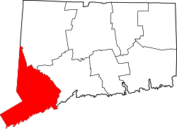 | |
| Towns | ||
| Borough | ||
| CDPs | ||
| Other communities | ||